
 United Kingdom
 France
 Germany
 Netherlands
 Sweden
 USA
USA
 Italy
Italy
 Spain
Spain
More From Contributor


Tenbury 1902
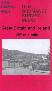
Tenbury in 1902 in a fascinating series of reproductions of old Ordnance Survey plans in the Alan Godfrey Editions, ideal for anyone interested in the history of their neighbourhood or family. The map is split between Worcestershire and Shropshire. Coverage stretches from Burford House eastward to Kyrewood House, and northward to Spurtree. Features include the town centre of Tenbury, Cross Street, Market Street, Teme Street, The Court, St Mary`s church, Workhouse, Kyrewood House, Goff`s Free School, Berrington House, Teme Bridge, etc. The River Teme runs across the map. On the Shropshire side features include railway with Tenbury station, Swan Hotel, St Mary`s Cottage Hospital, Dean Park, part of Burford parish, Old School House, Rose & Crown inn, Bank Farm, Burford
House, St Mary`s church Burford, Lockyers, etc. A commercial directory for Tenbury plus a 1906 railway timetable for the Bewdley-Tenbury-Woofferton line are on the reverse. About the Alan Godfrey Editions of the 25” OS Series:Selected towns in Great Britain and Ireland are covered by maps showing the extent of urban development in the last decades of the 19th and early 20th century. The plans have been taken from the Ordnance Survey mapping and reprinted at about 15 inches to one mile (1:4, 340). On the reverse most maps have historical notes and many also include extracts from contemporary directories. Most maps cover about one mile (1.6kms) north/south, one and a half miles (2.4kms) across; adjoining sheets can be combined to provide wider coverage.FOR MORE INFORMATION AND A
COMPLETE LIST OF ALL AVAILABLE TITLES PLEASE CLICK ON THE SERIES LINK.

Product Description
Reviews/Comments
Add New
Intelligent Comparison
Archived Product
Wednesbury 1902 Stanfords
£3.50
Archived Product

Banbury 1900 Stanfords
£3.50
Archived Product

Tetbury 1899 Stanfords
£3.50
Archived Product

Tisbury 1900 Stanfords
£3.50
Archived Product

Sudbury 1902 Stanfords
£3.50
Archived Product
Ledbury 1926 Stanfords
£2.95
Archived Product

Ledbury 1926 Stanfords
£3.50
Archived Product
Pendlebury 1907 Stanfords
£3.50
Vouchers
No voucher codes found.
Do you know a voucher code for this product or supplier? Add it to Insights for others to use.
Do you know a voucher code for this product or supplier? Add it to Insights for others to use.
 Denmark