
 United Kingdom
 France
 Germany
 Netherlands
 Sweden
 USA
USA
 Italy
Italy
 Spain
Spain
More From Contributor


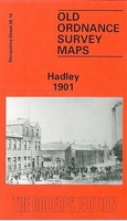
Hadley 1901
Hadley in 1901 in a fascinating series of reproductions of old Ordnance Survey plans in the Alan Godfrey Editions, ideal for anyone interested in the history of their neighbourhood or family. The map gives good coverage of the town and includes Haybridge, Pottersbank, Ketleybrook and New Hadley. Two railway lines run through the map (L.& N.W.R and GWR). Other features include Hadley Station, Holy Trinity Church, Trench Iron Works, Castle Car Works, Haybridge Hall, Ketley Junction, Haybridge Iron Works and Hadley Junction. On the reverse is an extract from a directory for the area.About the Alan Godfrey Editions of the 25” OS Series:Selected towns in Great Britain and Ireland are covered by maps showing the extent of urban development in the last decades of the 19th and early
20th century. The plans have been taken from the Ordnance Survey mapping and reprinted at about 15 inches to one mile (1:4, 340). On the reverse most maps have historical notes and many also include extracts from contemporary directories. Most maps cover about one mile (1.6kms) north/south, one and a half miles (2.4kms) across; adjoining sheets can be combined to provide wider coverage.FOR MORE INFORMATION AND A COMPLETE LIST OF ALL AVAILABLE TITLES PLEASE CLICK ON THE SERIES LINK.
20th century. The plans have been taken from the Ordnance Survey mapping and reprinted at about 15 inches to one mile (1:4, 340). On the reverse most maps have historical notes and many also include extracts from contemporary directories. Most maps cover about one mile (1.6kms) north/south, one and a half miles (2.4kms) across; adjoining sheets can be combined to provide wider coverage.FOR MORE INFORMATION AND A COMPLETE LIST OF ALL AVAILABLE TITLES PLEASE CLICK ON THE SERIES LINK.

Product Description
Reviews/Comments
Add New
Intelligent Comparison
Archived Product
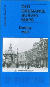
Dudley 1901 Stanfords
£3.50
Archived Product
Lawley 1901 Stanfords
£2.95
Archived Product
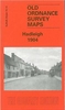
Wardley 1907 Stanfords
£3.50
Archived Product

Hindley 1907 Stanfords
£3.50
Archived Product
Headingley 1906 Stanfords
£3.50
Archived Product

Bardsley 1906 Stanfords
£3.50
Archived Product
Hadleigh 1904 Stanfords
£2.95
Archived Product
Wordsley 1901 Stanfords
£2.95
Vouchers
No voucher codes found.
Do you know a voucher code for this product or supplier? Add it to Insights for others to use.
Do you know a voucher code for this product or supplier? Add it to Insights for others to use.
 Denmark