
 United Kingdom
 France
 Germany
 Netherlands
 Sweden
 USA
USA
 Italy
Italy
 Spain
Spain
More From Contributor


Bardsley 1906
Bardsley in 1906 in a fascinating series of reproductions of old Ordnance Survey plans in the Alan Godfrey Editions, ideal for anyone interested in the history of their neighbourhood or family. The map covers Bardsley, between Oldham and Ashton. The Oldham Road runs north-south through the centre of the map, including Bardsley village with Wood Park Colliery, Holy Trinity church, Bardsley Colliery (disused), Wheatfield Iron Works, Bell Mill and Boundary Mill. Further east are Wester Hill and Lower Alt Hill, with a stretch of the Oldham & Guide Bridge railway and Park Bridge station. Further west are Knott Lanes, Wood Park and (top left of map) Hollins. Directories of Bardsley and Little Moss are on the reverse. About the Alan Godfrey Editions of the 25” OS Series:Selected towns
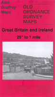
in Great Britain and Ireland are covered by maps showing the extent of urban development in the last decades of the 19th and early 20th century. The plans have been taken from the Ordnance Survey mapping and reprinted at about 15 inches to one mile (1:4, 340). On the reverse most maps have historical notes and many also include extracts from contemporary directories. Most maps cover about one mile (1.6kms) north/south, one and a half miles (2.4kms) across; adjoining sheets can be combined to provide wider coverage.FOR MORE INFORMATION AND A COMPLETE LIST OF ALL AVAILABLE TITLES PLEASE CLICK ON THE SERIES LINK.
in Great Britain and Ireland are covered by maps showing the extent of urban development in the last decades of the 19th and early 20th century. The plans have been taken from the Ordnance Survey mapping and reprinted at about 15 inches to one mile (1:4, 340). On the reverse most maps have historical notes and many also include extracts from contemporary directories. Most maps cover about one mile (1.6kms) north/south, one and a half miles (2.4kms) across; adjoining sheets can be combined to provide wider coverage.FOR MORE INFORMATION AND A COMPLETE LIST OF ALL AVAILABLE TITLES PLEASE CLICK ON THE SERIES LINK.

Product Description
Reviews/Comments
Add New
Intelligent Comparison
Archived Product

Barnsley 1904 Stanfords
£3.50
Archived Product
Wardley 1907 Stanfords
£3.50
Archived Product

Bramley 1906 Stanfords
£3.50
Archived Product

Wordsley 1901 Stanfords
£3.50
Archived Product
Wordsley 1901 Stanfords
£2.95
Archived Product

Kearsley 1907 Stanfords
£3.50
Archived Product
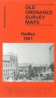
Hadley 1901 Stanfords
£3.50
Archived Product

Morley 1906 Stanfords
£3.50
Vouchers
No voucher codes found.
Do you know a voucher code for this product or supplier? Add it to Insights for others to use.
Do you know a voucher code for this product or supplier? Add it to Insights for others to use.
 Denmark