
 United Kingdom
 France
 Germany
 Netherlands
 Sweden
 USA
USA
 Italy
Italy
 Spain
Spain
More From Contributor


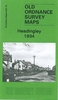


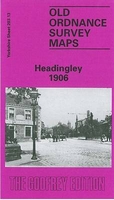
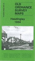
Headingley 1906
Headingley in 1906 in a fascinating series of reproductions of old Ordnance Survey plans in the Alan Godfrey Editions, ideal for anyone interested in the history of their neighbourhood or family. Two versions have been published for this area. The maps cover the Headingley area of north Leeds. Headingley, with the cricket ground and the adjacent football ground, fills most of the western half of the map, while further east is Woodhouse Ridge with much of Woodhouse Cliff. Coverage stretches from Headingley House and Canterbury Drive eastward to Hartley Avenue and the `Hawes` group of streets; and from Brudennel Road northward to Shaw Lane and Claremont Road. Features inlcude Headingley Hall, St Michael`s church, Moorfield House and numerous other detached villas, Hyde Park Corner,
Wesleyan College, Groves Mill printing works, Batty`s Wood, Cliff Tannery, Woodhouse Moor, St Mark`s church Woodhouse, etc. Headingley Lane, becoming Otley Road, runs through the map, with tramway. A selection of street directory entries are on the reverse: Hyde Park Road, Institution Street, Norwood Place/Road/Terrace, Otley Road, St Michael`s Lane/Road and Woodhouse Street (1906 map) and Cardigan Road, Grove Lane/Road and Headingley Lane (1934 map).About the Alan Godfrey Editions of the 25” OS Series:Selected towns in Great Britain and Ireland are covered by maps showing the extent of urban development in the last decades of the 19th and early 20th century. The plans have been taken from the Ordnance Survey mapping and reprinted at about 15 inches to one mile (1:4, 340).
On the reverse most maps have historical notes and many also include extracts from contemporary directories. Most maps cover about one mile (1.6kms) north/south, one and a half miles (2.4kms) across; adjoining sheets can be combined to provide wider coverage.FOR MORE INFORMATION AND A COMPLETE LIST OF ALL AVAILABLE TITLES PLEASE CLICK ON THE SERIES LINK.

Product Description
Reviews/Comments
Add New
Intelligent Comparison
Archived Product
Headingley 1934 Stanfords
£3.50
Archived Product

Bingley 1906 Stanfords
£3.50
Archived Product

Stanningley 1906 Stanfords
£3.50
Archived Product
Hadley 1901 Stanfords
£3.50
Archived Product

Hindley 1907 Stanfords
£3.50
Archived Product

Bardsley 1906 Stanfords
£3.50
Vouchers
No voucher codes found.
Do you know a voucher code for this product or supplier? Add it to Insights for others to use.
Do you know a voucher code for this product or supplier? Add it to Insights for others to use.
 Denmark