
 United Kingdom
 France
 Germany
 Netherlands
 Sweden
 USA
USA
 Italy
Italy
 Spain
Spain
More From Contributor
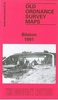


Bingley 1906
Bingley in 1906 in a fascinating series of reproductions of old Ordnance Survey plans in the Alan Godfrey Editions, ideal for anyone interested in the history of their neighbourhood or family. The map covers the town centre, extending from Bingley Cemetery eastward to Gilstead and south to Beck Foot. Features include All Saints church, Bowling Green Mills, Albert Mills, Stanley Mill, Argyll Mills, Victoria Mills, Britannia Mills, Leeds & Liverpool Canal, railway with station, River Aire, Myrtle Park, Old Hills (limestone boulder pits), Main Street, Market House, Ferncliffe, Gilstead Hall, Bingley Brewery, Milner Field, Delph Wood, Dowley Gap Locks, New Hirst Mill, etc. On the reverse are extracts from a contemporary directory.About the Alan Godfrey Editions of the
25” OS Series:Selected towns in Great Britain and Ireland are covered by maps showing the extent of urban development in the last decades of the 19th and early 20th century. The plans have been taken from the Ordnance Survey mapping and reprinted at about 15 inches to one mile (1:4, 340). On the reverse most maps have historical notes and many also include extracts from contemporary directories. Most maps cover about one mile (1.6kms) north/south, one and a half miles (2.4kms) across; adjoining sheets can be combined to provide wider coverage.FOR MORE INFORMATION AND A COMPLETE LIST OF ALL AVAILABLE TITLES PLEASE CLICK ON THE SERIES LINK.
25” OS Series:Selected towns in Great Britain and Ireland are covered by maps showing the extent of urban development in the last decades of the 19th and early 20th century. The plans have been taken from the Ordnance Survey mapping and reprinted at about 15 inches to one mile (1:4, 340). On the reverse most maps have historical notes and many also include extracts from contemporary directories. Most maps cover about one mile (1.6kms) north/south, one and a half miles (2.4kms) across; adjoining sheets can be combined to provide wider coverage.FOR MORE INFORMATION AND A COMPLETE LIST OF ALL AVAILABLE TITLES PLEASE CLICK ON THE SERIES LINK.

Product Description
Reviews/Comments
Add New
Intelligent Comparison
Archived Product
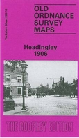
Headingley 1906 Stanfords
£3.50
Archived Product
Stanningley 1906 Stanfords
£3.50
Archived Product

Burnley 1910 Stanfords
£3.50
Archived Product

Hindley 1907 Stanfords
£3.50
Archived Product

Bramley 1906 Stanfords
£3.50
Archived Product
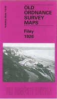
Filey 1926 Stanfords
£3.50
Archived Product

Otley 1906 Stanfords
£3.50
Archived Product
Brigg 1906 Stanfords
£2.95
Vouchers
No voucher codes found.
Do you know a voucher code for this product or supplier? Add it to Insights for others to use.
Do you know a voucher code for this product or supplier? Add it to Insights for others to use.
 Denmark