More From Contributor
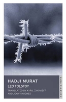
£2.95
Haddington in 1893 in a fascinating series of reproductions of old Ordnance Survey plans in the Alan Godfrey Editions, ideal for anyone interested in the history of their neighbourhood or family. Selected towns in Great Britain & Ireland are covered by maps showing the extent of urban development in the last decades of the 19th & early 20th century. In this title: the map covers most of the town, stretching southward to Lennoxlove Acredales & Clerkington, & westward to St Laurence House Bridge. Features include Trinity church, Haddington Maltings, Rosehall, River Tyne, Nungate Bridge, Market Street area, High Street area, Gimmers Mills, Nungate, Eastgate End, Court Street, Town Hall, Distillery Park, St Mary's church, Acredales, Dobson's Well, Clerkington Mill, St Laurence House, NBR railway with terminus, Somnerfield Works, etc. On the reverse is a register of voters for 1892. About the Alan Godfrey Editions of the 25 ...
Archived Product
£3.50
Haddington in 1893 in a fascinating series of reproductions of old Ordnance Survey plans in the Alan Godfrey Editions, ideal for anyone interested in the history of their neighbourhood or family. The map covers most of the town, stretching southward to Lennoxlove Acredales & Clerkington, & westward to St Laurence House Bridge. Features include Trinity church, Haddington Maltings, Rosehall, River Tyne, Nungate Bridge, Market Street area, High Street area, Gimmers Mills, Nungate, Eastgate End, Court Street, Town Hall, Distillery Park, St Mary`s church, Acredales, Dobson`s Well, Clerkington Mill, St Laurence House, NBR railway with terminus, Somnerfield Works, etc. On the reverse is a register of voters for 1892. About the Alan Godfrey Editions of the 25” OS Series: Selected towns in Great Britain & Ireland are covered by maps showing the extent of urban development in the last decades of the 19th & early 20th century. The plans have been taken from the Ordnance Survey mapping & reprinted at about 15 inches to one mile (1:4, 340). On the reverse most maps have historical notes & many also include extracts from contemporary directories. Most maps cover about one mile (1.6kms) north/south, one & a half miles (2.4kms) across; adjoining sheets can be combined to provide wider coverage.FOR MORE INFORMATION & A COMPLETE LIST OF ALL AVAILABLE TITLES PLEASE CLICK ON THE SERIES LINK. ...
Archived Product
£29.99
Topographic survey of Denmark at 1:100, 000 from Kort & Matrikelstyrelsen, the country’s national survey organization. The maps have contours at 5 metre intervals, with colouring and/or graphics showing various types of terrain & land use: woodlands, orchards, heath, sand & dunes, tidal flats, meadows & marshl&, etc. The maps provide detailed presentation of the road & rail networks & other information expected of topographic mapping at this scale. No specifically tourist information such as waymarked cycling or hiking routes is shown. Standard size sheets cover an area of 56 x 45km / 35x 28 miles approx. Map legend

Includes::
English. To see other titles in this series please click on the series link.IMPORTANT – PLEASE NOTE BEFORE ORDERING:AVAILABILITY: all the maps are now printed on dem&. Delivery from Denmark can take over 4 weeks. Once an order has been placed we cannot accept any returns for credit.COORDINATES: although the maps are meant to have UTM coordinates for EUREF 89 (WGS 84) datum, sheets are sometimes delivered printed without any grid or margin ticks for UTM or latitude & longitude.

...
Archived Product
£2.95
Hadfield & Tintwistle in 1907 in a fascinating series of reproductions of old Ordnance Survey plans in the Alan Godfrey Editions, ideal for anyone interested in the history of their neighbourhood or family. Selected towns in Great Britain & Ireland are covered by maps showing the extent of urban development in the last decades of the 19th & early 20th century. In this title: the map covers the village of Tintwistle & the northern part of Hollingworth in Cheshire, & the northern part of Hadfield in Derbyshire. Features include Arnfield Reservoir, Woolley Mill, Millbrook House, Market Street Hollingworth, St Mary's church (near foot of map), Arrowscroft Mill, River Etherow Bleach Works, Wedneshough Green (in the south-west corner of map), GCR Waterside Branch, Bridge Mill, Waterside Mill, River Etherow, Christ Church Tintwistle, Cockerhill, Station Mill Hadfield, The Cross, Old Hall Square, chapels, White Mill, St Charles RC church, Mersey Bank etc. On the reverse are directories of Hadfield & Tintwistle. About the Alan Godfrey Editions of the 25 ...
Archived Product
£3.50
Hadfield & Tintwistle in 1907 in a fascinating series of reproductions of old Ordnance Survey plans in the Alan Godfrey Editions, ideal for anyone interested in the history of their neighbourhood or family. The map covers the village of Tintwistle & the northern part of Hollingworth in Cheshire, & the northern part of Hadfield in Derbyshire. Features include Arnfield Reservoir, Woolley Mill, Millbrook House, Market Street Hollingworth, St Mary`s church (near foot of map), Arrowscroft Mill, River Etherow Bleach Works, Wedneshough Green (in the south-west corner of map), GCR Waterside Branch, Bridge Mill, Waterside Mill, River Etherow, Christ Church Tintwistle, Cockerhill, Station Mill Hadfield, The Cross, Old Hall Square, chapels, White Mill, St Charles RC church, Mersey Bank, etc. On the reverse are directories of Hadfield & Tintwistle. About the Alan Godfrey Editions of the 25” OS Series: Selected towns in Great Britain & Ireland are covered by maps showing the extent of urban development in the last decades of the 19th & early 20th century. The plans have been taken from the Ordnance Survey mapping & reprinted at about 15 inches to one mile (1:4, 340). On the reverse most maps have historical notes & many also include extracts from contemporary directories. Most maps cover about one mile (1.6kms) north/south, one & a half miles (2.4kms) across; adjoining sheets can be combined to provide wider coverage.FOR MORE INFORMATION & A COMPLETE LIST OF ALL AVAILABLE TITLES PLEASE CLICK ON THE SERIES LINK. ...
Archived Product
£2.95
Hadleigh in 1904 in a fascinating series of reproductions of old Ordnance Survey plans in the Alan Godfrey Editions, ideal for anyone interested in the history of their neighbourhood or family. Selected towns in Great Britain & Ireland are covered by maps showing the extent of urban development in the last decades of the 19th & early 20th century. In this title: the map is double-sided. The main map

Includes::
the town centre & extends a mile or so east into open country & as far as Valley Farm. Features include the station, malthouses, High Street, St Mary's church, coir matting factory, Angel Street, Tinker's Lane, Toppesfield Hall, George Street, Frog Hall, French's Farm, Durrant's Farm. On the reverse is a good portion of adjacent sheet 74.13 & this covers the western part of the town, including River Brett, Bridge Street, Broom Hill, Holbecks, cemetery, Hadleigh Bridge, Friars Hall, Hadleigh Hall. Also included is a commercial directory. About the Alan Godfrey Editions of the 25

...
Archived Product
£3.50
Hadleigh in 1904 in a fascinating series of reproductions of old Ordnance Survey plans in the Alan Godfrey Editions, ideal for anyone interested in the history of their neighbourhood or family. The map is double-sided; the main map

Includes::
the town centre & extends a mile or so east into open country & as far as Valley Farm. Features include the station, malthouses, High Street, St Mary`s church, coir matting factory, Angel Street, Tinker`s Lane, Toppesfield Hall, George Street, Frog Hall, French`s Farm, Durrant`s Farm, etc. On the reverse is a good portion of the adjacent sheet 74.13 covering the western part of the town, including River Brett, Bridge Street, Broom Hill, Holbecks, cemetery, Hadleigh Bridge, Friars Hall & Hadleigh Hall; plus a commercial directory. About the Alan Godfrey Editions of the 25” OS Series: Selected towns in Great Britain & Ireland are covered by maps showing the extent of urban development in the last decades of the 19th & early 20th century. The plans have been taken from the Ordnance Survey mapping & reprinted at about 15 inches to one mile (1:4, 340). On the reverse most maps have historical notes & many also include extracts from contemporary directories. Most maps cover about one mile (1.6kms) north/south, one & a half miles (2.4kms) across; adjoining sheets can be combined to provide wider coverage.FOR MORE INFORMATION & A COMPLETE LIST OF ALL AVAILABLE TITLES PLEASE CLICK ON THE SERIES LINK.

...
Archived Product
£3.50
Hadley in 1901 in a fascinating series of reproductions of old Ordnance Survey plans in the Alan Godfrey Editions, ideal for anyone interested in the history of their neighbourhood or family. The map gives good coverage of the town &

Includes::
Haybridge, Pottersbank, Ketleybrook & New Hadley. Two railway lines run through the map (L.& N.W.R & GWR). Other features include Hadley Station, Holy Trinity Church, Trench Iron Works, Castle Car Works, Haybridge Hall, Ketley Junction, Haybridge Iron Works & Hadley Junction. On the reverse is an extract from a directory for the area. About the Alan Godfrey Editions of the 25” OS Series: Selected towns in Great Britain & Ireland are covered by maps showing the extent of urban development in the last decades of the 19th & early 20th century. The plans have been taken from the Ordnance Survey mapping & reprinted at about 15 inches to one mile (1:4, 340). On the reverse most maps have historical notes & many also include extracts from contemporary directories. Most maps cover about one mile (1.6kms) north/south, one & a half miles (2.4kms) across; adjoining sheets can be combined to provide wider coverage.FOR MORE INFORMATION & A COMPLETE LIST OF ALL AVAILABLE TITLES PLEASE CLICK ON THE SERIES LINK.

...
Archived Product
£25.00
Hadrian (r. AD 117-138) is known for his restless & ambitious nature, his interest in architecture & his passion for Greece & Greek culture. This book & exhibition move beyond this image to give a new appraisal of this Emperor, exploring the sharp contradictions in his personality & his role as a ruthless military leader, against the backdrop of the events of his 21-year reign, in which he travelled throughout his empire. As ruler, Hadrian consolidated & strengthened the empire rather than continuing the campaigns of his predecessor Trajan. Individual chapters of the book look at Hadrian the man as an individual; Hadrian the military leader & strategist; Hadrian the amateur architect who created magnificent buildings such as his villa at Tivoli (an empire in miniature); Hadrian the lover who deified his male favourite Antinous after his mysterious death in the Nile; & Hadrian the traveller who tirelessly roamed his empire & its boundaries. The book will conclude with the legacy of Hadrian, including a discussion of the genesis of Marguerite Yourcenars famous Memoirs of Hadrian, about to be turned into a major Hollywood film. This important & timely book is richly illustrated throughout with key works of art -both celebrated & less well-known sculptures, bronzes, coins & medals, drawings & watercolours from major international museums & other public & private collections. ...
Archived Product
£12.99
Hadrian's Wall Path is the National Trail of some 84 miles (135 km) linking Wallsend, near Newcastle-upon-Tyne, with Bowness-on-Solway on England's west coast. The Path shadows, for its greater part, the historic line of Hadrian's Wall; it lies within a landscape of dramatic contrasts, starting amid bustling, redeveloped Newcastle & finishing on the lonely shores of the Solway Firth. This is the complete, official guide for the long-distance walker or the weekend stroller. National Trail Guides are the official guidebooks to the fifteen National Trails in England & Wales & are published in association with Natural Engl&, the official body charged with developing & maintaining the Trails. ...
Archived Product

Hadji Murat

Tolstoy knew as he was writing Hadji Murat, his last work of fiction, that it would not be published in his lifetime, and so gave an uncompromising portrayal of the Russians` faults and the nature of the rebels` struggle. In the process, he shows a mastery of style and an understanding of Chechnya that still carries great resonance today. Hadji Murat, one of the most feared and venerated mountain chiefs in the Chechen struggle against the Russians, defects from the Muslim rebels after feuding with his ruling Imam, Shamil. Hoping to protect his family, he joins the Russians, who accept him but never put their trust in him - and so Murat must find another way to end the struggle.
RIP - This product is no longer available on our network. It was last seen on 25.09.2019

This page now acts as a permanent archive for this product. Add more information using the comments box below to ensure it can still be found by future generations.

Use our search facility to see if it is available from an alternative contributor.
  • External links may include paid for promotion
  • Availability: Out Of Stock
  • Supplier: Stanfords
  • SKU: 9781847494818
Availability: In Stock
£7.99

Product Description

Tolstoy knew as he was writing Hadji Murat, his last work of fiction, that it would not be published in his lifetime, & so gave an uncompromising portrayal of the Russians` faults & the nature of the rebels` struggle. In the process, he shows a mastery of style & an understanding of Chechnya that still carries great resonance today. Hadji Murat, one of the most feared & venerated mountain chiefs in the Chechen struggle against the Russians, defects from the Muslim rebels after feuding with his ruling Imam, Shamil. Hoping to protect his family, he joins the Russians, who accept him but never put their trust in him
- & so Murat must find another way to end the struggle.

Reviews/Comments

Add New

Intelligent Comparison

Oooops!
We couldn't find anything!
Perhaps this product's unique.... Or perhaps we are still looking for comparisons!
Click to bump this page and we'll hurry up.

Price History

Vouchers

No voucher codes found.
Do you know a voucher code for this product or supplier? Add it to Insights for others to use.

Facebook

Jargon Buster

Family - A group of people that live together made up from parents and children.

Supplier Information

Stanfords
Stanfords was established in 1853 and opened their iconic Covent Garden flagship store in 1901. They have become the top retailer of maps, travel books and accessories in the UK and arguably offer the largest selection of maps and travel books worldwide. Famous names such as Captain Robert Falcon Scott, Ranulph Fiennes and Michael Palin have purchased from Stanfords. They now have a shop in Bristol and both stores together with other venues operate a calendar of events including talks, book signings and exhibitions. As a specialist map retailer, the map selection is comprehensive and includes road maps, street maps and walking maps from worldwide destinations, as well as a selection of world atlases and wall maps. Books include travel guides and travel literature. Stanfords also stock globes, from miniatures made of blue marble to magnificent floor-standing globes. The website features a selection of interesting articles on travel topics.
Page Updated: 2023-11-12 20:15:36

Community Generated Product Tags

Oh No! The productWIKI community hasn't generated any tags for this product yet!
Menu