More From Contributor
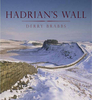
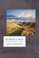
£3.50
Hadley in 1901 in a fascinating series of reproductions of old Ordnance Survey plans in the Alan Godfrey Editions, ideal for anyone interested in the history of their neighbourhood or family. The map gives good coverage of the town &

Includes::
Haybridge, Pottersbank, Ketleybrook & New Hadley. Two railway lines run through the map (L.& N.W.R & GWR). Other features include Hadley Station, Holy Trinity Church, Trench Iron Works, Castle Car Works, Haybridge Hall, Ketley Junction, Haybridge Iron Works & Hadley Junction. On the reverse is an extract from a directory for the area. About the Alan Godfrey Editions of the 25” OS Series: Selected towns in Great Britain & Ireland are covered by maps showing the extent of urban development in the last decades of the 19th & early 20th century. The plans have been taken from the Ordnance Survey mapping & reprinted at about 15 inches to one mile (1:4, 340). On the reverse most maps have historical notes & many also include extracts from contemporary directories. Most maps cover about one mile (1.6kms) north/south, one & a half miles (2.4kms) across; adjoining sheets can be combined to provide wider coverage.FOR MORE INFORMATION & A COMPLETE LIST OF ALL AVAILABLE TITLES PLEASE CLICK ON THE SERIES LINK.

...
Archived Product
£25.00
Hadrian (r. AD 117-138) is known for his restless & ambitious nature, his interest in architecture & his passion for Greece & Greek culture. This book & exhibition move beyond this image to give a new appraisal of this Emperor, exploring the sharp contradictions in his personality & his role as a ruthless military leader, against the backdrop of the events of his 21-year reign, in which he travelled throughout his empire. As ruler, Hadrian consolidated & strengthened the empire rather than continuing the campaigns of his predecessor Trajan. Individual chapters of the book look at Hadrian the man as an individual; Hadrian the military leader & strategist; Hadrian the amateur architect who created magnificent buildings such as his villa at Tivoli (an empire in miniature); Hadrian the lover who deified his male favourite Antinous after his mysterious death in the Nile; & Hadrian the traveller who tirelessly roamed his empire & its boundaries. The book will conclude with the legacy of Hadrian, including a discussion of the genesis of Marguerite Yourcenars famous Memoirs of Hadrian, about to be turned into a major Hollywood film. This important & timely book is richly illustrated throughout with key works of art -both celebrated & less well-known sculptures, bronzes, coins & medals, drawings & watercolours from major international museums & other public & private collections. ...
Archived Product
£12.99
Hadrian's Wall Path is the National Trail of some 84 miles (135 km) linking Wallsend, near Newcastle-upon-Tyne, with Bowness-on-Solway on England's west coast. The Path shadows, for its greater part, the historic line of Hadrian's Wall; it lies within a landscape of dramatic contrasts, starting amid bustling, redeveloped Newcastle & finishing on the lonely shores of the Solway Firth. This is the complete, official guide for the long-distance walker or the weekend stroller. National Trail Guides are the official guidebooks to the fifteen National Trails in England & Wales & are published in association with Natural Engl&, the official body charged with developing & maintaining the Trails. ...
Archived Product
£9.99
The official route map & information for the 174 mile (280 km) route from Ravensglass to South Shields
- Sustrans` route NN72.
...
Archived Product
£14.99
Hadrian`s Wall has been designated a World Heritage Site since 1987 & in 2005 was also incorporated into a wider UNESCO category
-
...
Archived Product
£14.99
Hadrian’s Wall on a detailed topographic & GPS compatible map OL43, waterproof version, from the Ordnance Survey’s 1:25, 000 Explorer series. The map covers the course of the wall from west of Gilsland on the border of Cumbria & Northumberland to east of Hexam, highlighting the course of the Hadrian’s Wall Path National Trail & showing various Roman remains: camps, forts, turrets, bridges, etc. Coverage

Includes::
part of the Northumberland National Park, the North Pennines Area of Outstanding Natural Beauty, Haltwhistle, the Pennine Way National Trail, etc. MOBILE DOWNLOADS: this title & all the other OS Explorer maps include a code for downloading after purchase the digital version onto your smartphone or tablet for viewing on the OS smartphone app.OS EXPLORER SERIES: to see the list of all the titles in the OS Explorer series, both paper & waterproof versions, please click on the series link. The Explorer series, Ordnance Survey’s most detailed maps recommended for anyone enjoying outdoor activities, provides topographic coverage of Great Britain at 1:25, 000 on GPS compatible maps with hiking trails, cycling routes & extensive tourist information. Each printed map is available either on paper or as a waterproof & tear-resistant OS Active Map, as indicated in its title. Britain’s National Parks & other areas of particular tourist interest are presented on often double-sided OL (Outdoor Leisure) maps, whilst most standard format Explorers cover an area of 30 x 20km (approx. 19 x 12 miles). All three versions (paper, waterproof & digital) are the same & provide plenty of recreational & tourist information, indicating the traditional public right of way paths (except in Scotland where different laws apply), including bridleways & byways. National Trails & other long-distance paths are marked, as well as permissive footpaths or bridleways & on-road or traffic-free cycle routes with, where appropriate, their National/ Regional Cycle Network numbers. Boundaries of access land are clearly marked. A wide range of symbols provides additional tourist information, highlighting camping & caravanning sites, information offices & visitors’ centres, parking & picnicking places, country pubs, sport & recreational facilities including cycle hire locations & mountain biking trails, historic buildings & museums, etc. Exceptionally clear presentation of the landscape is provided by contours at 5m or in the uplands at 10m intervals, with additional spot heights plus colouring and/or graphics for different types of woodlands, orchards, heath, marshl&, scree or boulders, & other topographic features. For GPS users the maps have British National Grid lines at 1km intervals, with latitude & longitude given by margin ticks at 1`. Clearly laid out map legend

Includes::
French & German translations for the tourist information symbols.


...
Archived Product
£8.99
Hadrian’s Wall on a detailed topographic & GPS compatible map OL43, paper version, from the Ordnance Survey’s 1:25, 000 Explorer series. The map covers the course of the wall from west of Gilsland on the border of Cumbria & Northumberland to east of Hexam, highlighting the course of the Hadrian’s Wall Path National Trail & showing various Roman remains: camps, forts, turrets, bridges, etc. Coverage

Includes::
part of the Northumberland National Park, the North Pennines Area of Outstanding Natural Beauty, Haltwhistle, the Pennine Way National Trail, etc. MOBILE DOWNLOADS: this title & all the other OS Explorer maps include a code for downloading after purchase the digital version onto your smartphone or tablet for viewing on the OS smartphone app.OS EXPLORER SERIES: to see the list of all the titles in the OS Explorer series, both paper & waterproof versions, please click on the series link. The Explorer series, Ordnance Survey’s most detailed maps recommended for anyone enjoying outdoor activities, provides topographic coverage of Great Britain at 1:25, 000 on GPS compatible maps with hiking trails, cycling routes & extensive tourist information. Each printed map is available either on paper or as a waterproof & tear-resistant OS Active Map, as indicated in its title. Britain’s National Parks & other areas of particular tourist interest are presented on often double-sided OL (Outdoor Leisure) maps, whilst most standard format Explorers cover an area of 30 x 20km (approx. 19 x 12 miles). All three versions (paper, waterproof & digital) are the same & provide plenty of recreational & tourist information, indicating the traditional public right of way paths (except in Scotland where different laws apply), including bridleways & byways. National Trails & other long-distance paths are marked, as well as permissive footpaths or bridleways & on-road or traffic-free cycle routes with, where appropriate, their National/ Regional Cycle Network numbers. Boundaries of access land are clearly marked. A wide range of symbols provides additional tourist information, highlighting camping & caravanning sites, information offices & visitors’ centres, parking & picnicking places, country pubs, sport & recreational facilities including cycle hire locations & mountain biking trails, historic buildings & museums, etc. Exceptionally clear presentation of the landscape is provided by contours at 5m or in the uplands at 10m intervals, with additional spot heights plus colouring and/or graphics for different types of woodlands, orchards, heath, marshl&, scree or boulders, & other topographic features. For GPS users the maps have British National Grid lines at 1km intervals, with latitude & longitude given by margin ticks at 1`. Clearly laid out map legend

Includes::
French & German translations for the tourist information symbols.


...
Archived Product
£18.99
Stretching 73 miles from coast to coast & reaching a height of about 13 feet, Hadrian`s Wall should have been counted as one of the seven wonders of the ancient world. Today, a World Heritage site, it stands as the most imposing monument north of the Alps & attracts millions of visitors a year. Yet, despite all the excavation & research that has been carried out, this is the first detailed guide to be written for many years. Having first dealt with the practical questions of transport, clothing & maps, Guy de la Bedoyere explains why & how the Wall was constructed. With the help of almost 100 sketch maps, drawings & photographs, he then conducts the visitor, stage by stage, along the full length of the Wall, providing map locations, route & parking instructions, details of access & opening times, & a full account of everything that can be seen. He also covers the outpost forts, the forts & settlements to the rear (South Shields, Corbridge & Vindolanda) & the local museums which house so many of the artefacts discovered along the Wall. This indispensable guide-book concludes with a list of dates, a glossary & a summary of all the key sources. ...
Archived Product
£7.99
The central part of the Hadrian`s Wall & the surrounding countryside at 1:25, 000 in a series of Walker’s Maps published by the AA with the cartography from the Ordnance Survey’s Explorer series. The map is double-sided & coverage

Includes::
Hexham, Corbridge, Haydon Bridge, Haltwhistel, Gilsl&, Wark, Colwell, Slaley, Allendale Town, Edmondbyers, Knarsdale, etc. Maps in the AA Walker’s series are identical to the OS Explorer maps & provide plenty of recreational & tourist information, indicating in England & Wales the traditional public rights of way paths, including bridleways & byways restricted or open to motorized traffic. Also shown are other routes with public access, including permissive footpaths & bridleways. For Scotl&, where different access rights apply, the maps provide an additional note explaining the regulations. Special marking indicates National Trails & Recreational Routes & for cyclists the maps show traffic-free routes & the National Cycle Network. A wide range of symbols highlights locations of special tourist interest: camping & caravanning sites, youth hostels, information offices & visitors’ centres, parking & picnicking places, historic buildings (indicating where appropriate National Trust, English Heritage, Historic Scotland or Cadw), sites for various recreational pursuits, country pubs, public toilets, etc. The maps provide detailed presentation of the topography with contours at 5 or 10m intervals, numerous spot heights & colouring and/or graphics for different types of vegetation. Additional colouring shows access l&, including areas managed by the National Trust, Forestry Commission & Woodland Trust. All the standard information expected of high quality survey mapping at this scale is included: finely graded road network, railway lines with stations, cuttings or embankments, individual isolated buildings, etc. For GPS users the British National Grid is drawn at 1km intervals.

...
Archived Product
£9.99
Hadrian’s Wall & the nearby archaeological Roman remains on a light, waterproof & tear-resistant map from the English Heritage with the base map from the Ordnance Survey 1:25, 000 Explorer series. The map presents in six panels the whole course of the wall including its sections across the present day Newcastle, plus the adjoining area along the Irish Sea coast. Cartography of the Ordnance Survey Explorer series has its standard colouring faded out to provide a clearer base for highlighting all the elements of the Roman frontiers which can be readily depicted at this scale. The map shows not only the wall & its fortifications, but also nearby camps, civil settlements, temples, bathhouses, quarries, watermills, kilns, etc, distinguishing between visible sites & those no longer there but known or strongly presumed to have existed. All the panels have the lines of the British National Grid at 1km intervals. ...
Archived Product

Hadrian`s Wall

Located at the far-flung and wild edge of the Roman Empire, Hadrian`s Wall was constructed by Emperor Hadrian in the 120s AD. Vast in size and stretching from the east to the west coast of the northern part of Britannia, it is the largest monument left by the Roman empire - all the more striking because it lies so far from Rome. Today, it is one of the most visited heritage sites in the country. Yet the story of the Wall is far more than the development of a line of fortifications and the defence of a troublesome imperial frontier. Generation after generation of soldiers served there, with their families as well as traders and other foreign and local civilians in and around the army bases. The glimpses of this vibrant, multinational community in Adrian Goldsworthy`s masterly book
bring the bare stones to life. Goldsworthy also considers why and how the wall was built, and discusses the fascinating history, afterlife and archaeology of this unique ancient monument.
RIP - This product is no longer available on our network. It was last seen on 25.09.2019

This page now acts as a permanent archive for this product. Add more information using the comments box below to ensure it can still be found by future generations.

Use our search facility to see if it is available from an alternative contributor.
  • External links may include paid for promotion
  • Availability: Out Of Stock
  • Supplier: Stanfords
  • SKU: 9781784974725
Availability: In Stock
£18.99

Product Description

Located at the far-flung & wild edge of the Roman Empire, Hadrian`s Wall was constructed by Emperor Hadrian in the 120s AD. Vast in size & stretching from the east to the west coast of the northern part of Britannia, it is the largest monument left by the Roman empire
- all the more striking because it lies so far from Rome. Today, it is one of the most visited heritage sites in the country. Yet the story of the Wall is far more than the development of a line of fortifications & the defence of a troublesome imperial frontier. Generation after generation of soldiers served there, with their families as well as traders & other foreign & local civilians in & around the army bases. The glimpses of this vibrant, multinational community in Adrian Goldsworthy`s masterly book bring the bare stones to life. Goldsworthy also considers why & how the wall was built, & discusses the fascinating history, afterlife & archaeology of this unique ancient monument.

Reviews/Comments

Add New

Intelligent Comparison

Oooops!
We couldn't find anything!
Perhaps this product's unique.... Or perhaps we are still looking for comparisons!
Click to bump this page and we'll hurry up.

Price History

Vouchers

No voucher codes found.
Do you know a voucher code for this product or supplier? Add it to Insights for others to use.

Facebook

Jargon Buster

Wall - A physical barrier between two areas
History - Anything that happens in the past. An acedemic subject.
edge - Enhanced data rates for GSM evolution also known as enhanced GPRS. A mobile phone technology with improved data transmission rates.
edge - The point at which two surfaces meet
Size - is the measurement of how big an object is in space.

Supplier Information

Stanfords
Stanfords was established in 1853 and opened their iconic Covent Garden flagship store in 1901. They have become the top retailer of maps, travel books and accessories in the UK and arguably offer the largest selection of maps and travel books worldwide. Famous names such as Captain Robert Falcon Scott, Ranulph Fiennes and Michael Palin have purchased from Stanfords. They now have a shop in Bristol and both stores together with other venues operate a calendar of events including talks, book signings and exhibitions. As a specialist map retailer, the map selection is comprehensive and includes road maps, street maps and walking maps from worldwide destinations, as well as a selection of world atlases and wall maps. Books include travel guides and travel literature. Stanfords also stock globes, from miniatures made of blue marble to magnificent floor-standing globes. The website features a selection of interesting articles on travel topics.
Page Updated: 2023-11-12 20:15:36

Community Generated Product Tags

Oh No! The productWIKI community hasn't generated any tags for this product yet!
Menu