
 United Kingdom
 France
 Germany
 Netherlands
 Sweden
 USA
USA
 Italy
Italy
 Spain
Spain
More From Contributor

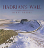


Hadrian`s Wall - History And Guide
Stretching 73 miles from coast to coast and reaching a height of about 13 feet, Hadrian`s Wall should have been counted as one of the seven wonders of the ancient world. Today, a World Heritage site, it stands as the most imposing monument north of the Alps and attracts millions of visitors a year. Yet, despite all the excavation and research that has been carried out, this is the first detailed guide to be written for many years. Having first dealt with the practical questions of transport, clothing and maps, Guy de la Bedoyere explains why and how the Wall was constructed. With the help of almost 100 sketch maps, drawings and photographs, he then conducts the visitor, stage by stage, along the full length of the Wall, providing map locations, route and parking instructions,
details of access and opening times, and a full account of everything that can be seen. He also covers the outpost forts, the forts and settlements to the rear (South Shields, Corbridge and Vindolanda) and the local museums which house so many of the artefacts discovered along the Wall. This indispensable guide-book concludes with a list of dates, a glossary and a summary of all the key sources.
details of access and opening times, and a full account of everything that can be seen. He also covers the outpost forts, the forts and settlements to the rear (South Shields, Corbridge and Vindolanda) and the local museums which house so many of the artefacts discovered along the Wall. This indispensable guide-book concludes with a list of dates, a glossary and a summary of all the key sources.
Product Description
Reviews/Comments
Add New
Vouchers
No voucher codes found.
Do you know a voucher code for this product or supplier? Add it to Insights for others to use.
Do you know a voucher code for this product or supplier? Add it to Insights for others to use.
 Denmark