
 United Kingdom
 France
 Germany
 Netherlands
 Sweden
 USA
USA
 Italy
Italy
 Spain
Spain
More From Contributor


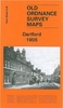
Dartford 1905
Dartford in 1905 in a fascinating series of reproductions of old Ordnance Survey plans in the Alan Godfrey Editions, ideal for anyone interested in the history of their neighbourhood or family. Selected towns in Great Britain and Ireland are covered by maps showing the extent of urban development in the last decades of the 19th and early 20th century.In this title: this detailed map covers the centre of Dartford, extending southward to Oakfield Lane and the northern tip of Wilmington parish. Features include West Hill, Spital Street, High Street in detail with individual buildings shown; Acacia Hall, Livingstone Cottage Hospital, Trinity church, Workhouse, River Darent, Masonic Hall, pumping station, The Dene, Shepherd's Lane area, Brickhill Woods, Heathclose House (at
western edge of map), gravel pits, Sessions House, cattle market etc. On the reverse is a list of private residents from a 1905 directory. About the Alan Godfrey Editions of the 25
western edge of map), gravel pits, Sessions House, cattle market etc. On the reverse is a list of private residents from a 1905 directory. About the Alan Godfrey Editions of the 25
Product Description
Reviews/Comments
Add New
Intelligent Comparison
Archived Product

Dartford 1905 Stanfords
£3.50
Archived Product

Castleford 1905 Stanfords
£3.50
Archived Product

Fairford 1920 Stanfords
£3.50
Archived Product

Dartmoor 1908 Stanfords
£3.50
Archived Product
Camelford 1905 Stanfords
£3.50
Archived Product

Brentford 1935 Stanfords
£3.50
Archived Product
Stretford 1904 Stanfords
£2.95
Archived Product

Stretford 1904 Stanfords
£3.50
Vouchers
No voucher codes found.
Do you know a voucher code for this product or supplier? Add it to Insights for others to use.
Do you know a voucher code for this product or supplier? Add it to Insights for others to use.
 Denmark