
 United Kingdom
 France
 Germany
 Netherlands
 Sweden
 USA
USA
 Italy
Italy
 Spain
Spain
More From Contributor


Stretford 1904
Stretford in 1904 in a fascinating series of reproductions of old Ordnance Survey plans in the Alan Godfrey Editions, ideal for anyone interested in the history of their neighbourhood or family. Selected towns in Great Britain and Ireland are covered by maps showing the extent of urban development in the last decades of the 19th and early 20th century.In this title: the map covers the western part of Stretford, and extends westward to show the eastern part of Urmston. Features on the Urmston side include Hawthorn Farm, Urmston Lodge, The Grange, New Croft Farm, Gorse Hill Farm. On the Stretford side we have St Matthew's church, New Shed Farm, Manor House, tramways, Victoria Park, Park Road Farm. Then map goes as far east as Victoria Road. On the reverse are street directory
entries, including Barton Road, Broady Street, Chester Road, Firwood Avenue, Higher Road.About the Alan Godfrey Editions of the 25
entries, including Barton Road, Broady Street, Chester Road, Firwood Avenue, Higher Road.About the Alan Godfrey Editions of the 25
Product Description
Reviews/Comments
Add New
Intelligent Comparison
Archived Product

Stretford 1904 Stanfords
£3.50
Archived Product
Stratford 1914 Stanfords
£2.95
Archived Product

Stratford 1914 Stanfords
£3.50
Archived Product

Stratford 1893 Stanfords
£3.50
Archived Product

Brentford 1894 Stanfords
£3.50
Archived Product
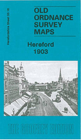
Hereford 1903 Stanfords
£3.50
Archived Product
Dartford 1905 Stanfords
£2.95
Archived Product
Shefford 1900 Stanfords
£2.95
Vouchers
No voucher codes found.
Do you know a voucher code for this product or supplier? Add it to Insights for others to use.
Do you know a voucher code for this product or supplier? Add it to Insights for others to use.
 Denmark