
 United Kingdom
 France
 Germany
 Netherlands
 Sweden
 USA
USA
 Italy
Italy
 Spain
Spain
More From Contributor

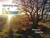


Dartmoor 1908
Dartmoor in 1908 in a series of reproductions of Ordnance Survey’s famous ”Inch to the Mile” maps published in the Alan Godfrey Editions to provide a historical record of England and Wales in the second half of 19th and early 20th century.Voverage stretches from Marytavy and Whitchurch eastwards to Ashburton, and from Lydford southwards to Buckfast Abbey and Sheepstor. Other locations include Buckland in the Moor, Buckland Monarchorun, Holne, Manaton, North Bovey, Petertavy, Princetown, Sampford Spiney, Walkhampton and Widecombe in the Moor. On the reverse is an extract from Devon Sheet 106.08 of the area immediately around Dartmoor prison in 1904, with a directory of Princetown.About the Alan Godfrey Editions of the OS Inch to the Mile Maps: the maps provide an invaluable
overview of a wider area, typically 18 x 12 miles (29 x 19 kms approx.), and offer historical mapping for small towns and villages not covered by the more detailed series for which the Godfrey Editions are better known. On the reverse all the maps have historical notes and most titles also include a more detailed, large scale map of a small town or a village in the area.To see other titles in this series please click on the series link.
overview of a wider area, typically 18 x 12 miles (29 x 19 kms approx.), and offer historical mapping for small towns and villages not covered by the more detailed series for which the Godfrey Editions are better known. On the reverse all the maps have historical notes and most titles also include a more detailed, large scale map of a small town or a village in the area.To see other titles in this series please click on the series link.

Product Description
Reviews/Comments
Add New
Vouchers
No voucher codes found.
Do you know a voucher code for this product or supplier? Add it to Insights for others to use.
Do you know a voucher code for this product or supplier? Add it to Insights for others to use.
 Denmark