
 United Kingdom
 France
 Germany
 Netherlands
 Sweden
 USA
USA
 Italy
Italy
 Spain
Spain
More From Contributor

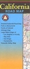


California Borch
Laminated and waterproof, double-sided, indexed tourist road map of California, with an enlargement for the Yosemite National Park. The map has relief shading and spot heights to show the topography, particularly the Sierra Nevada, with names of numerous peaks and ranges. National parks/protected areas and restricted military zones are clearly marked. Road network includes unsurfaced local roads and indicates toll routes. The map highlights various places of interest, campsites and ranger stations, beaches, panoramic views, etc. Coverage is divided between the southern part of the state, Mexican border to San Francisco extending east to Las Vegas, and northern California from Monterey to the Oregon border. No geographical coordinates are provided. An enlargement at 1:675.000
shows the Yosemite National Park in greater detail. An index of localities has lists of beaches, parks, and other places of interest. Also included is a small map of USA showing the states and the time zones, plus information on California’s climate. * This title is part of a nine map series covering the whole of USA.* The same cartography is used in a separate map of Southern California with additional street plans and more detailed road maps of popular areas.
shows the Yosemite National Park in greater detail. An index of localities has lists of beaches, parks, and other places of interest. Also included is a small map of USA showing the states and the time zones, plus information on California’s climate. * This title is part of a nine map series covering the whole of USA.* The same cartography is used in a separate map of Southern California with additional street plans and more detailed road maps of popular areas.

Product Description
Reviews/Comments
Add New
Intelligent Comparison
Archived Product
California South Stanfords
£9.50
Archived Product

California Northern Stanfords
£6.99
Archived Product
California F&B Stanfords
£10.99
Archived Product

California Benchmark Stanfords
£8.50
Archived Product
California ITMB Stanfords
£9.99
Archived Product

California Stanfords
£8.99
Archived Product
California Stanfords
£5.99
Archived Product
California Stanfords
£13.59
Vouchers
No voucher codes found.
Do you know a voucher code for this product or supplier? Add it to Insights for others to use.
Do you know a voucher code for this product or supplier? Add it to Insights for others to use.
 Denmark