
 United Kingdom
 France
 Germany
 Netherlands
 Sweden
 USA
USA
 Italy
Italy
 Spain
Spain
More From Contributor


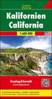
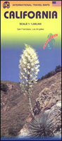
California
California on a double-sided, indexed road map from the German publishers Hildebrand, with street plans of central San Francisco, Los Angeles and San Diego, conurbation maps of SF and LA, plus a smaller scale road map of the whole state for route planning.The main map at approx. 1:700, 000 is divided between the two sides of the sheet, with a generous overlap. Topography is well presented by relief shading, spot heights (in metres) and bold colouring for national parks and forests. The map also indicates Indian Reservations and restricted entry military areas. Road network show free and toll highways, and includes selected small unpaved local roads. Driving distances (in miles) are marked on main roads and scenic routes are highlighted. The map shows various points of interest,
including locations of campsites. Latitude and longitude lines are drawn at 30’ intervals. The map is indexed and its map legend includes English.A separate panel shows the whole of California and Nevada at a less detailed scale of 1:3, 000, 000 approx for easier route planning. Central San Francisco, Los Angeles, and San Diego are shown on street plans, and also provided are road maps of the LA conurbation (including Santa Monica, Long Beach and Pasadena) and of San Francisco – both show access to the international airports.
including locations of campsites. Latitude and longitude lines are drawn at 30’ intervals. The map is indexed and its map legend includes English.A separate panel shows the whole of California and Nevada at a less detailed scale of 1:3, 000, 000 approx for easier route planning. Central San Francisco, Los Angeles, and San Diego are shown on street plans, and also provided are road maps of the LA conurbation (including Santa Monica, Long Beach and Pasadena) and of San Francisco – both show access to the international airports.

Product Description
Reviews/Comments
Add New
Intelligent Comparison
Archived Product
California Stanfords
£9.95
Archived Product
California Stanfords
£5.99
Archived Product
California Stanfords
£13.59
Archived Product
California Stanfords
£12.79
Archived Product
California Stanfords
£6.99
Archived Product
California F&B Stanfords
£10.99
Archived Product
California ITMB Stanfords
£9.99
Archived Product
California 2013 Stanfords
£16.99
Vouchers
No voucher codes found.
Do you know a voucher code for this product or supplier? Add it to Insights for others to use.
Do you know a voucher code for this product or supplier? Add it to Insights for others to use.
 Denmark