
 United Kingdom
 France
 Germany
 Netherlands
 Sweden
 USA
USA
 Italy
Italy
 Spain
Spain
More From Contributor


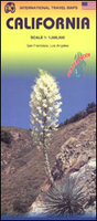
California ITMB
California at 1:1, 000, 000 on a double-sided, indexed road map from ITMB printed on light, waterproof and tear-resistant synthetic paper, with enlargements and street plans for Los Angeles and San Francisco. The map is double-sided, with a good overlap and the San Francisco Bay area shown on both sides. Altitude colouring shows the topography, with national parks and many other protected areas highlighted. Road network indicates exit numbers on Interstate and selected other highways, as well as toll sections. Driving distances are shown on main and selected secondary routes. Railway lines are included and local airports are marked. Symbols indicate various places of interest including numerous campsites. Latitude and longitude lines are drawn at 1° intervals. Each side has a
separate index.The map also includes large panels showing city mapping as below. The street plans are very clear and well presented, and show one way streets, main sights, selected hotels, etc: - For LA: an enlargement showing the network of main roads across the whole conurbation including Santa Monica, Long Beach, Pasadena and San Fernando, plus four separate street plans covering Downtown LA, West Hollywood, Beverly Hills, and the Santa Monica – Venice Beach seafront.- For San Francisco: a large street plan extending south to Haight Ashbury nnd Mission Dolores, and west to the Golden Gate Park, plus a an enlargement covering most of the Bay area.To see other regional titles from ITMB covering USA please click on the series link.
separate index.The map also includes large panels showing city mapping as below. The street plans are very clear and well presented, and show one way streets, main sights, selected hotels, etc: - For LA: an enlargement showing the network of main roads across the whole conurbation including Santa Monica, Long Beach, Pasadena and San Fernando, plus four separate street plans covering Downtown LA, West Hollywood, Beverly Hills, and the Santa Monica – Venice Beach seafront.- For San Francisco: a large street plan extending south to Haight Ashbury nnd Mission Dolores, and west to the Golden Gate Park, plus a an enlargement covering most of the Bay area.To see other regional titles from ITMB covering USA please click on the series link.

Product Description
Reviews/Comments
Add New
Vouchers
No voucher codes found.
Do you know a voucher code for this product or supplier? Add it to Insights for others to use.
Do you know a voucher code for this product or supplier? Add it to Insights for others to use.
 Denmark