More From Contributor

£14.99
Acclaimed outdoors author & expert angler Tom Stienstra knows the best fishing spots in the Golden State, from the crystal-clear lakes dotting the Sierra Nevada to the abundant waters just off the coast of San Francisco. Moon California Fishing leads both beginner & expert anglers to the best lakes, rivers, & coasts that the state has to offer. The eighth edition of this classic guidebook offers detailed descriptions of over 2, 000 fishing locations &

Includes::
over 70 pages of fishing tips & advice. Complete with detailed regional maps as well as directions & ratings for each location, Moon California Fishing provides anglers with first-rate expert advice & all the necessary tools to head outdoors. Devoted campers, hikers, boaters, anglers, & bikers agree: Moon Outdoors authors know their stuff. They're recreation gurus who have hiked the trails, fished the rivers, & pitched their tents to provide readers with authoritative information & first-hand experiences. From coast to coast, Moon Outdoors has the U.S. covered.

...
Archived Product
£4.99
California on a laminated, tear-resistant Insight Flexi Map with an indexed, double-sided road map the state at 1:1, 150, 000, an enlargement of the Yosemite National Park at 1:520, 000, plus extensive tourist information. The map divides the state north/south with a generous overlap between the two sides. Coverage

Includes::
the adjoining areas of Nevada with Las Vegas & Reno. Topography is shown by colouring & relief shading, with names of numerous mountain ranges & peaks with heights, clearly contrasting Sierra Nevada & the Coastal Ranges from the flatter parts of the state. Numerous national parks & other protected areas are marked. Road network

Includes::
local roads, with distances shown on main & selected secondary routes. Railways are included & local airports are marked. Interesting towns are highlighted & a wide range of symbols mark various historical sites, sport & recreational areas or facilities, Indian reservations, etc. Also shown are internal administrative boundaries with names of counties. The map has no geographical coordinates & is indexed for places & points of interest. An enlargement at 1:520, 000 presents the Yosemite National Park in greater detail with more tourist information & selected local tracks.A special feature of the Insight Flexi series are panels with additional tourist information: 17 main sights, neatly grouped into sections covering Major Attractions & Other Places to Visit, are given brief descriptions & are prominently highlighted on the relevant maps. Further panels provide information on Getting Around & Facts for Visitors, including tourist information offices, public holidays, opening times, money, telephoning & monthly climate charts.


...
Archived Product
£5.99
California on a laminated, tear-resistant Insight Flexi Map with an indexed, double-sided road map the state at 1:1, 150, 000, an enlargement of the Yosemite National Park at 1:520, 000, plus extensive tourist information. The map divides the state north/south with a generous overlap between the two sides. Coverage

Includes::
the adjoining areas of Nevada with Las Vegas & Reno. Topography is shown by colouring & relief shading, with names of numerous mountain ranges & peaks with heights, clearly contrasting Sierra Nevada & the Coastal Ranges from the flatter parts of the state. Numerous national parks & other protected areas are marked. Road network

Includes::
local roads, with distances shown on main & selected secondary routes. Railways are included & local airports are marked. Interesting towns are highlighted & a wide range of symbols mark various historical sites, sport & recreational areas or facilities, Indian reservations, etc. Also shown are internal administrative boundaries with names of counties. The map has no geographical coordinates & is indexed for places & points of interest. An enlargement at 1:520, 000 presents the Yosemite National Park in greater detail with more tourist information & selected local tracks.A special feature of the Insight Flexi series are panels with additional tourist information:- 17 main sights, neatly grouped into sections covering Major Attractions & Other Places to Visit, are given brief descriptions & are prominently highlighted on the relevant maps.- Further panels provide information on Getting Around & Facts for Visitors, including tourist information offices, public holidays, opening times, money, telephoning & monthly climate charts. To see the list of other titles in this series please click on the series link.


...
Archived Product
£4.99
Designed as a simple guide & map in one, covering the environs of part of Highway 1, one of the most scenic roads in the USA. Coverage extends from Monterey Bay in the north to San Luis Obispo. Some smaller connecting roads are also shown & useful mileposts are indicated, but the main emphasis is on identifying landmarks, attractions, scenic overlooks, retail centres, motels, campgrounds etc. Annotations provide more details about these features & milepost numbers are provided to assist in locating them ...
Archived Product
£18.99
California Hiking in the Moon Outdoor Guides series; exploring a wide range of outdoor activities
- including camping, biking
...
Archived Product
£6.99
Insight Guides Travel Map: has a fold up map of the country ideal for planning routes or taking on holiday.· This California Travel Map is drawn to a scale of 1:800, 000 & shows the entire country complete with a comprehensive index. This is an ideal on-the-move companion when you`re exploring California · It

Includes::
detailed street plans of San Francisco & Los Angeles · Outlines Top Attractions & places of interest· Pictorial symbols for instant recognition· Shows countries roads, rail networks & ferry routes·

Includes::
distance indicators · Detailed topography · Legend shown in eight languages


...
Archived Product
£9.99
California at 1:1, 000, 000 on a double-sided, indexed road map from ITMB printed on light, waterproof & tear-resistant synthetic paper, with enlargements & street plans for Los Angeles & San Francisco. The map is double-sided, with a good overlap & the San Francisco Bay area shown on both sides. Altitude colouring shows the topography, with national parks & many other protected areas highlighted. Road network indicates exit numbers on Interstate & selected other highways, as well as toll sections. Driving distances are shown on main & selected secondary routes. Railway lines are included & local airports are marked. Symbols indicate various places of interest including numerous campsites. Latitude & longitude lines are drawn at 1° intervals. Each side has a separate index. The map also

Includes::
large panels showing city mapping as below. The street plans are very clear & well presented, & show one way streets, main sights, selected hotels, etc:
- For LA: an enlargement showing the network of main roads across the whole conurbation including Santa Monica, Long Beach, Pasadena & San Fernando, plus four separate street plans covering Downtown LA, West Hollywood, Beverly Hills, & the Santa Monica – Venice Beach seafront.- For San Francisco: a large street plan extending south to Haight Ashbury nnd Mission Dolores, & west to the Golden Gate Park, plus a an enlargement covering most of the Bay area. To see other regional titles from ITMB covering USA please click on the series link.


...
Archived Product
£6.99
Experience all of California`s attractions with this up-to date & authoritative travel guide, complete with Insider Tips. Most holidaymakers want to have fun & feel relaxed from the moment they arrive at their holiday destination that`s what Marco Polo Guides are all about. You`ll discover hotels & restaurants, trendy places to go & the best nightlife spots, as well as tips for shopping & what to do with kids. Further sections include: Festivals & Events, Travel Tips, Links, Blogs, Apps & more, & Index. The Streets of San Francisco, Mickey Mouse, Hollywood, Napa Valley, Yosemite, giant redwoods & golden beaches, the list of California`s attractions is endless. You might think you know it all ready from movies & TV, but the reality is much more colourful, flashy, quirky & above all beautiful. With Marco Polo California experience a holiday that mixes hip urban culture with the glamour of celebrity & a real-life road movie with awesome scenery, & the Insider Tips reveal where you can still find Love & Peace & where trees grow like cathedrals. Panels in each chapter suggest things to do if you`re on a tight budget & where you might pick up some real bargains. The Best Of pages highlight what`s currently in vogue in California, recommend things to do for free, & have tips for rainy days & where you can relax & unwind. The Trips & Tours section takes you from the wild coast & mountains of the north to the surfing paradise of the south, whilst the Dos & Don`ts explain why you should avoid certain city neighbourhoods, amongst other precautions. Marco Polo California provides comprehensive coverage of all parts of the state. To help you find your way around there`s the detailed Road Atlas, a useful map of San Francisco in the cover, plus the pull-out map. A must-have for all travellers, including those who haven`t bought a travel guide in the past! ...
Archived Product
£6.99
California, including Las Vegas & the Grand Canyon, at 1:800, 000 on an indexed road map from Marco Polo Travel Publishing with prominent highlighting of interesting locations, enlargements and/or street plans for San Francisco, Los Angeles & Las Vegas, maps of seven national parks, descriptions of the regions 15 most interesting sights, etc. The map is double-sided with a very generous overlap; the south side extends beyond San Francisco to Sacramento, & the north side starts with the northern part of the LA conurbation. Cartography is from the renowned German publishers Mair Dumont. Topography is presented by relief shading & spot heights, with plenty of names of mountain ranges, valleys, etc. Boundaries of national parks are marked, also of Indian Reservations & of restricted entry military areas. Road network clearly shows the numbers of interstate & main state roads, plus driving distances. Railway lines are included & local airports are marked. Locations of interest are highlighted, with separate colouring for towns or villages & for natural sites; 15 most interesting sights are cross-referenced to their descriptions in a booklet attached to the map cover & symbols indicate various other places of interest. Latitude & longitude lines are drawn at 1º intervals. The index is in the booklet &

Includes::
landscape features such as national parks, mountain ranges & peaks, rivers & lakes, etc. Next to the map or in the booklet are: for Los Angeles, a map of the central part of its conurbation including the international airport, plus street plans of downtown, Hollywood & Beverly Hills; for San Francisco, an enlargement of the SF/ Oakland Bay area including the international airport, plus street plans of downtown & of the Presidio
- Golden Gate Bridge area; for Las Vegas an overview plan of the city plus street plans of downtown & the Strip with access to the international airport. The booklet also

Includes::
maps of the Bryce Canyon, Death Valley, Grand Canyon, Joshua Tree, King’s Canyon/ Sequoia, Yosemite & Zion National Parks, a list of airports & UNESCO World Heritage sites, etc.A fold-out flap in the cover shows for route planning an overview of the whole area covered by the map plus the adjacent regions, prominently highlighting main places of interest, with the grid reference system in the margins making it easier to find locations on the main map. Also included are a distance/driving times table & basic driving regulations.


...
Archived Product
£14.99
California in the Green Guide series from Michelin; detailed guides exploring the major sights & attractions of a range of cities, regions & countries. Drawing on a long publishing history, Michelin guides are renowned for their individual ‘star rating’, ranking restaurants, sights & attractions. Listings in each guide are organised alphabetically, allowing readers to access information quickly as well as being designed for practical use on the road. With an emphasis on cultural activities & history, each sight is graded & has extensive background information. Practical visitor information is clearly highlighted with symbols. Predominantly recognised for their extensive coverage of French regions (shown on our website in a separate series), the Green Guides also cover international destinations. An extensive introductory section on planning your trip provides information on when & where to go, useful pre-trip information, getting there, where to stay & eat & what to do & see. There are also individual sections on Nature, History & Art ad Culture & a selection of driving tours of the area. Fold-out maps at the front & back of the book give an overview of the area covered by the guide. The structure of each guide varies depending on the type of destination. National & regional guides cover regions alphabetically, each with their own accommodation, sights & food & drink listings, while City guides cover sights alphabetically with one city-wide section for listings. Accommodation & food & drink listings are both concise & comprehensive, aiming to cater for all budgets & tastes. Both sights & listings often include information specific to travelling with kids. Each of the places covered in the guide is listed alphabetically & three Michelin star ratings
- highly recommended, recommended & interesting, which have been used for more than 100 years
- help readers identify places of interest, restaurants & notable local attractions. Individual listings include principal sights for each city or town, local walking & driving tours in addition to tips on local excursions. There is also an ‘address book’ information box in each section including recommendations for the best restaurants & accommodation in the area, as well as any relevant leisure activities. A series of overview regional & city plans also helps navigation & orientation for each region.

...
Archived Product

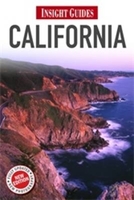
California Insight Guide

”Insight Guide California” is a comprehensive full-colour guide to everybody`s favourite state. The new edition of this travel guide, completely revised in 2012 and with hundreds of specially commissioned photos, gives detailed coverage of all the best attractions, with full-colour mapping and plenty of practical information to help you get around. New chapters on California cuisine, touring the wine regions, and exploring the great outdoors complement lively features on California`s culture and history. Special magazine-style essays cover a variety of subjects, such as the moviemakers of Sunset Boulevard and San Francisco`s cable cars. Our ”Best of California” section is an easy short-cut to all that is unmissable - from the Golden Gate Bridge to the Napa Valley, Hearst
Castle to the Redwood Forests. Travel tips provide all the planning information you`ll need, such as how to get around, how much to budget for your trip, plus our selective, independent listings recommend where to stay and where to eat in California.Whether it`s your first time of visiting or your fifth, and whether you want a coastal drive or a hike in the mountains, a tour of Disneyland or a wine tour, ”Insight Guide California” is the ideal companion.
RIP - This product is no longer available on our network. It was last seen on 25.09.2019

This page now acts as a permanent archive for this product. Add more information using the comments box below to ensure it can still be found by future generations.

Use our search facility to see if it is available from an alternative contributor.
  • Availability: Out Of Stock
  • Supplier: Stanfords
  • SKU: 9781780051147
Availability: In Stock
£16.99

Product Description

” Insight Guide California” is a comprehensive full-colour guide to everybody`s favourite state. The new edition of this travel guide, completely revised in 2012 & with hundreds of specially commissioned photos, gives detailed coverage of all the best attractions, with full-colour mapping & plenty of practical information to help you get around. New chapters on California cuisine, touring the wine regions, & exploring the great outdoors complement lively features on California`s culture & history. Special magazine-style essays cover a variety of subjects, such as the moviemakers of Sunset Boulevard & San Francisco`s cable cars. Our ” Best of California” section is an easy short-cut to all that is unmissable
- from the Golden Gate Bridge to the Napa Valley, Hearst Castle to the Redwood Forests. Travel tips provide all the planning information you`ll need, such as how to get around, how much to budget for your trip, plus our selective, independent listings recommend where to stay & where to eat in California. Whether it`s your first time of visiting or your fifth, & whether you want a coastal drive or a hike in the mountains, a tour of Disneyland or a wine tour, ” Insight Guide California” is the ideal companion.

Reviews/Comments

Add New

Intelligent Comparison

Oooops!
We couldn't find anything!
Perhaps this product's unique.... Or perhaps we are still looking for comparisons!
Click to bump this page and we'll hurry up.

Price History

Vouchers

No voucher codes found.
Do you know a voucher code for this product or supplier? Add it to Insights for others to use.

Facebook

Jargon Buster

Wine - An alcoholic drink made from fermented grapes.
Cable - A series of wires bonded to form a single thread
History - Anything that happens in the past. An acedemic subject.
Colour - The categorised spectrum of light visable to humans
Practical - Weather a task is easy to carry out and realistically succeed.
Ideal - Something that satisfies a perfect criteria.

Supplier Information

Stanfords
Stanfords was established in 1853 and opened their iconic Covent Garden flagship store in 1901. They have become the top retailer of maps, travel books and accessories in the UK and arguably offer the largest selection of maps and travel books worldwide. Famous names such as Captain Robert Falcon Scott, Ranulph Fiennes and Michael Palin have purchased from Stanfords. They now have a shop in Bristol and both stores together with other venues operate a calendar of events including talks, book signings and exhibitions. As a specialist map retailer, the map selection is comprehensive and includes road maps, street maps and walking maps from worldwide destinations, as well as a selection of world atlases and wall maps. Books include travel guides and travel literature. Stanfords also stock globes, from miniatures made of blue marble to magnificent floor-standing globes. The website features a selection of interesting articles on travel topics.
Page Updated: 2023-11-12 20:15:36

Community Generated Product Tags

Oh No! The productWIKI community hasn't generated any tags for this product yet!
Menu