
 United Kingdom
 France
 Germany
 Netherlands
 Sweden
 USA
USA
 Italy
Italy
 Spain
Spain
More From Contributor


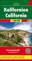
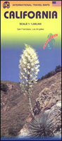
California
Large, double-sided, indexed general map of California with an uncluttered appearance, and including inset maps of LA, San Francisco and Las Vegas. The state is divided into north and south sections, with a generous overlap, and coverage also includes a little of neighbouring western Nevada. The cartography is based on that by Reise Know-How (Rough Guides). They share the same basic geographic content, although there is a slight increase in scale of reproduction in this case, plus alterations to colouring and the presentation of the topography - here with vivid relief shading rather than with contours and altitude tinting, and the omission of bathymetric tinting. Spot heights and selected peak elevations are marked, and highland ranges named. The clear road detail shows some
minor roads, with intermediate driving distances marked on selected main routes. Railways and some major ferries are marked and symbols show airports, airfields and harbours. County boundaries and names are clearly marked, and national parks, reserves, protected areas, marine sanctuaries, reservations and restricted zones are shown, and further symbols indicate tourism features and landmarks such as rest areas, beaches, vineyards, archeological sites, campsites, waterfalls, dams, lighthouses, border crossings, UNESCO sites and selected places of interest. Latitude and longitude lines are drawn at 30
minor roads, with intermediate driving distances marked on selected main routes. Railways and some major ferries are marked and symbols show airports, airfields and harbours. County boundaries and names are clearly marked, and national parks, reserves, protected areas, marine sanctuaries, reservations and restricted zones are shown, and further symbols indicate tourism features and landmarks such as rest areas, beaches, vineyards, archeological sites, campsites, waterfalls, dams, lighthouses, border crossings, UNESCO sites and selected places of interest. Latitude and longitude lines are drawn at 30
Product Description
Reviews/Comments
Add New
Intelligent Comparison
Archived Product

California Stanfords
£8.99
Archived Product
California Stanfords
£5.99
Archived Product
California Stanfords
£13.59
Archived Product
California Stanfords
£12.79
Archived Product
California Stanfords
£6.99
Archived Product
California F&B Stanfords
£10.99
Archived Product
California ITMB Stanfords
£9.99
Archived Product
California 2013 Stanfords
£16.99
Vouchers
No voucher codes found.
Do you know a voucher code for this product or supplier? Add it to Insights for others to use.
Do you know a voucher code for this product or supplier? Add it to Insights for others to use.
 Denmark