
 United Kingdom
 France
 Germany
 Netherlands
 Sweden
 USA
USA
 Italy
Italy
 Spain
Spain
More From Contributor


California F&B
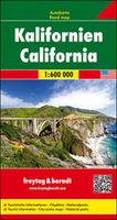
California at 1:600, 000 on a large, double-sided road map from Freytag & Berndt with a booklet attached to the map cover containing an index and street plans of downtown Los Angeles and San Francisco plus The Strip area of Las Vegas.The map divides California north/south with a generous overlap between the sides. Coverage extends eastwards to include Las Vegas with Lake Mead and the Hoover Dam. Bold relief shading with plenty of names of mountain ranges, etc, plus colouring for national/state parks and other protected areas. Outside the major conurbations road network is well presented, with road and junction numbers easy to read and driving distances marked on most small local routes. Unfortunately, in the San Francisco Bay area and particularly in the Los Angeles conurbation the
map shows so many place names that road network is very difficult to follow. Icons highlight various places of interest, including numerous campsites. The map has latitude and longitude lines at intervals of 20’. Multilingual map legend included English. The index is in a separate booklet attached to the map cover; the booklet also provides street plans of central Los Angeles, San Francisco and Las Vegas.
map shows so many place names that road network is very difficult to follow. Icons highlight various places of interest, including numerous campsites. The map has latitude and longitude lines at intervals of 20’. Multilingual map legend included English. The index is in a separate booklet attached to the map cover; the booklet also provides street plans of central Los Angeles, San Francisco and Las Vegas.

Product Description
Reviews/Comments
Add New
Vouchers
No voucher codes found.
Do you know a voucher code for this product or supplier? Add it to Insights for others to use.
Do you know a voucher code for this product or supplier? Add it to Insights for others to use.
 Denmark