
 United Kingdom
 France
 Germany
 Netherlands
 Sweden
 USA
USA
 Italy
Italy
 Spain
Spain
More From Contributor


Berlin Borch
Laminated and waterproof map for visitors to Berlin, combining a plan of the city with an enlargement for the central area, a road map of the environs, and a diagram of public transport network. The main plan at 1:18, 000 extends west to the Olympia stadium and beyond it to the Old Town of Spandau, south to the Tempelhof airport, east to Frankfurter Tor, and north to the port area along the city’s canals. An enlargement at 1:11, 500 presents the Mitte, the city’s historic centre, in greater detail. Coverage extends to include the new Central Station, the Chancellery and the Reichstag, the Kulturforum complex of museums and concert halls, Checkpoint Charlie and Alexander Platz. Both plans show the U-Bahn and S-Bahn stations, tram lines with stops, one way streets and car
parks, selected accommodation, places of interest, etc. A list of top 30 sights shows the city’s main places of interest, all highlighted on the plans.On the reverse is a map of the city’s environs within the E55 ring road, including Potsdam and the lakes surrounding Berlin east and west of the city. Both plans and the map are indexed with lists of streets/localities plus main sights and places of interest. Also included is a comprehensive diagram of Berlin’s public transport networks, a map showing the division of the city into the four sectors with the Berlin Wall, an administrative map of Germany, and information of the city’s climate.
parks, selected accommodation, places of interest, etc. A list of top 30 sights shows the city’s main places of interest, all highlighted on the plans.On the reverse is a map of the city’s environs within the E55 ring road, including Potsdam and the lakes surrounding Berlin east and west of the city. Both plans and the map are indexed with lists of streets/localities plus main sights and places of interest. Also included is a comprehensive diagram of Berlin’s public transport networks, a map showing the division of the city into the four sectors with the Berlin Wall, an administrative map of Germany, and information of the city’s climate.

Product Description
Reviews/Comments
Add New
Intelligent Comparison
Archived Product

Belize Borch Stanfords
£9.99
Archived Product
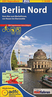
Berlin North Stanfords
£9.99
Archived Product

Beijing Borch Stanfords
£8.99
Archived Product

Berlin Noir Stanfords
£16.99
Archived Product

Dublin Borch Stanfords
£8.99
Archived Product

Brazil Borch Stanfords
£9.99
Archived Product
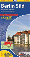
Berlin South Stanfords
£9.99
Archived Product
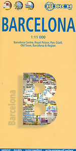
Barcelona Borch Stanfords
£8.99
Vouchers
No voucher codes found.
Do you know a voucher code for this product or supplier? Add it to Insights for others to use.
Do you know a voucher code for this product or supplier? Add it to Insights for others to use.
 Denmark