
 United Kingdom
 France
 Germany
 Netherlands
 Sweden
 USA
USA
 Italy
Italy
 Spain
Spain
More From Contributor


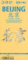
Beijing Borch
Beijing on an excellent tourist map from Borch: clear, indexed, laminated and waterproof, with detailed plans of the Forbidden City and other main sights and a road map of the capital’s environs fro day trips out of the city.The main plan at 1:75, 000 covers an area of just beyond the city’s main motorway ring (5th Ring Road), extending north-east to include the international airport. Numerous places of interest are highlighted. A street plan at 1:24, 000 provides an enlargement of the central part of the city within its inner ring (2nd Ring), again highlighting places of interest and various facilities. On both plans metro stations are prominently marked and indicate line numbers. Street names are given in Roman alphabet only, with names of selected places of interest and main
avenues also shown in ChineseOn the reverse is a map of the city’s environs at 1:1, 200, 000 extending over to the coast and highlighting main places of interest, including the Great Wall. Detailed plans are provided for the main sites: the Forbidden City (1:6, 000), the Summer Palace (1:6, 000), the Fragrant Hills Park (1:13, 000), Badaling (1:18, 000) and Chengde (1:30, 000). All the maps and plans are indexed, with, as appropriate, lists of streets, localities and places of interest.Also included are a list of top 30 sights, administrative maps of the city and the country, and other useful tourist information including climate graphs.
avenues also shown in ChineseOn the reverse is a map of the city’s environs at 1:1, 200, 000 extending over to the coast and highlighting main places of interest, including the Great Wall. Detailed plans are provided for the main sites: the Forbidden City (1:6, 000), the Summer Palace (1:6, 000), the Fragrant Hills Park (1:13, 000), Badaling (1:18, 000) and Chengde (1:30, 000). All the maps and plans are indexed, with, as appropriate, lists of streets, localities and places of interest.Also included are a list of top 30 sights, administrative maps of the city and the country, and other useful tourist information including climate graphs.

Product Description
Reviews/Comments
Add New
Vouchers
No voucher codes found.
Do you know a voucher code for this product or supplier? Add it to Insights for others to use.
Do you know a voucher code for this product or supplier? Add it to Insights for others to use.
 Denmark