More From Contributor
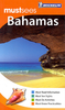
£59.99
We are able to source a wide range of courtesy flags. Flags are available in many sizes & can be sewn or printed on 100% Ministry Of Defence Standard Woven & Knitted Polyester. Flags are supplied with rope & toggle. If you would like more information, have a custom size request or cannot find a desired product, please email us at maritime@stanfords.co.uk. We will be glad to help! ...
Archived Product
£29.99
We are able to source a wide range of courtesy flags. Flags are available in many sizes & can be sewn or printed on 100% Ministry Of Defence Standard Woven & Knitted Polyester. Flags are supplied with rope & toggle. If you would like more information, have a custom size request or cannot find a desired product, please email us at maritime@stanfords.co.uk. We will be glad to help! ...
Archived Product
£110.00
We are able to source a wide range of courtesy flags. Flags are available in many sizes & can be sewn or printed on 100% Ministry Of Defence Standard Woven & Knitted Polyester. Flags are supplied with rope & toggle. If you would like more information, have a custom size request or cannot find a desired product, please email us at maritime@stanfords.co.uk. We will be glad to help! ...
Archived Product
£8.00
For the traveler attracted to the Bahamas, this book provides all the needed information on the people, culture, & history of the islands as well as the flora, fauna, undersea life, agriculture, & sports. Walking tours of Nassau are a unique feature of the guide & a chapter on nightlife shows that evenings can be as enjoyable as the days. ...
Archived Product
£4.99
Durable, laminated tourist map with street plans & tourist information
- one of the many handy-sized Flexi Maps by this publisher,
...
Archived Product
£7.99
The Bahamas in Michelin’s ‘ Must Sees’ series is a lightweight guide containing must see information, must see sights, must do activities & must know practicalities graded using Michelin’s time-honoured star rating system. The guide opens with a section of useful ‘ Must Know’ information that

Includes::
a calendar of events, practical tips on getting by & a summary of Michelin selected star attractions. The ‘ Must See’ section of the guide look at shopping, nightlife & theatre, hotels & dining, parks & gardens, neighbourhoods, landmarks, museums, historic sites, practical information, events, tips & excursions. The ‘ Must Do’ chapter

Includes::
a focus on activities for children, whereas places to eat & places to stay are reviewed in the ‘ Must Eat’ & ‘ Must Stay’ chapters.


...
Archived Product
£25.00
We are able to source a wide range of courtesy flags. Flags are available in many sizes & can be sewn or printed on 100% Ministry Of Defence Standard Woven & Knitted Polyester. Flags are supplied with rope & toggle. If you would like more information, have a custom size request or cannot find a desired product, please email us at maritime@stanfords.co.uk. We will be glad to help! ...
Archived Product
£20.00
The Bahamas on a double-sided nautical chart from Wavey Line Ltd showing on one side the whole group & on the reverse several enlargements of main harbours and/or coastal waters, plus lists of GPS waypoints, marina directories, etc. On one side is a map of the whole archipelago, with the adjoining coast of Florida & Cuba, plus the Turk & Caicos Islands. On the reverse enlargements show in greater detail: Binimi Harbours, Gun Cay Anchorage & Cat Cay Marina, Old Bahama Bay Marina, Chub Cay, Highbourne Cay, Staniel Cay & Big Rock Cut, West Bay Anchorage, Port, Nelson, Clarence Town, Nassau Harbour, Elizabeth Harbour, South West Anchorage, Pirate’s Well Basin, Abraham’s Bay & Attwood Harbour. The chart shows sea depths, sand bars, reefs, rocks & other obstructions, marinas, fuelling stations, anchorages, major landmarks on l&, & light beacons with their flashing pattern & visibility range. Suggested routes between waypoints with their bearings & distances are also shown. Navigation advice is helpfully printed on the body of the chart in the relevant sections. Also provided are marina directories with contact numbers, technical information, fees, lists of facilities, etc; an extensive list of GPS Waypoints; plus a telephone directory. ...
Archived Product
£40.00
Pilots rely on the Bahamas & the Caribbean Pilot`s Guides each year for all the information they need in one convenient place. These essential Pilot`s Guides have a well-earned reputation as the one complete resource for aviation travel in the islands. Updated annually, the Pilot`s Guides are packed full of procedures, Customs & Immigration information, phone numbers, frequencies, fuel availability, aerial photos, forms, & so much more to help you plan, prepare for & enjoy your trip. Much more than just a list of airports, these full-color, spiral-bound books will help you fly confidently on your next island getaway. ...
Archived Product
£4.99
Bahamas in the Pocket Guide series from Berlitz; a collection of handy, pocket-sized guides dedicated to an extensive range of cities, regions & countries worldwide. Written in narrative form, individual guides explore the history, main sights & attractions, food & drink, accommodation & local culture of the destination in detail. Each Berlitz pocket guide has a similar format, with colour-coded sections helping readers locate information quickly in addition to distinctive chapters exploring the city or region. An introduction outlines the destination for visitors & a section dedicated to 'A Brief History' actually explores the area in relative depth. A where to go chapter is organized by region & city & is written in prose form with references to individual sites highlighted in bold for clarity. There are also further suggestions on where & when to eat. Recommendations for leisure activities in the region, including sport, nightlife & shopping, are also provided & tailored accordingly for each destination. Handy travel tips are listed alphabetically in a dedicated section, providing practical guidance & helping visitors make the most of their stay. The main hotels, particularly for cities, are also listed in an accommodation section, offering a brief overview with approximate price bandings & relevant contact details. ...
Archived Product

Bahamas ITMB

The Bahamas at 1:500, 000 from ITMB on a double-sided, indexed map printed on light, waterproof and tear-resistant paper, with street plans of Nassau and Freeport, plus New Providence Island shown in greater detail at 1:140, 000. The maps divides the whole archipelago north/south, covering on one side the islands from Grand Bahama and Abaco to Eleuthera, Andros and the small northern islands of the Exuma Cays, with Bimini Island and Isaac Island shown as insets. This side on the map also has street plans of Nassau and Freetown, plus an enlargement presenting New Providence in greater detail at 1:140, 000.On the reverse is the southern part of the Bahamas group, from Eleuthera, Exuma Cays and Cat Island to Acklins Islands and Mayaguana, with Great and Little Inagua Islands shown
as insets. On both sides of the map several small outlaying atolls are also included as insets.The map shows the road network on the islands, with symbols indicating various places ot interest including beaches, scuba diving/snorkeling/surfing sites, national park and other protected areas including wild life and bird sanctuaries, golf courses and other recreational facilities, marinas, etc. Swamps or mangrove areas, and in the coastal waters coral reefs are marked. Latitude and longitude are expressed in decimal parts of a degree, with the lines drawn at 0.30º intervals. Each side of the map has a separate index.The two street plans and the enlargement of New Providence are also overprinted with various tourist facilities and places of interest, including selected accommodation.
RIP - This product is no longer available on our network. It was last seen on 25.09.2019

This page now acts as a permanent archive for this product. Add more information using the comments box below to ensure it can still be found by future generations.

Use our search facility to see if it is available from an alternative contributor.
  • External links may include paid for promotion
  • Availability: Out Of Stock
  • Supplier: Stanfords
  • SKU: 9781553411239
Availability: In Stock
£9.99

Product Description

The Bahamas at 1:500, 000 from ITMB on a double-sided, indexed map printed on light, waterproof & tear-resistant paper, with street plans of Nassau & Freeport, plus New Providence Island shown in greater detail at 1:140, 000. The maps divides the whole archipelago north/south, covering on one side the islands from Grand Bahama & Abaco to Eleuthera, Andros & the small northern islands of the Exuma Cays, with Bimini Island & Isaac Island shown as insets. This side on the map also has street plans of Nassau & Freetown, plus an enlargement presenting New Providence in greater detail at 1:140, 000. On the reverse is the southern part of the Bahamas group, from Eleuthera, Exuma Cays & Cat Island to Acklins Islands & Mayaguana, with Great & Little Inagua Islands shown as insets. On both sides of the map several small outlaying atolls are also included as insets. The map shows the road network on the islands, with symbols indicating various places ot interest including beaches, scuba diving/snorkeling/surfing sites, national park & other protected areas including wild life & bird sanctuaries, golf courses & other recreational facilities, marinas, etc. Swamps or mangrove areas, & in the coastal waters coral reefs are marked. Latitude & longitude are expressed in decimal parts of a degree, with the lines drawn at 0.30º intervals. Each side of the map has a separate index. The two street plans & the enlargement of New Providence are also overprinted with various tourist facilities & places of interest, including selected accommodation.

Reviews/Comments

Add New

Price History

Vouchers

No voucher codes found.
Do you know a voucher code for this product or supplier? Add it to Insights for others to use.

Facebook

Jargon Buster

Paper - A thin sheet mainly used for writing. Available in a variety of colours. Made mainly from wood pulp.
Waterproof - Resistant to water, usualy specified by depth in metres
Network - A link and communication between things. Often computers or people.
Small - something that takes up less space than normal.
Road - a manmade lane or a path that is used to speed up travel.
Resistant - Something that can repel against something.
Golf - A sport played on a large outside grass course, the aim to hit a small ball with a club into small holes.
Accommodation - A room in which someone can live in, for example in a hotel
Degree - An angle measurement, also can be the measurement of an extent that something happens, can also relate to an university academic measurement.
degree - The extremity of something or the angle. Can also relate to a university achievement.

Supplier Information

Stanfords
Stanfords was established in 1853 and opened their iconic Covent Garden flagship store in 1901. They have become the top retailer of maps, travel books and accessories in the UK and arguably offer the largest selection of maps and travel books worldwide. Famous names such as Captain Robert Falcon Scott, Ranulph Fiennes and Michael Palin have purchased from Stanfords. They now have a shop in Bristol and both stores together with other venues operate a calendar of events including talks, book signings and exhibitions. As a specialist map retailer, the map selection is comprehensive and includes road maps, street maps and walking maps from worldwide destinations, as well as a selection of world atlases and wall maps. Books include travel guides and travel literature. Stanfords also stock globes, from miniatures made of blue marble to magnificent floor-standing globes. The website features a selection of interesting articles on travel topics.
Page Updated: 2023-11-12 20:15:36

Community Generated Product Tags

Oh No! The productWIKI community hasn't generated any tags for this product yet!
Menu