
 United Kingdom
 France
 Germany
 Netherlands
 Sweden
 USA
USA
 Italy
Italy
 Spain
Spain
More From Contributor


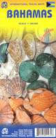
Bahamas
Laminated, waterproof tourist map of the Bahamas from Borch, showing both the whole of the archipelago together and individual islands separately at more detailed scales, plus street plans of Nassau and Freeport. The whole of the Bahamas, including the southern tip of Florida and Turks and Caicos Islands, is shown at 1:2, 250, 000, indicating local airports. Individual islands are presented at:- Grand Bahama, Abaco and the surrounding little islands together at 1:500, 000, with a street plan of Freetown at 1:50, 000- New Providence at 1:150, 000, with a street plan of Nassau at 1:20, 000- Bimini Islands at 1:100, 000- San Salvador Island at 1;250, 000- Berry Islands, Cat Island, Eleuthera, Exuma Islands North, Exuma Islands South, Inagua Islands, Long Island, Mayaguana,
Ragged Islands, and South Acklins and Crooked Islands at 1:500, 000- Andros Island at 1:550, 000All the maps and street plans highlight places of interest, including national parks, beaches, yachting and scuba diving facilities, shipwrecks, etc. and are indexed with separate lists for accommodation, places of interest, etc. Map legend includes English. Also provided are climate charts with average monthly temperature, precipitation, etc.
Ragged Islands, and South Acklins and Crooked Islands at 1:500, 000- Andros Island at 1:550, 000All the maps and street plans highlight places of interest, including national parks, beaches, yachting and scuba diving facilities, shipwrecks, etc. and are indexed with separate lists for accommodation, places of interest, etc. Map legend includes English. Also provided are climate charts with average monthly temperature, precipitation, etc.
Product Description
Reviews/Comments
Add New
Intelligent Comparison
Archived Product

The Bahamas Stanfords
£11.99
Archived Product
Bahamas ITMB Stanfords
£9.99
Vouchers
No voucher codes found.
Do you know a voucher code for this product or supplier? Add it to Insights for others to use.
Do you know a voucher code for this product or supplier? Add it to Insights for others to use.
 Denmark