More From Contributor
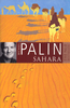
£9.99
Map No. 237, Saguaro National Park, AZ, in an extensive series of GPS compatible, contoured hiking maps of USA’s national & state parks or forests & other popular recreational areas. Cartography based on the national topographic survey, with additional tourist information. The maps, with most titles now printed on light, waterproof & tear-resistant plastic paper, highlight walking trails along with campsites & other accommodation, picnic sites, areas for various recreational pursuits such as horse riding or skiing, drinking water sources, & many other facilities of interest to the outdoor enthusiast. Cartography is based on information from the USGS (United States Geological Survey
- the country’s national survey organization), revised by the National Geographic Maps in cooperation with the National Park Service, USDA Forest Service, etc. Topography is excellently presented by contours (interval varies according to scale), enhanced by relief shading & colouring/graphics for wood cover, glaciers, etc. All heights are given in feet. The maps have a UTM grid plus latitude & longitude margin ticks & GPS waypoints for selected important locations. Each map is double-sided to give either maximum coverage of the chosen area or additional enlargements of its important sections. Accompanying notes provide useful information on relevant regulations, safety precautions, contact addresses, etc.* *IMPORTANT
- PLEASE NOTE: the series is very extensive, ranging in scale from 1:400, 000 for the vast national parks of Alaska to 1:25, 000 for local map in several states. We recommend, therefore, viewing the series by state rather than the whole list.*

...
Archived Product
£6.95
Topographic coverage of mainland Spain at 1:50, 000 in the MTN50 (Mapa Topográfico Nacional) series from the Centro Nacional de Información Geografica, the country’s civilian survey organization. The maps have contours at 20m intervals, enhanced by relief shading, plus colouring and/or graphics to show different types of terrain, vegetation or land use. Boundaries of national parks & other protected areas are marked. In addition to all the usual information featured on topographic mapping at this scale, detailed presentation of the road & rail networks, rural tracks & paths, etc, the maps also show campsites & mountain refuges. On more recent editions some GRs, the official long-distance hiking routes, are also marked (although not as clearly as on hiking maps from other publishers). Each map covers 29.5x 18.5 km (with adjustments in the border or coastal areas). The maps have a 1-km UTM grid, plus margin ticks for latitude & longitude at 1` intervals. Map legend is in Spanish only.HOW TO CHOOSE THE RIGHT 50K MAP: all the titles in CNIG’s 200K Provincial Road Maps series at 1:200, 000 are overprinted with the grid for the 1:50, 000 maps & can be used to see the area covered by each 50K title. TO SEE THE LIST OF TITLES IN THIS SERIES PLEASE CLICK ON THE SERIES LINK.PLEASE NOTE
- MAP TITLES: the grids shown on our website serve both the civilian & the military 1:50, 000 topographic series. Although the areas covered by maps in both series are identical (apart from some border or coastal sheets), occasionally map titles differ – only one title is shown on the grid, usually the military one. In Galicia, the Basque country & in the Catalan speaking areas the tendency now is to use local place names rather than the often better known Castilian ones. Where possible, both versions are included in our titles. Map titles listed on our website are based on information received by us at the time of publication, but sometimes maps arrive showing a completely different title! As long as the map number is as ordered, the correct map has been supplied.
...
Archived Product
£18.99
Melbourne-based chef, Greg Malouf grew up in a family whose longing for their homeland Lebanon was most often expressed through food. His childhood was filled with the noisy chatter of generations of women sitting around the kitchen table preparing Arabic dishes the way they've been prepared for centuries. Saha chronicles Greg's epic journey to the lands of his ancestors to explore its broad & influential cuisine & discover the roots of his culinary heritage. From desert kingdoms to sea castles, from citadels to souks, through olive groves & snow-capped mountain ranges, Greg, & his writing partner, Lucy, unearth a dazzling array of traditional dishes, as well as new culinary delights. The recipes in Saha are as rich & varied as the lands themselves. Enjoy traditional dishes, such as Aleppo-Style Chicken Cooked on Coals, Armenian-inspired Slow Roasted Lamb with Red Pepper & Pomegranate Paste; a simple Bedouin Spinach, Lentil & Lemon Soup or the famous Mediterranean Red Mullet Cooked with Golden Spices. For dessert, try the legendary Rose of Damascus
- crisp filo with Turkish delight ice-cream & toffee strawberries. Throughout their journey, Greg & Lucy were welcomed into the homes of fishermen, bee-keepers, bakers, arak distillers, cooks & housewives & the book is filled with their heart-warming & evocative stories.
...
Archived Product
£8.99
Of all Michael Palin’s epic voyages around the world, his Sahara trip was perhaps the most challenging. Shrugging aside the perils of camel stew & being run over by the Paris-Dakar rally, Palin discovers that, far from being an empty wastel&, the vast & merciless Saharan desert is, in fact, home to a wonderful diversity of cultures & some of the most spectacular landscapes on earth. ...
Archived Product
£20.50
Michael Palin's epic voyages have seen him circumnavigate the globe, travel from the North to the South Pole & circle the countries of the Pacific Ocean, but perhaps the greatest challenge facing an intrepid explorer is crossing the vast & merciless Sahara desert. There is no easy way to do it, & Palin's experiences are like nothing he has encountered before. As the journey unfolds, the Sahara reveals not the emptiness of endless sand dunes, but a huge & diverse range of cultures & landscapes & a long history of civilisation, trade, commerce & conquest stretching from the ancient Egyptians to the oil-rich Islamic republics of today. ...
Archived Product
£14.50
Michael Palin's epic voyages have seen him circumnavigate the globe, travel from the North to the South Pole & circle the countries of the Pacific Ocean, but perhaps the greatest challenge facing an intrepid explorer is crossing the vast & merciless Sahara desert. There is no easy way to do it, & Palin's experiences are like nothing he has encountered before. As the journey unfolds, the Sahara reveals not the emptiness of endless sand dunes, but a huge & diverse range of cultures & landscapes & a long history of civilisation, trade, commerce & conquest stretching from the ancient Egyptians to the oil-rich Islamic republics of today. ...
Archived Product
£9.99
Published for the first time in one volume, Sven Lindqvist`s uncategorizable, beautiful & angry books about the African continent & the legacy of colonialism. Exterminate All the Brutes takes us on an intellectual trip to `the heart of the darkness` of the European mind & its attitude towards Africa, tracing the legacy of European explorers, missionaries, politicians & historians in Africa from the late eighteenth century onwards. Its sequel, Desert Divers, describes Lindqvist`s journey through Algeria & Morocco, & explores the way European writers of the early twentieth century plunged into the stony, baking expanse of the Sahara, drawn by their own strange dreams. ...
Archived Product
£29.95
In 1984 Sebastiao Salgado began what would be a fifteen-month project of photographing the drought-stricken Sahel region of Africa in the countries of Chad, Ethiopia, Mali, & Sudan, where Approx. one million people died from extreme malnutrition & related causes. Working with the humanitarian organization Doctors Without Borders, Salgado documented the enormous suffering & the great dignity of the refugees. This early work became a template for his future photographic projects about other afflicted people around the world. Since then, Salgado has again & again sought to give visual voice to those millions of human beings who, because of military conflict, poverty, famine, overpopulation, pestilence, environmental degradation, & other forms of catastrophe, teeter on the edge of survival. Beautifully produced, with thoughtful supporting narratives by Orville Schell, Fred Ritchin, & Eduardo Galeano, this first U.S. edition brings some of Salgado`s earliest & most important work to an American audience for the first time. Twenty years after the photographs were taken, ” Sahel: The End of the Road” is still painfully relevant. Born in Brazil in 1944, Sebastiao Salgado studied economics in Sao Paulo & Paris & worked in Brazil & Engl&. While traveling as an economist to Africa, he began photographing the people he encountered. Working entirely in a black-&-white format, Salgado highlights the larger meaning of what is happening to his subjects with an imagery that testifies to the fundamental dignity of all humanity while simultaneously protesting its violation by war, poverty, & other injustices. ` The planet remains divided, ` Salgado explains. ` The first world in a crisis of excess, the third world in a crisis of need.` This disparity between the haves & the have-nots is the subtext of almost all of Salgado`s work. ...
Archived Product
£25.00
The Sahel, where the southern edge of the Sahara meets the land in between it & the savannah, is alternatively ignored & misunderstood. In the 1970s it was synonymous with drought & famine, yet crops & herds flourish along its riverbanks & fears of `desertification` have been debunked. After a century of colonialism & military rule the Sahelian nations of Mali & Niger built democracies fortified by long political traditions & Islam, though challenged by recurring violence, especially in Niger, which also witnessed a return of famine. Yet it was Mali that nearly collapsed, in 2012, & there was talk of it becoming an Al Qaeda safe haven, which precipitated French military intervention. Once again the Sahel is a political & environmental faultline, invoked as an `arc of instability`, yet while the portents seem gloomy, Niger has uranium, Mali is Africa`s third largest gold producer & new partners, like China, are rushing in. In his entwined history of Mali & Niger, Thomas Miles contends that today`s crises are neither inevitable nor permanent. The Sahel has long exchanged goods & ideas with the wider world & the presence there of French soldiers & American drones is only one moment in a long & distinguished trajectory. ...
Archived Product
£12.99
Map No. 1104, Saignelégier, in the topographic survey of Switzerland at 1:25, 000 from Bundesamt für Landestopographie (swisstopo), covering the whole country on 247 small format sheets, with special larger maps published for popular regions including some titles now available in hiking versions. Highly regarded for their superb use of graphic relief & hill shading, the maps give an almost 3-D picture of Switzerland`s mountainous terrain. Contours are at 10 m intervals, with 20m intervals in the mountainous areas. All the maps have a 1-km grid for Swiss national coordinates (datum CH 1903). * Small format sheets (Nos. 1011
- 1374)* Map legend in the language of the area covered by the map. Additional margin ticks show latitude & longitude in steps of 2`. The area covered by each map is 17 x 12 km (11 x 7 miles approx). * Special larger sheets (Nos. from 2501 onwards) – STANDARD editions:* No map legend is included but a separate leaflet can be provided instead. The area covered by each map is 25 x 17 km (15 x 11 miles approx).* Special larger sheets (Nos. from 2501 onwards) – HIKING editions:* An overprint highlights hiking, mountain & alpine paths, including regional & national long-distance trails. The maps also show bus routes with bus stops, plus inns in remote locations. The area covered by each map is 25 x 17 km (15 x 11 miles approx).
...
Archived Product

Sahara ITMB

The Sahara Desert at 1:3, 400, 000 on an indexed, double-sided map from ITMB. Coverage extends southwards from approx. 30ºN within Morocco (Agadir) and 33ºN elsewhere (Ourgla in Algeria, Tripoli in Libya and Alexandria in Egypt) to approx. 16ºN (Timbuktu in Mali and Agadez in Niger). West / east the map covers the region from the coastline of Western Sahara and Nouakchott in Mauritania to the Abu Simbel temple in Egypt and the bend of the Nile in northern Sudan.Elevation colouring indicates the topography, with landscape features such as seasonal rivers and lakes, salt flats, and marshes/swamps. Oases and numerous wells/waterholes are also marked, most of them with names. International boundaries are shown with, where appropriate, border crossings. Road network includes selected
desert tracks and shows distances on main routes; the map also shows domestic airfields. A range of symbols indicate various places of interest. Latitude and longitude lines are drawn at 5° intervals. Each side has a separate index.To see other titles in this series please click on the series link.
RIP - This product is no longer available on our network. It was last seen on 25.09.2019

This page now acts as a permanent archive for this product. Add more information using the comments box below to ensure it can still be found by future generations.

Use our search facility to see if it is available from an alternative contributor.
  • External links may include paid for promotion
  • Availability: Out Of Stock
  • Supplier: Stanfords
  • SKU: 9781771296922
Availability: In Stock
£9.99

Product Description

The Sahara Desert at 1:3, 400, 000 on an indexed, double-sided map from ITMB. Coverage extends southwards from approx. 30ºN within Morocco (Agadir) & 33ºN elsewhere (Ourgla in Algeria, Tripoli in Libya & Alexandria in Egypt) to approx. 16ºN (Timbuktu in Mali & Agadez in Niger). West / east the map covers the region from the coastline of Western Sahara & Nouakchott in Mauritania to the Abu Simbel temple in Egypt & the bend of the Nile in northern Sudan. Elevation colouring indicates the topography, with landscape features such as seasonal rivers & lakes, salt flats, & marshes/swamps. Oases & numerous wells/waterholes are also marked, most of them with names. International boundaries are shown with, where appropriate, border crossings. Road network

Includes::
selected desert tracks & shows distances on main routes; the map also shows domestic airfields. A range of symbols indicate various places of interest. Latitude & longitude lines are drawn at 5° intervals. Each side has a separate index. To see other titles in this series please click on the series link.

Reviews/Comments

Add New

Intelligent Comparison

Oooops!
We couldn't find anything!
Perhaps this product's unique.... Or perhaps we are still looking for comparisons!
Click to bump this page and we'll hurry up.

Price History

Vouchers

No voucher codes found.
Do you know a voucher code for this product or supplier? Add it to Insights for others to use.

Facebook

Jargon Buster

Network - A link and communication between things. Often computers or people.
Road - a manmade lane or a path that is used to speed up travel.

Supplier Information

Stanfords
Stanfords was established in 1853 and opened their iconic Covent Garden flagship store in 1901. They have become the top retailer of maps, travel books and accessories in the UK and arguably offer the largest selection of maps and travel books worldwide. Famous names such as Captain Robert Falcon Scott, Ranulph Fiennes and Michael Palin have purchased from Stanfords. They now have a shop in Bristol and both stores together with other venues operate a calendar of events including talks, book signings and exhibitions. As a specialist map retailer, the map selection is comprehensive and includes road maps, street maps and walking maps from worldwide destinations, as well as a selection of world atlases and wall maps. Books include travel guides and travel literature. Stanfords also stock globes, from miniatures made of blue marble to magnificent floor-standing globes. The website features a selection of interesting articles on travel topics.
Page Updated: 2023-11-12 20:15:36

Community Generated Product Tags

Oh No! The productWIKI community hasn't generated any tags for this product yet!
Menu