
 United Kingdom
 France
 Germany
 Netherlands
 Sweden
 USA
USA
 Italy
Italy
 Spain
Spain
More From Contributor


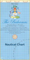
Bahamas Overall Chart
The Bahamas on a double-sided nautical chart from Wavey Line Ltd showing on one side the whole group and on the reverse several enlargements of main harbours and/or coastal waters, plus lists of GPS waypoints, marina directories, etc.On one side is a map of the whole archipelago, with the adjoining coast of Florida and Cuba, plus the Turk and Caicos Islands. On the reverse enlargements show in greater detail: Binimi Harbours, Gun Cay Anchorage and Cat Cay Marina, Old Bahama Bay Marina, Chub Cay, Highbourne Cay, Staniel Cay & Big Rock Cut, West Bay Anchorage, Port, Nelson, Clarence Town, Nassau Harbour, Elizabeth Harbour, South West Anchorage, Pirate’s Well Basin, Abraham’s Bay and Attwood Harbour.The chart shows sea depths, sand bars, reefs, rocks and other
obstructions, marinas, fuelling stations, anchorages, major landmarks on land, and light beacons with their flashing pattern and visibility range. Suggested routes between waypoints with their bearings and distances are also shown. Navigation advice is helpfully printed on the body of the chart in the relevant sections.Also provided are marina directories with contact numbers, technical information, fees, lists of facilities, etc; an extensive list of GPS Waypoints; plus a telephone directory.
obstructions, marinas, fuelling stations, anchorages, major landmarks on land, and light beacons with their flashing pattern and visibility range. Suggested routes between waypoints with their bearings and distances are also shown. Navigation advice is helpfully printed on the body of the chart in the relevant sections.Also provided are marina directories with contact numbers, technical information, fees, lists of facilities, etc; an extensive list of GPS Waypoints; plus a telephone directory.

Product Description
Reviews/Comments
Add New
Vouchers
No voucher codes found.
Do you know a voucher code for this product or supplier? Add it to Insights for others to use.
Do you know a voucher code for this product or supplier? Add it to Insights for others to use.
 Denmark