
 United Kingdom
 France
 Germany
 Netherlands
 Sweden
 USA
USA
 Italy
Italy
 Spain
Spain
More From Contributor


France Physical Wall Map
France Physical Wall Map from the IGN, 80 x 76cm, beautifully presenting the country's geography with bright colours and shading against light blue seas. Larger towns are marked and many of the topographic features: rivers and canals, plateaux, mountain ranges, peaks, etc, are named. The map does not show the country
Product Description
Reviews/Comments
Add New
Intelligent Comparison
Archived Product
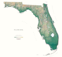
Florida State Physical Wall Map Stanfords
£30.00
Archived Product
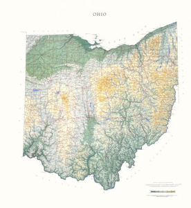
Ohio State Physical Wall Map Stanfords
£30.00
Archived Product
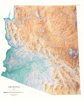
Arizona State Physical Wall Map Stanfords
£30.00
Archived Product

Georgia State Physical Wall Map Stanfords
£30.00
Archived Product
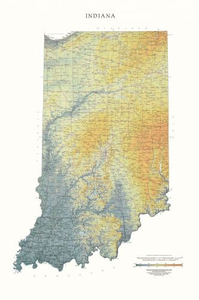
Indiana State Physical Wall Map Stanfords
£30.00
Archived Product
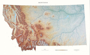
Montana State Physical Wall Map Stanfords
£30.00
Archived Product
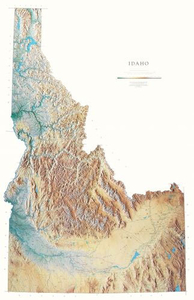
Idaho State Physical Wall Map Stanfords
£30.00
Archived Product

New York State Physical Wall Map Stanfords
£30.00
Vouchers
No voucher codes found.
Do you know a voucher code for this product or supplier? Add it to Insights for others to use.
Do you know a voucher code for this product or supplier? Add it to Insights for others to use.
 Denmark