More From Contributor

£9.99
Georgia at 1:500, 000 on a double-sided road map
- paper version
- from the Tbilisi-based Geol&, showing a large number of

...
Archived Product
£15.99
Georgia at 1:500, 000 on a double-sided road map
- waterproof & tear-resistant version
- from the Tbilisi-based Geol&, showing

...
Archived Product
£25.00
Peter Nasmyth has lived in & travelled extensively throughout Georgia for twenty years. Georgia in the Mountains of Poetry is his fascinating account of this intriguing country, based on his travels & hundreds of wide-ranging interviews. Reprinted numerous times, it remains the only comprehensive book on Georgia`s history & culture written for the general reader, now substantially revised & expanded for this new edition. Georgia
- no larger than Switzerland
- ranks in the world`s top twelve countries for geographical diversity. It borders on the Black Sea & contains the heart of the Caucasus mountains, subtropical wetlands & semi-arid regions. Stone towers attest to its 3, 000-year-old history, which has witnessed the thous&-year reign of the Bagratuni monarchy, the rise & fall of the Soviet Union, a bitter civil war & the celebration of its independence in 1991. Yet little is known about this remarkable place outside its borders, & Georgia in the Mountains of Poetry is essential reading for anyone interested in this fascinating region, as well as for students & researchers looking for an insight into life after the collapse of the old Soviet order in the richest & most dramatic of its former republics.

...
Archived Product
£19.99
Georgia Recreational Atlas & Gazetteer at 1:185, 000 approx. in a series of large format paperback state atlases from De Lorme, with detailed, contoured, GPS compatible topographic mapping. Recreational information

Includes::
lists of hiking trails, tables of salt or fresh water fishing sites & hunting grounds, recreational areas, scenic drives, historic sites, unique natural features, campgrounds, attractions, golf courses, etc. Each title in this De Lorme series covers one state & presents it at a scale much more detailed than used on most state road maps. Particularly popular areas are often also presented on enlargements. The maps are contoured, show variation of terrain (deserts, glaciers, wetlands, woodlands, etc) & have latitude & longitude and/or UTM grid lines for GPS use. Various types of protected areas are distinguished by the colouring of their boundaries, e.g. national or state parks, forests, etc. Also marked are Indian Reservations & restricted entry military zones. Road network is shown in much more detail than on other state mapping, with local roads, unsurfaced back roads & tracks, forest trails, etc. Where appropriate, old historical routes are marked. Railway lines & local airports or landing strips are included & the maps also indicate administrative boundaries. Symbols highlight various recreational areas & facilities such as campgrounds, unique natural features, etc. Each title contains extensive lists of outdoor adventure sites (grouped into activities such as hiking, biking, paddling, fishing, skiing, etc.), diverse family outing sites, campgrounds, & tables showing what facilities can be found in the state’s recreational areas. Each atlas also has an index of localities. To see the list of titles in this series please click on the series link.

...
Archived Product
£11.50
Georgia at 1:350, 000 on an indexed, waterproof & tear-resistant road map with topographic & tourist information, published by Reise Know-How as part of their highly acclaimed World Mapping Project. All place names are in the Latin alphabet, with larger towns also in the Georgian script, plus in Abkhazia in Cyrillic. The map is double-sided, dividing the country east/west with a good overlap between the sides, & shows Abkhazia & South Ossetia as administrative provinces of Georgia, although their currently different status is indicated by inclusion of signs for “closed frontier crossings”. Topography is indicated by light, unobtrusive altitude colouring, plus plenty of names of mountain ranges, peaks & passes with heights, glaciers, etc. National parks & other protected areas are highlighted. Road network

Includes::
selected unpaved seasonal tracks & gives driving distances on main routes. Railway lines are shown & local airports are marked. Symbols highlight various places of interest including UNESCO World Heritage sites, archaeological remains, religious buildings, beaches, winter sports area, etc. The map has latitude & longitude lines at 20’ intervals & is indexed. Map legend

Includes::
English.” World Mapping Project” is an extensive series of maps at varying scales, aiming to provide coverage of countries & regions worldwide using clear, well presented cartography with both topographic & tourist information.


...
Archived Product
£14.99
This guide provides the most up-to-date & detailed source of hard facts for independent travellers & hikers on getting to & around this little-explored but very welcoming ex-Soviet state. Thorough coverage is provided on the increasingly cosmopolitan capital, Tbilisi, together with plenty of suggestions for itineraries further afield highlighting Georgia's picturesque & unspoiled countryside. ...
Archived Product
£11.99
Despite being located on the extreme eastern boundary of Europe, & having been frequently conquered by invading people from Asia, including Arabs, Turks, Persians, Mongols, & more recently Russians, Georgians still regard themselves very much as Europeans & it is to becoming a future member state of the EU that the majority of the people now aspire. As for the traditional folk-tales from the region, one of their main characteristics is that they are packed with action: Whilst a written, `literary` novel or short story might devote paragraphs to descriptions of people or places, these tales usually settle for an adjective or two; `a thick impassable forest`, `a handsome stately man`, or a formula such as `not-seen-beneath-the-sun beauty`. Many of the heroes & heroines do not even have names (Hunt, 1999, p.8). Safely cocooned, or so we like to kid ourselves, in our sanitised western urban environment, we tend to take the elements for granted. However, tales from a time when the Earth was new help to jolt us out of our daily lethargy, as do the stories in this collection
- a number of which have never been translated from Georgian direct into English before.
...
Archived Product
£8.95
Western Georgia at 1:250, 000 in a series of on four double-sided road maps from the locally based Geoplan, with topographic & tourist information, detailed grading of towns & villages according to the number of inhabitants, etc. The map covers the provinces of Svaneti, Samegrelo, Lechkhumi, Imereti, Guria & Achara. Relief shading with numerous peak heights, plus colouring or graphics for marshl&, glaciers, forests, gardens & vineyards, etc. shows the topography. Internal administrative boundaries are marked, & presentation of towns & villages is finely graded to indicate both their administrative status & the number of inhabitants. Road network distinguished between local paved or unpaved roads & dirt tracks. Railway lines are also included. A range of symbols highlight various places of interest including nine different types of religious establishments, cave towns, historical towers & bridges, archaeological sites, temporary shelters & ruined villages, etc. Each map has a latitude & longitude grid at intervals of 20 ...
Archived Product
£12.79
Georgia, Armenia & Azerbaijan in the Countries & Regions series from Lonely Planet, market-leading comprehensive guides aimed at independent travellers & serving a large range of international destinations. Frank & informal in style, the guides explore an extensive range of sights, activities, accommodation, restaurants & nightlife & are designed for practical use while travelling on the road. Written & researched by a team of experts, each book is independent in its recommendations & suggestions, often offering individual takes on individual destinations. Widely recognised for their reliability, each Lonely Planet country & region guide has the same layout. Introductory sections profile the destination with individual chapters on particular highlights, getting started, (including when to go) itineraries, history, culture, arts, food & drink & the environment. Each guide is organised geographically by region, with individual sections detailing an extensive range of sights, places of interest, attractions, restaurants, nightlife, accommodation & any local activities. The guides have detailed explanations of historical context where relevant. There is also practical guidance on ...
Archived Product

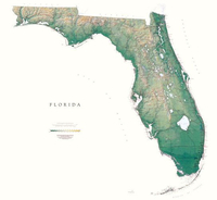
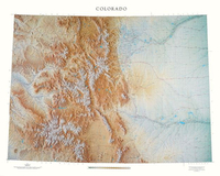
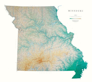
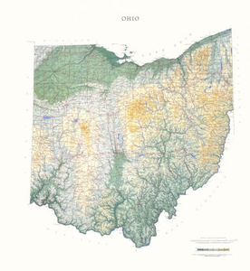
Georgia State Physical Wall Map

Detailed physical wall map of Georgia State at a scale of 1:500, 000. The cartography shows relief through a stunning, highly detailed shading, with different elevations varing in colouring, giving an almost 3-dimensional feel to the map. Peak heights are also clearly marked.The map displays land only within the boundaries of the chosen states - there is no overlap with neigbouring states. Principal physical features such as glaciers, mountain ranges, rivers and lakes are shown clearly. Human features, such as main towns, cities, roads and railways, are shown in a very fine, subtle and elegant cartographic style. State capitals are also clearly marked.This map measures 102x115cm (40”x45”). The state of Georgia lies between the Chattahoochee and the Savannah Rivers, and the
Blue Ridge Mountains and the Atlantic Ocean. The plains, the hilly piedmont, and even the Appalachian Plateau in the northwestern corner are all depicted in delicate shades of brown and green, with each color repres*About this series:*Located on the corner of Main and Central in downtown Medford, Oregon since 1986, Raven has become the quintessential small company with a big reputation. Every map is created with attention to accuracy and elegance, from gathering the base information to the final color adjustment on the printing press.
RIP - This product is no longer available on our network. It was last seen on 25.09.2019

This page now acts as a permanent archive for this product. Add more information using the comments box below to ensure it can still be found by future generations.

Use our search facility to see if it is available from an alternative contributor.
  • Availability: Out Of Stock
  • Supplier: Stanfords
  • SKU: 9780783425511
Availability: In Stock
£30.00

Product Description

Detailed physical wall map of Georgia State at a scale of 1:500, 000. The cartography shows relief through a stunning, highly detailed shading, with different elevations varing in colouring, giving an almost 3-dimensional feel to the map. Peak heights are also clearly marked. The map displays land only within the boundaries of the chosen states
- there is no overlap with neigbouring states. Principal physical features such as glaciers, mountain ranges, rivers & lakes are shown clearly. Human features, such as main towns, cities, roads & railways, are shown in a very fine, subtle & elegant cartographic style. State capitals are also clearly marked. This map measures 102x 115cm (40”x 45”). The state of Georgia lies between the Chattahoochee & the Savannah Rivers, & the Blue Ridge Mountains & the Atlantic Ocean. The plains, the hilly piedmont, & even the Appalachian Plateau in the northwestern corner are all depicted in delicate shades of brown & green, with each color repres* About this series:* Located on the corner of Main & Central in downtown Medford, Oregon since 1986, Raven has become the quintessential small company with a big reputation. Every map is created with attention to accuracy & elegance, from gathering the base information to the final color adjustment on the printing press.

Reviews/Comments

Add New

Price History

Vouchers

No voucher codes found.
Do you know a voucher code for this product or supplier? Add it to Insights for others to use.

Facebook

Jargon Buster

Brown - A colour, commonly associated with earth or soil
Blue - A primary colour
Physical - Used to describe strength or visual properties of an item
Wall - A physical barrier between two areas
Human - A highly developed and adapted mamal and deminant species on earth
Railways - A set of tracks that have been laid for the purpose of trains to travel up and down them
Small - something that takes up less space than normal.
Subtle - Something that is delicate and not to harsh, can be difficult to describe.

Supplier Information

Stanfords
Stanfords was established in 1853 and opened their iconic Covent Garden flagship store in 1901. They have become the top retailer of maps, travel books and accessories in the UK and arguably offer the largest selection of maps and travel books worldwide. Famous names such as Captain Robert Falcon Scott, Ranulph Fiennes and Michael Palin have purchased from Stanfords. They now have a shop in Bristol and both stores together with other venues operate a calendar of events including talks, book signings and exhibitions. As a specialist map retailer, the map selection is comprehensive and includes road maps, street maps and walking maps from worldwide destinations, as well as a selection of world atlases and wall maps. Books include travel guides and travel literature. Stanfords also stock globes, from miniatures made of blue marble to magnificent floor-standing globes. The website features a selection of interesting articles on travel topics.
Page Updated: 2023-11-12 20:15:36

Community Generated Product Tags

Oh No! The productWIKI community hasn't generated any tags for this product yet!
Menu