
 United Kingdom
 France
 Germany
 Netherlands
 Sweden
 USA
USA
 Italy
Italy
 Spain
Spain
More From Contributor


Zimbabwe
Zimbabwe is a country both blessed and cursed. Arriving to work at the British Embassy in Zimbabwe, Philip Barclay found a temperate paradise and a sophisticated and charming population. But during a three-year stay in what used to be Africa's finest country, he saw it ruined by violence and grotesque economic mismanagement. Philip Barclay was at the centre of the tumultuous events of 2008. Zimbabwe's people voted against Robert Mugabe, but their desire for change was denied as vicious squads of indoctrinated youths loyal to the ageing dictator launched a campaign of murder, rape, and destruction. In the wake of such terror, the country's economy and public services collapsed, leading to widespread poverty and epidemics of diseases that Zimbabwe had not seen in living memory. This
electrifying account records the violent excesses of a hated clique prepared to do anything to cling to power. It asks why the world stood by and watched as Zimbabwe burned and questions whether power-sharing between Robert Mugabe and Morgan Tsvangirai offers the way forward which the country needs. An honest account of a diplomat's confrontation with a brutal dictatorship, Zimbabwe is also a personal story of the resilience - despite their daily experience of despair and death - of Zimbabwe's people.
electrifying account records the violent excesses of a hated clique prepared to do anything to cling to power. It asks why the world stood by and watched as Zimbabwe burned and questions whether power-sharing between Robert Mugabe and Morgan Tsvangirai offers the way forward which the country needs. An honest account of a diplomat's confrontation with a brutal dictatorship, Zimbabwe is also a personal story of the resilience - despite their daily experience of despair and death - of Zimbabwe's people.
Product Description
Reviews/Comments
Add New
Intelligent Comparison
Archived Product

Zimbabwe Stanfords
£13.99
Archived Product
Zimbabwe Stanfords
£9.50
Archived Product
Zimbabwe Stanfords
£16.99
Archived Product
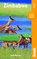
Zimbabwe 3 Stanfords
£16.99
Vouchers
No voucher codes found.
Do you know a voucher code for this product or supplier? Add it to Insights for others to use.
Do you know a voucher code for this product or supplier? Add it to Insights for others to use.
 Denmark