-
Home
-
Contributors
-
International
-
Account
-
Information
More From Contributor
- ski edition, in a series of ski & hiking maps produced by the German & Austrian Alpine Clubs ...
- Deutscher Alpenverein & produced by the German & Austrian Alpine Clubs using cartography from their respective survey organizations. Maps in this series have topography vividly presented by contours at 20 metres intervals, enhanced by shading & finely drawn graphic relief. An overprint highlights hiking paths and/or ski routes (please see the note below), campsites & various types of mountain huts & refuges. The area covered by each map varies according to the scale; for 1:25, 000 maps it is Approx. 25x 18 km (15 x 11 miles). The maps have a 1-km UTM grid, plus margin ticks with latitude & longitude at intervals of 1`. Map legend is in German only.PLEASE NOTE – THE OVERPRINT FOR HIKING and/or SKI ROUTES: all Sheet Ref. numbers shown on the accompanying grid are available with an overprint highlighting hiking trails, indicating sections with fixed climbing ropes &, where appropriate, the waymarking route numbers. Several titles are now published with both hiking & ski routes on them. Other areas are covered by two separate maps: a hiking edition plus a ski edition. The type of the overprint is indicated in our title of each map. To see the list of titles in this series please click on the series link. ...
- Deutscher Alpenverein & produced by the German & Austrian Alpine Clubs using cartography from their respective survey organizations. Maps in this series have topography vividly presented by contours at 20 metres intervals, enhanced by shading & finely drawn graphic relief. An overprint highlights hiking paths and/or ski routes (please see the note below), campsites & various types of mountain huts & refuges. The area covered by each map varies according to the scale; for 1:25, 000 maps it is Approx. 25x 18 km (15 x 11 miles). The maps have a 1-km UTM grid, plus margin ticks with latitude & longitude at intervals of 1`. Map legend is in German only.PLEASE NOTE – THE OVERPRINT FOR HIKING and/or SKI ROUTES: all Sheet Ref. numbers shown on the accompanying grid are available with an overprint highlighting hiking trails, indicating sections with fixed climbing ropes &, where appropriate, the waymarking route numbers. Several titles are now published with both hiking & ski routes on them. Other areas are covered by two separate maps: a hiking edition plus a ski edition. The type of the overprint is indicated in our title of each map. To see the list of titles in this series please click on the series link. ...
Includes:: 30-page hut directory providing for each hut not only full contact details but also a description with its history, etc. An introductory chapter gives general information about the region & tips for hikers. Four appendices include route summary tables, a glossary, etc. ...
- for fun & adventures galore! Colours, animals, space, music, fairytale fireworks...! Here is a collection of poems especially written for performance. With delightful illustrations by a talented new illustrator, this is a brilliant introduction to poetry for young children. ...
- despite their daily experience of despair & death
- of Zimbabwe's people. ...
Includes:: seasonal tracks & indicates intermediate driving distances on main & secondary roads. Locations of petrol stations, veterinary cordon fences & border crossings are also marked. Other transport details include railways & local airfields. Internal administrative boundaries are shown with names of the provinces. National parks & protected areas are marked & symbols highlight various places of interest: UNESCO world heritage sites, archaeological remains, viewpoints, hot springs & wells, caves & rock paintings, selected accommodation including campsites & lodges, medical facilities, etc. The map has a latitude & longitude grid at intervals of 1 ...

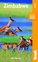
Zimbabwe
on the publishers’ similar maps of other southern African countries. A basic street plan shows central Harare naming mains streets. The map, published in 2005, also includes an “Accommodation and Activities Legend” with an extensive list of symbols for various types of accommodation, sport and recreational facilities, etc, none of which appear on the map itself.
This page now acts as a permanent archive for this product. Add more information using the comments box below to ensure it can still be found by future generations.
Use our search facility to see if it is available from an alternative contributor.
- External links may include paid for promotion
- Availability: Out Of Stock
- Supplier: Stanfords
- SKU: 9780958484442
Product Description
Zimbabwe on a double-side road map from the South African publishers International Motoring Productions with GPS waypoints for selected towns or settlements. The map, one of a series of similar maps covering countries & selected regions of southern Africa, has rather simple cartography with somewhat basic elevation tinting & occasional spot heights. Main rivers (not named) & lakes are marked & protected areas are highlighted. Roads are classified as national, major, minor, & 4WD tracks & show driving distances on main routes & locations of fuel stations. Border crossings to neighbouring countries indicate opening times. Symbols mark various places of interest. Some towns or settlements & important road junctions are annotated with GPS waypoints, although far fewer than on the publishers’ similar maps of other southern African countries. A basic street plan shows central Harare naming mains streets. The map, published in 2005, also
Includes:: an “ Accommodation & Activities Legend” with an extensive list of symbols for various types of accommodation, sport & recreational facilities, etc, none of which appear on the map itself.
Reviews/Comments
Add New
Intelligent Comparison
Price History
Vouchers
Do you know a voucher code for this product or supplier? Add it to Insights for others to use.


 United Kingdom
 France
 Germany
 Netherlands
 Sweden
 USA
USA
 Italy
Italy
 Spain
Spain


 Denmark