
 United Kingdom
 France
 Germany
 Netherlands
 Sweden
 USA
USA
 Italy
Italy
 Spain
Spain
More From Contributor

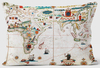

World K+F Physical 20M Wall Map ENCAPSULATED
Encapsulated version of a beautiful, 203.5 x 123.5cm (6ft 8” x 4ft 1” approx.) large physical map of the world with exceptionally well designed relief shading, making the mountainous areas appear almost in 3-D when viewed from a distance. The map has light, subdued colouring of the land masses and has always been very popular with interior designers, having been featured in several magazines and makeover programs.Political boundaries (and in larger countries internal administrative boundaries) are shown less prominently than on other physical world maps. Country names are given as used in the country itself (Al-Maghrib, Türkiye, Nippon) with less familiar names accompanied by their *English* equivalents. City names are also in the local language (Athína, Dimashq, Al-Qahira),
again, where necessary, with their English equivalents. Names of geographical features on land are in the local languages and/or English. Oceans and seas are in English. Map projection is Mercator.*LAMINATED and ENCAPSULATED WALL MAPS:*- *laminated* wall maps have a thin layer of plastic usually applied to the printed side only. They can be written on with suitable marker pens without any damage to the map but, unless they have been laminated on both sides, they are not damp-proof.- *encapsulated* wall maps are sealed between two sheets of plastic. They are more rigid and heavier than laminated maps of the same size. They are damp-proof and do not crinkle in humid conditions. Encapsulation gives the map a shiny surface, similar to being displayed behind glass.- *please note:* many
publishers and retailers often use these two terms interchangeably. Our map titles and descriptions follow the definitions provided above.
Product Description
Reviews/Comments
Add New
Vouchers
No voucher codes found.
Do you know a voucher code for this product or supplier? Add it to Insights for others to use.
Do you know a voucher code for this product or supplier? Add it to Insights for others to use.
 Denmark