
 United Kingdom
 France
 Germany
 Netherlands
 Sweden
 USA
USA
 Italy
Italy
 Spain
Spain
More From Contributor

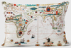

World K+F Physical 30M Wall Map ENCAPSULATED
Encapsulated version of an elegant physical map of the world (139 x 81cm / 4ft 7” x 2ft 8”) with land masses in light shades of greens and yellows and subtle relief shading. This is an *English edition* from the Swiss publishers Kümmerly+Frey, renown for their high quality world maps, with English names used throughout. The map provides names of a large number of geographical features: mountain ranges, plateaux, deserts, etc., as well as peak names with heights in metres. Political boundaries (and in larger countries internal administrative boundaries) are shown less prominently than on other physical world mapsOn oceans shades of colouring show the depths and selected shipping lanes are marked. Central Pacific, from Alaska/Siberia to New Zealand, is repeated on both sides of
the map for better presentation of that region. Projection is van der Grinten.* This map is also available in a larger size (188.5 x 110cm / 6ft 2” x 3ft 8” approx.).*LAMINATED and ENCAPSULATED WALL MAPS:*- *laminated* wall maps have a thin layer of plastic usually applied to the printed side only. They can be written on with suitable marker pens without any damage to the map but, unless they have been laminated on both sides, they are not damp-proof.- *encapsulated* wall maps are sealed between two sheets of plastic. They are more rigid and heavier than laminated maps of the same size. They are damp-proof and do not crinkle in humid conditions. Encapsulation gives the map a shiny surface, similar to being displayed behind glass.- *please note:* many publishers and retailers often
use these two terms interchangeably. Our map titles and descriptions follow the definitions provided above.
Product Description
Reviews/Comments
Add New
Vouchers
No voucher codes found.
Do you know a voucher code for this product or supplier? Add it to Insights for others to use.
Do you know a voucher code for this product or supplier? Add it to Insights for others to use.
 Denmark