
 United Kingdom
 France
 Germany
 Netherlands
 Sweden
 USA
USA
 Italy
Italy
 Spain
Spain
More From Contributor


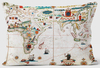
World IGN Physical 14M Wall Map PLASTIC 3-Sheet Set
IGN’s very attractive large wall map of the world published in three separate sheets (size when combined 289 x 143 cm / 114” x 56” approx) and printed on light, waterproof and tear-resistant synthetic paper. The sheets can be assembled either Atlantic- or Pacific-centred.Physical geography of the land masses is vividly presented in pleasant shades of light green, yellow and brown against the blue colouring of the oceans. Political boundaries and in selected larger countries internal administrative borders are marked and more cities and towns are shown than on most other maps of this size. Country names are given as used in the country itself (Eesti, Djazâir, Bharat) with less familiar names accompanied by their French equivalent. City names are also in the local language
(Bucuresti, Roma, Wien), again, where necessary, with their French equivalent. Names of geographical features on land are mostly in the local languages, with some in French. Oceans and seas are mostly in French (Océan Indien, Mer du Nord, Mer Baltique). Map projection is Mercator. Map legend includes English. Current edition of this title was published in late 2015.
(Bucuresti, Roma, Wien), again, where necessary, with their French equivalent. Names of geographical features on land are mostly in the local languages, with some in French. Oceans and seas are mostly in French (Océan Indien, Mer du Nord, Mer Baltique). Map projection is Mercator. Map legend includes English. Current edition of this title was published in late 2015.
Product Description
Reviews/Comments
Add New
Vouchers
No voucher codes found.
Do you know a voucher code for this product or supplier? Add it to Insights for others to use.
Do you know a voucher code for this product or supplier? Add it to Insights for others to use.
 Denmark