
 United Kingdom
 France
 Germany
 Netherlands
 Sweden
 USA
USA
 Italy
Italy
 Spain
Spain
More From Contributor


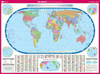

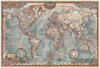


World Educational ITMB Map Set (2 Maps)
World Educational Map Set from ITMB consists of two separate, laminated political maps of the world, both slightly larger than A4 size: one with place names of countries, major cities and important geographical features such mountain peaks, rivers and lakes, the other just an outline map for names to be filled in. Both maps have laminated, write-on-wipe-off surface and are waterproof. A simple but a very effective way to learn quickly what’s where!PLEASE NOTE: although the set is very light, the measurements exceed the size allowed for letter post, hence the slightly higher postage charge.
 "Pin It")
Product Description
Reviews/Comments
Add New
Vouchers
No voucher codes found.
Do you know a voucher code for this product or supplier? Add it to Insights for others to use.
Do you know a voucher code for this product or supplier? Add it to Insights for others to use.
 Denmark