More From Contributor

£6.50
Topographic coverage of the Balearic Islands at 1:25, 000 published by the Instituto Geográfico Nacional – Centro Nacional de Información Geografica, the country’s civilian survey organization. The maps have contours at 10m intervals & colouring and/or graphics to show different types of vegetation or land use. Boundaries of national parks & other protected areas are marked. In addition to all the usual information shown on topographic mapping at this scale: detailed presentation of the road & rail networks, rural tracks & paths, etc, the maps also show campsites. The maps have a 1-km UTM grid, plus margin ticks for latitude & longitude at 1` intervals. The majority of the titles have been published since late 1990s. Map legend is in Spanish only. COVERAGE: each 25K map covers one quarter of the corresponding 1:50, 000 map, with the numbering system: I = NW quarter, II = NE quarter, III = SW quarter, & IV = SE quarter. To see other titles in this ser 25K Spain CNIG Topographic Survey Map No. ies please click on the series link. ...
Archived Product
£7.99
In the dead of night, a watchman is brutally attacked & with his dying breath cries out, ” The Green Finger!” It is the latest in a series of robberies to take place that have left Scotland Yard mystified, & with no other choice but to call upon the expertise of Detective Paul Temple. Aided by the beautiful journalist Louise Harvey
- affectionately known as Steve
- the duo discover that this is not the first victim to warn of the dangerous & elusive ` Green Finger`...who or what is it? The pair must work together to solve the deepening mystery.

...
Archived Product
£16.95
Very clear contoured mapping, with explicit legend, showing the route from Zuriza to Aneto in sections on 14 individual sheets, each measuring 45x 24cm. For each section an elevation profile diagram is included. A detailed colour guide book to the route is included (in Spanish only). ...
Archived Product
£10.99
Senegal road map at 1:1, 000, 000 from the IGN, France’s national survey organization, with plans of Dakar & Saint-Louis, plus an enlargement for the Cap Vert peninsula. The map has relief shading & indicates areas of different types of vegetation. Railways & various sizes of airfields & aerodromes shown, & the road network indicates seasonal routes. Boundaries of national parks & forest reserves are marked, but the map has no other specific tourist information. Latitude & longitude are shown in the margins at 1º intervals, with cross ticks on the map itself. The map also

Includes::
an enlargement for the Cap Vert peninsula & insets showing Dakar & Saint-Louis, naming main streets. Map legend is in French only. Information within Gambia is limited to main settlements & connecting roads.

...
Archived Product
£9.99
Senegal road map at 1:1, 000, 000 from Laure Kane, specialist in maps of north-African destinations, with street plans of Dakar, Gorée Island & Saint-Louis, plus an administrative map of the country & a distance table. The map shows the country’s network of trunk, regional & secondary roads, plus a selection of other local roads or passable tracks. Locations of petrol stations & border crossings are marked. Railway lines are shown with stations & local airfields are indicated. A range of symbols indicate various places of interest, including beaches, historical sites, medical centres, etc. Topography is indicated by altitude colouring, with graphics to indicate flood zones & colouring for national parks. Also marked are the country’s internal administrative boundaries with town symbols showing their administrative status. The map is not indexed & has no geographical coordinates. Separate insets show streets plan of Dakar & the Gorée Isl&, plus a more general plan of Saint-Louis, all annotated with places of interest. Also provided is a small administrative map of the country & a distance table. ...
Archived Product
£11.50
Senegal & Gambia at 1:550, 000 on an indexed, waterproof & tear-resistant road map of with topographic & tourist information, published by Reise Know-How as part of their highly acclaimed World Mapping Project. The map is double-sided, with a good overlap, to provide the best balance between a good scale & a convenient size sheet. Topography is shown by altitude colouring with contours, spot heights, marshes & flooding zones, seasonal rivers, mangroves, deserts & quicksand areas, wells, oases, etc. Numerous national parks & protected areas are highlighted. Road network

Includes::
local dirt tracks, indicating driving distances on main roads. Railway lines & local airfields are also marked. Internal administrative boundaries are shown with names of the provinces. Symbols highlight various places of interest, including UNESCO heritage sites, archaeological remains, churches & mosques, selected hotels & campsites, etc. The map has a latitude & longitude grid at intervals of 30’ & an extensive index of place names. Map legend

Includes::
English.


...
Archived Product
£9.50
Indexed, waterproof & tear-resistant road map of Senegal & Gambia with topographic & tourist information, published by Reise Know-How as part of their highly acclaimed World Mapping Project. The map is double-sided to provide the best balance between a good scale & a convenient size sheet. Topography is shown by altitude colouring with contours, spot heights, marshes & flooding zones, seasonal rivers, mangroves, deserts & quicksand areas, wells, oases, etc. Numerous national parks & protected areas are highlighted. Road network

Includes::
local dirt tracks, indicating driving distances on main roads. Railway lines & local airfields are also marked. Internal administrative boundaries are shown with names of the provinces. A wide range of symbols highlights various places of interest, including UNESCO heritage sites, archaeological remains, churches & mosques, selected hotels & campsites, etc. The map has a latitude & longitude grid at intervals of 30

...
Archived Product
£17.99
Like the whole of West Africa in microcosm, Senegal boasts a variety of landscapes & cultures that belie its compact size. Northern desert wilds give way to the rain-soaked Casamance, fringed by hundreds of kilometres of pristine beaches & the fantastically frenetic capital city, Dakar, surrounded by ocean & proudly perched at the westernmost point on the African continent. This smorgasbord of landscapes is all accessible within a day`s travel, making Senegal the perfect choice for anyone looking to sink their teeth into West Africa, for the first time or the hundredth. ...
Archived Product
£22.99
The Senja National Tourist Route Map belongs to a series of 18 map & postcards sets describing popular tourist routes all over Norway. The map set

Includes::
a map in 1: 50, 000 presenting an accurate topography (based on the Norwegian topographic survey) which describes local footpaths, cycle or ski routes, sport & recreational facilities, places of interest, places to stay & eat, viewpoints. Senja National Tourist Route is a 90-kilometre-long stretch of road between Gryllefjord & Botnhamn on the island Senja in the county of Troms in Northern Norway. In addition, the official route

Includes::
detours to Mefjordvær & Husøya, for an additional 12 kilometres of road. The rich fishing in the sea has shaped life on the isl&. In the fjords there are characteristic examples of the lively coastal culture. Small, scattered fishing hamlets & villages claw onto thin strips of land between the mountains & the sea. Here you will find the beautiful Husøya with a population of less than 250 & a five-minute walk to anywhere. An exotic gem with traditions from former Spanish shipwrecks
- the siesta is alive & well on Senja. Senja is hospitable all year round, in summer with its constant light, but also in winter with its short days & changeable weather. There are two panoramic view & rest areas: Tungeneset, rest area with services & full accessibility close to the sea. Here, scenic rock cauldrons are refilled by the sea every day at high tide & quickly heated by the sun. & Bergsbotn, a rest area & viewing platform with a magnificent view over the Bergsfjord & the sea beyond. The set
Features: One map: scale 1:50, 000 Text in three languages (Norwegian, English & German)5 Postcards (13.5x 25cm) To see the list of other titles in this series, please click on the series link.


...
Archived Product
£23.99
Map No. 10151, Senjahopen, in the new topographic survey of Norway at 1:50, 000 covering the country on 195 double-sided sheets & first published by Nordeca in 2011
- 2012; fully GPS compatible, indicating waymarked footpaths, campsites, tourist huts, illuminated ski runs, etc. The maps, now published by Nordeca, the successors to Statens Kartverk & its subsequent owners the Ugland Group, are printed on light, waterproof & tear-resistant synthetic paper. Each map covers an area of 62x 45 kilometres (39 x 28 miles approx.), with a 2-km overlap between the sheets. The maps have contours at 20m intervals (10m glacier contours), plus colouring & graphics to show cultivated areas, bogs, forests, etc. In addition to all the information expected of topographic mapping at this scale the maps distinguish between waymarked & unmarked footpaths & show campsites, tourist huts (serviced/self service/no supplies), country hotels & restaurants, & illuminated ski trails. The series uses EUREF89 (WGS84) datum & the maps have a 1-km UTM grid. Map legend is in Norwegian & English. Each title comes in a sturdy protective card envelope.
...
Archived Product

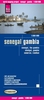
Senegal & Gambia ITMB

Senegal with Gambia at 1:740, 000 with, on the reverse, Gambia itself at a more detailed scale of 1;340, 000 on an indexed road map from ITMB with street plans of Dakar, Ile de Gorée and Banjul. Brief annotations accompany various places of interest highlighted in the map.On one side is Senegal with Gambia at 1:740, 000, with on the reverse Gambia shown in greater detail at 1:340, 000, with many more settlements and roads or tracks. Topography on both maps is shown by altitude colouring (in metres), with graphics for mangrove/swamps and salt pans. Within Senegal numeroud national parks and other protected areas are highlighted.Road network distinguishes between all season and seasonal roads and includes selected tracks. Driving distances are marked on main routes, and the map also
indicates locations of petrol supplies and border crossings. Railway lines are included and local airports are marked. The maps also show each country’s internal administrative boundaries with names of the provinces. Various places of interest are highlighted, many annotated with brief descriptions. The map also indicates locations with tourist accommodation and/or medical facilities. Latitude and longitude lines are drawn at 1° intervals (Senegal/Gambia) and 15’ (Gambia). Each country has a separate index. The map includes street plans of Dakar, Ile de Gorée and Banjul, showing main streets and indicating locations of various places of interest, including selected hotels. Also provided is a small inset showing precipitation/aridity in that part of Western Africa.
RIP - This product is no longer available on our network. It was last seen on 25.09.2019

This page now acts as a permanent archive for this product. Add more information using the comments box below to ensure it can still be found by future generations.

Use our search facility to see if it is available from an alternative contributor.
  • External links may include paid for promotion
  • Availability: Out Of Stock
  • Supplier: Stanfords
  • SKU: 9781553413981
Availability: In Stock
£9.99

Product Description

Senegal with Gambia at 1:740, 000 with, on the reverse, Gambia itself at a more detailed scale of 1;340, 000 on an indexed road map from ITMB with street plans of Dakar, Ile de Gorée & Banjul. Brief annotations accompany various places of interest highlighted in the map. On one side is Senegal with Gambia at 1:740, 000, with on the reverse Gambia shown in greater detail at 1:340, 000, with many more settlements & roads or tracks. Topography on both maps is shown by altitude colouring (in metres), with graphics for mangrove/swamps & salt pans. Within Senegal numeroud national parks & other protected areas are highlighted. Road network distinguishes between all season & seasonal roads &

Includes::
selected tracks. Driving distances are marked on main routes, & the map also indicates locations of petrol supplies & border crossings. Railway lines are included & local airports are marked. The maps also show each country’s internal administrative boundaries with names of the provinces. Various places of interest are highlighted, many annotated with brief descriptions. The map also indicates locations with tourist accommodation and/or medical facilities. Latitude & longitude lines are drawn at 1° intervals (Senegal/ Gambia) & 15’ (Gambia). Each country has a separate index. The map

Includes::
street plans of Dakar, Ile de Gorée & Banjul, showing main streets & indicating locations of various places of interest, including selected hotels. Also provided is a small inset showing precipitation/aridity in that part of Western Africa.

Reviews/Comments

Add New

Intelligent Comparison

Oooops!
We couldn't find anything!
Perhaps this product's unique.... Or perhaps we are still looking for comparisons!
Click to bump this page and we'll hurry up.

Price History

Vouchers

No voucher codes found.
Do you know a voucher code for this product or supplier? Add it to Insights for others to use.

Facebook

Jargon Buster

Metres - A unit of measure, one metre equals 100 centimetres
Graphics - A general term for visual aspects of an item/display
Network - A link and communication between things. Often computers or people.
Small - something that takes up less space than normal.
Road - a manmade lane or a path that is used to speed up travel.
Season - The separation of four parts of the year into Spring, Summer, Autumn, Winter.
Altitude - Something that can be quite high in relation to sea or ground level.
Accommodation - A room in which someone can live in, for example in a hotel

Supplier Information

Stanfords
Stanfords was established in 1853 and opened their iconic Covent Garden flagship store in 1901. They have become the top retailer of maps, travel books and accessories in the UK and arguably offer the largest selection of maps and travel books worldwide. Famous names such as Captain Robert Falcon Scott, Ranulph Fiennes and Michael Palin have purchased from Stanfords. They now have a shop in Bristol and both stores together with other venues operate a calendar of events including talks, book signings and exhibitions. As a specialist map retailer, the map selection is comprehensive and includes road maps, street maps and walking maps from worldwide destinations, as well as a selection of world atlases and wall maps. Books include travel guides and travel literature. Stanfords also stock globes, from miniatures made of blue marble to magnificent floor-standing globes. The website features a selection of interesting articles on travel topics.
Page Updated: 2023-11-12 20:15:36

Community Generated Product Tags

Oh No! The productWIKI community hasn't generated any tags for this product yet!
Menu