
 United Kingdom
 France
 Germany
 Netherlands
 Sweden
 USA
USA
 Italy
Italy
 Spain
Spain
More From Contributor


Rwanda Administrative Map
Administrative map of Rwanda at 1:300, 000 published by the survey organization Rhineland-Palatinate, showing the division of the country into provinces, districts and sectors, plus on the reverse extensive notes illustrated with photos.The map, prepared by the survey organization of the German state which has extensive links with Rwanda, shows the division of the country into its five provinces, indicating in different colours the districts within each province. Within each district boundaries of local sectors are also marked. Road network is classified into national paved or unsurfaced roads, district roads and local tracks. Symbols indicate airports, church missions and hospital facilities. Topography is shown by spot heights and boundaries of national parks and other protected
areas are also marked on the map. Latitude and longitude lines are drawn at 10
areas are also marked on the map. Latitude and longitude lines are drawn at 10

Product Description
Reviews/Comments
Add New
Intelligent Comparison
Archived Product
Iran Administrative Map Stanfords
£33.95
Archived Product
France Administrative Map Stanfords
£5.50
Archived Product
France Administrative Map Stanfords
£5.50
Archived Product
Switzerland Administrative Map Stanfords
£12.50
Archived Product
Switzerland K+F Administrative Map Stanfords
£12.99
Archived Product
China Administrative Gizi Map Stanfords
£9.99
Archived Product
China Administrative Wall Map Stanfords
£13.50
Archived Product
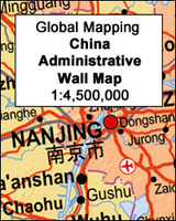
China Administrative Wall Map Stanfords
£9.99
Vouchers
No voucher codes found.
Do you know a voucher code for this product or supplier? Add it to Insights for others to use.
Do you know a voucher code for this product or supplier? Add it to Insights for others to use.
 Denmark