
 United Kingdom
 France
 Germany
 Netherlands
 Sweden
 USA
USA
 Italy
Italy
 Spain
Spain
More From Contributor


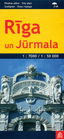
Riga And Jurmala
Riga and Jurmala on waterproof and tear-resistant street plan from Jana Seta, including on the reverse side a large street plan at 1:7, 000 of Riga’s central districts highlighting 25 of the city’s principal tourist sites.On one side is a detail plan of the city’s historic heart and the surrounding districts. Tram routs are shown with stops and line numbers and the map also shows the bus connections from the city centre to the airport. For divers, principal traffic routes are highlighted and locations of petrol stations and car parks are marked. Streets are annotated with selected house numbers for easier identification of addresses. 25 of Riga’s principal tourist sights are prominently highlighted. Street index is on the reverse side which also includes a plan at 1:25, 000
covering the city with its outer suburbs and Jurmala, highlighting 13 more places of interest outside the city centre. Also provided is a large, clear diagram of the public transport network: tram lines, bus route to the airport and suburban railway lines.Map legend includes English.
covering the city with its outer suburbs and Jurmala, highlighting 13 more places of interest outside the city centre. Also provided is a large, clear diagram of the public transport network: tram lines, bus route to the airport and suburban railway lines.Map legend includes English.

Product Description
Reviews/Comments
Add New
Vouchers
No voucher codes found.
Do you know a voucher code for this product or supplier? Add it to Insights for others to use.
Do you know a voucher code for this product or supplier? Add it to Insights for others to use.
 Denmark