
 United Kingdom
 France
 Germany
 Netherlands
 Sweden
 USA
USA
 Italy
Italy
 Spain
Spain
More From Contributor


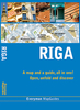


Riga Central
Central Riga on a tourist street plan combining coverage of the city’s inner districts with a large, clear plan of its historic heart, a diagram of public transport lines across the city and its suburbs, plus contact details for its museums, etc.On one side is a street plan at 1:10, 000 showing Riga’s inner districts on both sides of the Daugava. Bus, tram and trolleybus routes are shown stops and line numbers. For drivers one way streets, car parks and locations of petrol stations are marked. Streets are annotated with selected house numbers for easier identification of addresses.On the reverse Riga’s Old Town is shown in much greater detail at 1:5, 000. Symbols indicate locations of hotels and other accommodation, as well as various places of interest. Also provided is a
large clear map of the public transport network within the city and its outer suburbs: trams, buses, trolleybuses and railway lines. The map includes a street index, lists of museums, theatres or concert halls, plus over 50 embassies/consulates, all with contact details.Map legend and all the information includes English.
large clear map of the public transport network within the city and its outer suburbs: trams, buses, trolleybuses and railway lines. The map includes a street index, lists of museums, theatres or concert halls, plus over 50 embassies/consulates, all with contact details.Map legend and all the information includes English.

Product Description
Reviews/Comments
Add New
Vouchers
No voucher codes found.
Do you know a voucher code for this product or supplier? Add it to Insights for others to use.
Do you know a voucher code for this product or supplier? Add it to Insights for others to use.
 Denmark