
 United Kingdom
 France
 Germany
 Netherlands
 Sweden
 USA
USA
 Italy
Italy
 Spain
Spain
More From Contributor


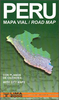
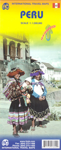
Peru ITMB
Peru at 1:1, 500, 000 on a double-sided, waterproof and tear-resistant, indexed map from ITMB, with large, clear street plans of central Lima and Cusco, highlighting accommodation, places of interest and various facilities.The map divides the country north/south, approximately along the line between the Cordillera Blanca and Cordillera Huyahuash, with very little overlap between the two sides. Topography is very effectively presented by altitude colouring, with spot heights and additional graphics for swamps and marshland, glaciers and volcanos.The map shows the country’s road network distinguishing between all-weather and seasonable roads and indicates driving distances on main routes. Railway lines, including the popular routes linking Cusco with Puno and Arequipa, are very
clearly shown. The map also shows local airports and airstrips, as well as internal administrative boundaries with names of the provinces.National parks are highlighted and symbols indicate various other places of interest, including the country archaeological sites. Latitude and longitude lines are drawn at intervals of 1°. Each side has a separate index of localities.Also included are very clear street plans of central Lima and Cusco highlighting selected accommodation, supermarkets, various institutions and places of interest, etc.
clearly shown. The map also shows local airports and airstrips, as well as internal administrative boundaries with names of the provinces.National parks are highlighted and symbols indicate various other places of interest, including the country archaeological sites. Latitude and longitude lines are drawn at intervals of 1°. Each side has a separate index of localities.Also included are very clear street plans of central Lima and Cusco highlighting selected accommodation, supermarkets, various institutions and places of interest, etc.

Product Description
Reviews/Comments
Add New
Intelligent Comparison
Archived Product
Belarus ITMB Stanfords
£9.99
Archived Product

Bermuda ITMB Stanfords
£9.99
Archived Product
Paraguay ITMB Stanfords
£9.99
Archived Product

Peru F&B Stanfords
£10.99
Vouchers
No voucher codes found.
Do you know a voucher code for this product or supplier? Add it to Insights for others to use.
Do you know a voucher code for this product or supplier? Add it to Insights for others to use.
 Denmark