
 United Kingdom
 France
 Germany
 Netherlands
 Sweden
 USA
USA
 Italy
Italy
 Spain
Spain
More From Contributor


Ontario FastTrack
Ontario on a waterproof and tear-resistant FastTrack map, presenting the southern part of the province on five panels to fit the coverage onto a smaller size map, more convenient use when travelling. The main part of the state, from Toronto west and east to Windsor and Kingston respectively, is covered at 1:890, 000, with three panels at the same scale extending it eastwards to the Kingston - Ottawa area, plus westwards to cover the Trans-Canada Highway to the North-Bay region. South-western Ontario from North Bay to Sault Ste Marie, Thunder Bay and the border with Manitoba is covered at 1:1, 920, 000. Road and rail networks are presented on a base with colouring highlighting national/provincial parks. Road network indicates paved, loose surface and unimproved roads and shows
driving distances on most routes. Railway lines are included and local airports are marked. Symbols indicate campsites, ski areas and various places of interest. The maps have no geographical coordinates. The maps of southern and northern Ontario have separate indexes.To see the list of currently available Canadian province and regional maps form the MapArt / Canadian Cartographics Corporation / JDM Géo publishing group, including waterproof and tear-resistant FastTrack titles, please click on the series link.
driving distances on most routes. Railway lines are included and local airports are marked. Symbols indicate campsites, ski areas and various places of interest. The maps have no geographical coordinates. The maps of southern and northern Ontario have separate indexes.To see the list of currently available Canadian province and regional maps form the MapArt / Canadian Cartographics Corporation / JDM Géo publishing group, including waterproof and tear-resistant FastTrack titles, please click on the series link.
Product Description
Reviews/Comments
Add New
Intelligent Comparison
Archived Product
Montreal FastTrack Stanfords
£10.99
Archived Product

Victoria FastTrack Stanfords
£10.99
Archived Product
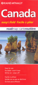
Canada FastTrack Stanfords
£10.99
Archived Product

Alberta FastTrack Stanfords
£10.99
Archived Product
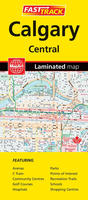
Calgary FastTrack Stanfords
£10.99
Vouchers
No voucher codes found.
Do you know a voucher code for this product or supplier? Add it to Insights for others to use.
Do you know a voucher code for this product or supplier? Add it to Insights for others to use.
 Denmark