
 United Kingdom
 France
 Germany
 Netherlands
 Sweden
 USA
USA
 Italy
Italy
 Spain
Spain
More From Contributor


Ontario MapArt
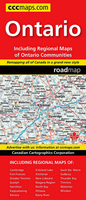
Ontario on an indexed, double-sided road map presenting the southern part of the province at 1:800, 000 and northern Ontario at 1:1, 725, 000 but with main town across the whole province also on enlargements at 1:250, 000, plus a comprehensive distance table.On one side is southern Ontario ay 1:800, 000 with coverage extending north to the Trans-Canada Highway linking Ottawa with North Bay and Sudbury. Enlargements at 1:250, 000 show Greater Toronto conurbation, Ottawa with Hull and Gatineau, the Niagara region both sides of the border, Windsor, Kitchener – Waterloo area, and Hamilton.On the reverse Ontario north of Sudbury and Lake Superior is presented at 1:1, 725, 000 with enlargements at 1:250, 000 for North Bay, Sudbury, Timmins, Sault Ste Marie, Thunder Bay, Kenora,
Rainy River, Fort Frances, Kapuskasing, Kirkland Lake and New Liskeard. Road and rail networks are presented on a base with colouring highlighting national/provincial parks, plus plenty of names of smaller rivers and lakes. Road network indicates paved, loose surface and unimproved roads and shows driving distances and rest areas / service centres on most routes. In areas with no roads locations with access by air are marked. Symbols indicate campsites, ski areas and various places of interest. The maps have no geographical coordinates. The maps of southern and northern Ontario have separate indexes.To see the list of currently available Canadian province and regional maps form the MapArt / Canadian Cartographics Corporation / JDM Géo publishing group, including waterproof and
tear-resistant FastTrack titles, please click on the series link.

Product Description
Reviews/Comments
Add New
Vouchers
No voucher codes found.
Do you know a voucher code for this product or supplier? Add it to Insights for others to use.
Do you know a voucher code for this product or supplier? Add it to Insights for others to use.
 Denmark