
 United Kingdom
 France
 Germany
 Netherlands
 Sweden
 USA
USA
 Italy
Italy
 Spain
Spain
More From Contributor

Munich F&B
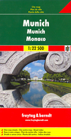
Large street plan of Munich within its administrative boundaries, with an enlargement of the city centre, a plan of its airport, a diagram of the U and S-Bahn networks and a map of the outer suburbs all conveniently placed in a separate booklet. The main plan covers Munich at 1:22, 500, showing the city’s public transport network: tram and bus routes with stops and line numbers, plus U- and S-Bahn stations. Campsites and youth hostels are marked, as well as the usual range of facilities shown on street plans; public buildings, religious establishments, police, etc.Map legend which includes English is in a separate booklet attached to the map cover. The booklet also contains a very clear enlargement at 1:10, 000 of the town centre within the inner ring, indicating one way
streets and public transport connection, a diagram of the U- and S-Bahn networks and an overview map of the city with its outer suburbs.
streets and public transport connection, a diagram of the U- and S-Bahn networks and an overview map of the city with its outer suburbs.

Product Description
Reviews/Comments
Add New
Intelligent Comparison
Archived Product
Munich Stanfords
£8.99
Archived Product
Munich Stanfords
£8.99
Archived Product
Munich Stanfords
£4.99
Archived Product

Munich Stanfords
£20.00
Archived Product

Munich Stanfords
£12.99
Archived Product

Munich Stanfords
£8.99
Archived Product
Munich Stanfords
£8.99
Archived Product
Munich Borch Stanfords
£8.99
Vouchers
No voucher codes found.
Do you know a voucher code for this product or supplier? Add it to Insights for others to use.
Do you know a voucher code for this product or supplier? Add it to Insights for others to use.
 Denmark