More From Contributor

£10.00
Munich Crumpled City Map from a collection of street plans of major cities printed on soft, very lightweight (approximately only 20g) & yet extremely tear-resistant & 100% waterproof material, specifically designed to be scrunched & crammed into pockets, handbags & backpacks, either on its own or in the pouch from the same material provided with each map. Creases are a fully intentional part of the quirkiness of the Crumpled City maps – the more battered they are they better they look. Parks & other green spaces are highlighted, as are metro stations, & important buildings are named. Each map also highlights 10 recommended “soulsights”, imaginatively chosen to present the essence of each city rather than the most obvious tourist destinations. The accompanying index placed next to the map lists locations of tourist interest: selected streets & squares, monuments & historical places, museums & galleries, parks, etc. Whilst cartographically these Crumpled City maps provide perhaps not the most precise representation of the street network, they are handy for sightseeing, light & durable, can be used as a table cloth when picnicking in the Luxembourg Gardens, Hyde Park, the Retiro or the Central Park, or just as an unusual decoration… Selected cities are also presented on more colourful ‘junior’ maps, specially designed for children. Drawings highlight not only important buildings & famous locations but also places which will specifically appeal to children: toy shops, bookshops, best ice cream, etc. Each title has a list of the recommended not-to-be missed locations with addresses &, where available, websites. To see the full list of cities covered by this unique series please click on the series link. ...
Archived Product
£12.99
Munich in Marshall Cavendish's Culture Shock! Series; comprising a range of guides that inform visitors of the finer points & details relating to social etiquette, traditions & customs; bringing visitors to a sensitive yet substantial understanding of the country or city in question. The series targets those who are planning long stays in the destination or extended periods of residence. The guides are written by authors who have experienced the joys & pitfalls of cultural adaptation, & so are ideally placed to provide informative & relevant advice. Each title contains insights into local culture & traditions, guidance on adapting to the local environment, linguistic help & lots of general advice about local culture & idiosyncrasies to help prepare readers for their visit. Each title is structured similarly, beginning with the first impressions a visitor might expect to have. The guides aim to help readers understand the local culture through first appreciating the motivations, beliefs & attitudes of the local people. Practical advice on settling in is provided, with focused sections on accommodation, utilities, health, education & telecommunications. There is also extensive information on the destination ...
Archived Product
£8.25
Munich East, map no. 50-42, in a series of special GPS compatible recreational editions of the German topographic survey at 1:50, 000, with waymarked hiking trails & cycling routes, campsites & youth hostels, etc. Coverage

Includes::
Ebersberg & Erding. All the maps have cartography identical to the standard topographic survey of Germany, with extensive overprint highlighting local & long-distance footpaths & cycle routes, including King Ludwig Way, different variants of the Way of St James, etc, indicating their waymarking. Symbols highlight various types of accommodation (campsites, youth hostels, refuges, etc), sport & recreational facilities, places of interest, ski & cable car lift, etc. The maps have an overprint showing 1-km UTM grid. Many of the titles have on the reverse photos of fauna & flora & descriptions of the area covered by them. Map legend & all the text are in German only.

...
Archived Product
£11.50
Munich East, map no. 50-42, in a series of special contoured & GP-compatible recreational maps from the Bavarian state survey organization, with cartography of the German topographic survey at 1:50, 000 & extensive additional tourist overprint highlighting waymarked hiking trails & cycling routes, campsites & youth hostels, etc. Maps in this series have cartography identical to the standard topographic survey of Germany. Topography is vividly presented by contours at 20m intervals, enhanced by bold shading & graphic relief, plus colouring and/or graphics to show forests & other types of vegetation. Extensive tourist overprint highlights local & long-distance footpaths & cycle routes
- including King Ludwig Way, different variants of the Way of St James, etc
- indicating, where appropriate, their waymarking designation. Symbols show various types of accommodation (campsites, youth hostels, refuges, etc), sport & recreational facilities, places of interest, ski & cable car lift, etc. The maps have UTM grid lines at 1-km UTM intervals. Map legend &, where included, additional text, are in German only. To see the other titles in this series please click on the series link.

...
Archived Product
£8.99
Falk, Germany`s leading publishers of street plans, produce three different versions of their plan of Munich: a large folded map of the whole city, the same plan in the publisher’s unique folding system, & a handy-size pocket map.* Falk Extra* plans are folded in a standard way, where the map can be opened to view the whole area it covers. * Falk Special Fold*, available only for larger cities, has a special folding system designed to show only a small section of the map at one time. The whole map can be opened but it will be cut in several places. Some find these street plans very user-friendly & easier to handle than conventional maps, others simply hate them!* City Plan*, in a handy 10x 17cm pocket size, covers most of the city, although a smaller area than on the other two formats. This large * Falk Extra* plan covers the whole city within its administrative boundaries, indicating names of various districts. U- & S-Bahn networks are marked, & the plan also shows bus & tram lines with stops & line numbers. Car parks & park-&-ride facilities are indicated. Access from streets onto the city’s motorway network is clearly presented. Symbols highlight a wide range of facilities usually shown on street plans, including campsites & youth hostels. Also marked are local district & postcode boundaries, with the index providing individual codes for all the streets listed in it. * Map legend

Includes::
English.* An *enlargement for the city centre* is in a separate booklet, which also contains an extensive street index, lists of various facilities, & descriptions (in German only) of main sights. The booklet also has plans the airport & the Munich Messe grounds, plus a map of postal zones. On the reverse of the main map there a diagrams of the city’s U- & S-Bahn lines, indicating various ticket zones & disabled access, plus a diagram of the S-Bahn, tram & bus night lines. Also included are two road maps: the immediate environs of the city at 1:100, 000, plus a wider area at 1:150, 000, extending north to Freising, west to Augsburg, south to Murnau, east to beyond Rosenheim.

...
Archived Product
£7.99
Munich in the Eyewitness Top 10 series from Dorling Kindersley is a condensed format guide book featuring dozens of illustrated, top ten lists for the traveller regardless of their disposable budget. To save you time & money a Top 10 Things to Avoid is also included. Top 10 lists are given for things to see & do both in & around town, as well as the top ten features of particular locations or events. Practicalities are not forgotten as Top 10s are also provided for topics such as planning your trip, getting around & shopping. Accommodation lists provide the ten most recommended places to stay for a range of budgets, whilst restaurant top tens feature as the guide works its way through the location in question. Simple, small street plans illustrate the location of the top ten recommends within their neighbourhoods & basic, fold out maps form the inside covers. An additional pull out feature of the guide suggests ideas on how to spend your day. ...
Archived Product
£9.99
Large street plan of Munich within its administrative boundaries, with an enlargement of the city centre, a plan of its airport, a diagram of the U & S-Bahn networks & a map of the outer suburbs all conveniently placed in a separate booklet. The main plan covers Munich at 1:22, 500, showing the city’s public transport network: tram & bus routes with stops & line numbers, plus U- & S-Bahn stations. Campsites & youth hostels are marked, as well as the usual range of facilities shown on street plans; public buildings, religious establishments, police, etc. Map legend which

Includes::
English is in a separate booklet attached to the map cover. The booklet also contains a very clear enlargement at 1:10, 000 of the town centre within the inner ring, indicating one way streets & public transport connection, a diagram of the U- & S-Bahn networks & an overview map of the city with its outer suburbs.

...
Archived Product
£4.99
Central Munich in a series of handy pocket street plans from Freytag & Berndt. Each map is laminated, so waterproof & tear-resistant, & highlights the publishers’ recommendations of five best choices in five categories: shopping, restaurants & cafes, culture, nightlife & sights. On one side is an indexed street plan annotated with colour-coded markers highlighting the publishers’ recommendations, all listed on the reverse of the map with brief notes in several languages. In larger cities the plans cover only the central districts. Also provided are a small road map of the city’s environs, if appropriate a diagram of the metro network, & a Fact Box with phone numbers for tourist offices, car hire & emergency services. Map legend & notes on the recommendations include English. To see other titles in this series please click on the series link. ...
Archived Product
£13.99
Large street plan of Munich within its administrative boundaries, with an enlargement of the city centre, a plan of its airport, a diagram of the U & S-Bahn networks & a map of the outer suburbs all conveniently placed in a separate booklet. The main plan covers Munich at 1:22, 500, showing the city’s public transport network: tram & bus routes with stops & line numbers, plus U- & S-Bahn stations. Campsites & youth hostels are marked, as well as the usual range of facilities shown on street plans; public buildings, religious establishments, police, etc. Map legend which

Includes::
English is in a separate booklet attached to the map cover. The booklet also contains a very clear enlargement at 1:10, 000 of the town centre within the inner ring, indicating one way streets & public transport connection, a diagram of the U- & S-Bahn networks & an overview map of the city with its outer suburbs.

...
Archived Product

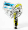
Munich Eyewitness Top 10

Munich in the Eyewitness Top 10 series from Dorling Kindersley is a condensed format guide book featuring dozens of illustrated, top ten lists for the traveller regardless of their disposable budget. To save you time and money a Top 10 Things to Avoid is also included.Top 10 lists are given for things to see and do both in and around town, as well as the top ten features of particular locations or events. Practicalities are not forgotten as Top 10s are also provided for topics such as planning your trip, getting around and shopping. Accommodation lists provide the ten most recommended places to stay for a range of budgets, whilst restaurant top tens feature as the guide works its way through the location in question.Simple, small street plans illustrate the location of the top ten
recommends within their neighbourhoods and basic, fold out maps form the inside covers. An additional pull out feature of the guide suggests ideas on how to spend your day.
RIP - This product is no longer available on our network. It was last seen on 25.09.2019

This page now acts as a permanent archive for this product. Add more information using the comments box below to ensure it can still be found by future generations.

Use our search facility to see if it is available from an alternative contributor.
  • Availability: Out Of Stock
  • Supplier: Stanfords
  • SKU: 9781405358477
Availability: In Stock
£7.99

Product Description

Munich in the Eyewitness Top 10 series from Dorling Kindersley is a condensed format guide book featuring dozens of illustrated, top ten lists for the traveller regardless of their disposable budget. To save you time & money a Top 10 Things to Avoid is also included. Top 10 lists are given for things to see & do both in & around town, as well as the top ten features of particular locations or events. Practicalities are not forgotten as Top 10s are also provided for topics such as planning your trip, getting around & shopping. Accommodation lists provide the ten most recommended places to stay for a range of budgets, whilst restaurant top tens feature as the guide works its way through the location in question. Simple, small street plans illustrate the location of the top ten recommends within their neighbourhoods & basic, fold out maps form the inside covers. An additional pull out feature of the guide suggests ideas on how to spend your day.

Reviews/Comments

Add New

Price History

Vouchers

No voucher codes found.
Do you know a voucher code for this product or supplier? Add it to Insights for others to use.

Facebook

Jargon Buster

Day - The time it takes a planet or other space objects to complete one rotation.
Small - something that takes up less space than normal.
Accommodation - A room in which someone can live in, for example in a hotel
Simple - Basic, easy no difficulty in understanding.
Feature - An attribute that makes something stand out.
Disposable - Something that is used and then thrown away.

Supplier Information

Stanfords
Stanfords was established in 1853 and opened their iconic Covent Garden flagship store in 1901. They have become the top retailer of maps, travel books and accessories in the UK and arguably offer the largest selection of maps and travel books worldwide. Famous names such as Captain Robert Falcon Scott, Ranulph Fiennes and Michael Palin have purchased from Stanfords. They now have a shop in Bristol and both stores together with other venues operate a calendar of events including talks, book signings and exhibitions. As a specialist map retailer, the map selection is comprehensive and includes road maps, street maps and walking maps from worldwide destinations, as well as a selection of world atlases and wall maps. Books include travel guides and travel literature. Stanfords also stock globes, from miniatures made of blue marble to magnificent floor-standing globes. The website features a selection of interesting articles on travel topics.
Page Updated: 2023-11-12 20:15:36

Community Generated Product Tags

Oh No! The productWIKI community hasn't generated any tags for this product yet!
Menu