
 United Kingdom
 France
 Germany
 Netherlands
 Sweden
 USA
USA
 Italy
Italy
 Spain
Spain
More From Contributor


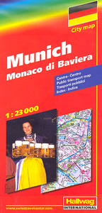
Munich
Indexed street plan of Munich and its outer suburbs, with an enlargement for the city centre, a road map of the environs for day trips, and a diagram of the U- and S-Bahn networks. Postcode numbers are given for all streets and districts.The main map at 1:23, 000 includes virtually all of the city within its municipal boundaries and shows public transport network: tram and bus routes with stops and line numbers, plus U- and S-Bahn stations. One way streets, pedestrian zones, car parks and park-and-ride facilities are marked. Main routes across the city and access to the motorway network are very clearly presented. Campsites and youth hostels are marked, as well as the usual range of facilities shown on street plans; public buildings, religious establishments, police, etc. The map
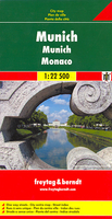
gives names of local districts and also shows postcode boundaries with their corresponding postcode numbers. The city centre, roughly from the central railway station to the English Gardens and the Museum Island, is at a more detailed scale of 1:9, 000, showing main public buildings, transport network, pedestrian zones, etc.A map of the city’s environs shows roads leading to the main Alpine resorts, from Garmisch-Partenkirchen to Salzburg and further south to Innsbruck, and north to Augsburg, Ingolstadt and Regensburg. Map legend includes English. An extensive index, placed on the reverse of the map, gives postcodes of all the streets listed in it.
gives names of local districts and also shows postcode boundaries with their corresponding postcode numbers. The city centre, roughly from the central railway station to the English Gardens and the Museum Island, is at a more detailed scale of 1:9, 000, showing main public buildings, transport network, pedestrian zones, etc.A map of the city’s environs shows roads leading to the main Alpine resorts, from Garmisch-Partenkirchen to Salzburg and further south to Innsbruck, and north to Augsburg, Ingolstadt and Regensburg. Map legend includes English. An extensive index, placed on the reverse of the map, gives postcodes of all the streets listed in it.

Product Description
Reviews/Comments
Add New
Intelligent Comparison
Archived Product
Munich Stanfords
£8.99
Archived Product
Munich Stanfords
£4.99
Archived Product

Munich Stanfords
£20.00
Archived Product

Munich Stanfords
£12.99
Archived Product

Munich Stanfords
£8.99
Archived Product
Munich Stanfords
£8.99
Archived Product
Munich F&B Stanfords
£9.99
Archived Product
Munich East Stanfords
£8.25
Vouchers
No voucher codes found.
Do you know a voucher code for this product or supplier? Add it to Insights for others to use.
Do you know a voucher code for this product or supplier? Add it to Insights for others to use.
 Denmark