More From Contributor
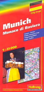
£11.50
Munchberg in a series of GPS compatible recreational editions of the Bavarian topographic survey at 1:25, 000, with waymarked hiking trails & cycling routes, campsites & youth hostels, etc. Coverage

Includes::
Helmbrechts, Marktleugast, Stammbach, Weißenstadt, Gefrees, Zell im Fichtelgebirge. Contours used in this map vary between 5 to 20m according to the terrain, with 20m interval predominantly used for hilly areas. Varied colouring show different types of landscape: woods, vineyards, fields etc. Maps in this series feature extensive overprint highlighting local & long-distance footpaths & cycle routes, including King Ludwig Way or different variants of the Way of St James, indicating their waymarking. Symbols highlight different types of accommodation (campsites, youth hostels, refuges, etc), sport & recreational facilities, various places of interest, etc. The maps have a 1-km UTM grid. Map legend & all the text are in German only. To see other titles in this series please click on the series link.

...
Archived Product
£7.99
Join Mungo Monkey & his friends in Miss Raffy`s class at school: the second adventure in this brilliant pre-school series by Julia Donaldson`s award-winning illustrator, Lydia Monks. Today the class are learning about bugs! Lift the flaps to help everyone find some creepy-crawlies & then play hide-&-seek with Mungo`s spider. ...
Archived Product
£3.99
Mungo Monkey has woken up very early.. .because today is his Birthday! There are so many things to do before Mungo`s birthday party starts: balloons to blow up, party hats to make & a cake to bake. Mungo needs to pick his fancy dress costume, too. What will he choose? Lift the flaps & join in the party preparations with Mungo, his friends & his favourite toy Narnie in this new pre-school series by Lydia Monks, the award-winning illustrator of Julia Donaldson`s What the Ladybird Heard. ...
Archived Product
£7.99
Mungo Monkey is spending the day with his daddy in his fourth lift-the-flap adventure, by award-winning illustrator, Lydia Monks, whose previous titles include What the Ladybird Heard & The Princess & the Wizard. Mungo can`t wait to join his daddy at work & ride in the fire engine! Where will he go & who will need rescuing? Mungo Monkey comes from the genius of Lydia Monks, award-winning illustrator whose collaborations include What the Ladybird Heard & The Princess & the Wizard with Julia Donaldson & the ` Indie Kidd` series with Karen Mc Combie. Mungo Monkey`s beautiful illustrations with flaps to lift on every page make for an interactive reading experience that is perfect for children aged 3 & up. ...
Archived Product
£8.99
Indexed street plan of Munich & its outer suburbs, with an enlargement for the city centre, a road map of the environs for day trips, & a diagram of the U- & S-Bahn networks. Postcode numbers are given for all streets & districts. The main map at 1:23, 000

Includes::
virtually all of the city within its municipal boundaries & shows public transport network: tram & bus routes with stops & line numbers, plus U- & S-Bahn stations. One way streets, pedestrian zones, car parks & park-&-ride facilities are marked. Main routes across the city & access to the motorway network are very clearly presented. Campsites & youth hostels are marked, as well as the usual range of facilities shown on street plans; public buildings, religious establishments, police, etc. The map gives names of local districts & also shows postcode boundaries with their corresponding postcode numbers. The city centre, roughly from the central railway station to the English Gardens & the Museum Isl&, is at a more detailed scale of 1:9, 000, showing main public buildings, transport network, pedestrian zones, etc.A map of the city’s environs shows roads leading to the main Alpine resorts, from Garmisch-Partenkirchen to Salzburg & further south to Innsbruck, & north to Augsburg, Ingolstadt & Regensburg. Map legend

Includes::
English. An extensive index, placed on the reverse of the map, gives postcodes of all the streets listed in it.


...
Archived Product
£4.99
Central Munich at 1:20, 500 on a laminated, waterproof & tear-resistant street plan from the AA with on the reverse a mini guide to the city highlighting its top 25 sights, recommendations for eating out, shopping & entertainment, plus general tourist information. Coverage

Includes::
the Theresienwiese grounds of the annual Oktoberfest, & extends west to the palace & the grounds of Nymphenburg, & north to BMW museum & the Olympic Village. Recommended sights are highlighted & other places of interest are prominently marked. The map also shows selected car parks. Cartography is from the well known German publisher of street plans, Falk Verlag. Street index is next to the map. Separate insets show the city

...
Archived Product
£20.00
September 1938. Hitler is determined to start a war. Chamberlain is desperate to preserve the peace. The issue is to be decided in a city that will forever afterwards be notorious for what takes place there. Munich. As Chamberlain`s plane judders over the Channel & the Furher`s train steams relentlessly south from Berlin, two young men travel with secrets of their own. Hugh Legat is one of Chamberlain`s private secretaries, Paul Hartmann a German diplomat & member of the anti-Hitler resistance. Great friends at Oxford before Hitler came to power, they haven`t seen one another since they were last in Munich six years earlier. Now their paths are destined to cross again as the future of Europe hangs in the balance. When the stakes are this high, who are you willing to betray? Your friends, your family, your country or your conscience? ...
Archived Product
£12.99
FROM THE BESTSELLING AUTHOR OF FATHERL&, CONCLAVE & AN OFFICER & A SPY. September 1938 Hitler is determined to start a war. Chamberlain is desperate to preserve the peace. The issue is to be decided in a city that will forever afterwards be notorious for what takes place there. Munich. As Chamberlain`s plane judders over the Channel & the Fuhrer`s train steams relentlessly south from Berlin, two young men travel with secrets of their own. Hugh Legat is one of Chamberlain`s private secretaries; Paul Hartmann a German diplomat & member of the anti-Hitler resistance. Great friends at Oxford before Hitler came to power, they haven`t seen one another since they were last in Munich six years earlier. Now, as the future of Europe hangs in the balance, their paths are destined to cross again. When the stakes are this high, who are you willing to betray? Your friends, your family, your country or your conscience? ...
Archived Product
£8.99
MUNICH, SEPTEMBER 1938 Hitler is determined to start a war. Chamberlain is desperate to preserve the peace. They will meet in a city which forever afterwards will be notorious for what is about to take place. As Chamberlain’s plane judders over the channel & the Fuhrer’s train steams south, two young men travel with their leaders. Former friends from a more peaceful time, they are now on opposing sides. As Britain’s darkest hour approaches, the fate of millions could depend on them
- & the secrets they’re hiding. Spying. Betrayal. Murder. Is any price too high for peace?‘A brilliantly constructed spy novel’ Observer
...
Archived Product

Munich

ADAC, Germany`s equivalent of the British Automobile Association publishes an extensive series of street plans which provide detailed high-quality mapping of all the major towns and cities, including their outer suburbs. The plans name all the individual streets and indicate all the main landmarks and public buildings. All public transport facilities are shown: buses, trams, underground and overland rail lines. One way streets and car parks are indicated. Plans of larger cities include an enlargement for the city centre. The plans also show the administrative and postal divisions and have an extensive street index which, where appropriate, shows individual postal codes for each street. On the reverse, each plan has a road map at 1:100, 000, covering a very wide area around the
city. Map legend includes English.
RIP - This product is no longer available on our network. It was last seen on 25.09.2019

This page now acts as a permanent archive for this product. Add more information using the comments box below to ensure it can still be found by future generations.

Use our search facility to see if it is available from an alternative contributor.
  • Availability: Out Of Stock
  • Supplier: Stanfords
  • SKU: 9783826405334
Availability: In Stock
£8.99

Product Description

ADAC, Germany`s equivalent of the British Automobile Association publishes an extensive series of street plans which provide detailed high-quality mapping of all the major towns & cities, including their outer suburbs. The plans name all the individual streets & indicate all the main landmarks & public buildings. All public transport facilities are shown: buses, trams, underground & overland rail lines. One way streets & car parks are indicated. Plans of larger cities include an enlargement for the city centre. The plans also show the administrative & postal divisions & have an extensive street index which, where appropriate, shows individual postal codes for each street. On the reverse, each plan has a road map at 1:100, 000, covering a very wide area around the city. Map legend

Includes::
English.

Reviews/Comments

Add New

Price History

Vouchers

No voucher codes found.
Do you know a voucher code for this product or supplier? Add it to Insights for others to use.

Facebook

Jargon Buster

Germany - A country in Central Europe.
Car - A machine used for transport which runs on roads
Quality - An object that has quality is superior in function and finish than a less quality object.
Road - a manmade lane or a path that is used to speed up travel.
Wide - Something with a large width.
Individual - A single separate item or person.
Transport - Something that carries people or goods.

Supplier Information

Stanfords
Stanfords was established in 1853 and opened their iconic Covent Garden flagship store in 1901. They have become the top retailer of maps, travel books and accessories in the UK and arguably offer the largest selection of maps and travel books worldwide. Famous names such as Captain Robert Falcon Scott, Ranulph Fiennes and Michael Palin have purchased from Stanfords. They now have a shop in Bristol and both stores together with other venues operate a calendar of events including talks, book signings and exhibitions. As a specialist map retailer, the map selection is comprehensive and includes road maps, street maps and walking maps from worldwide destinations, as well as a selection of world atlases and wall maps. Books include travel guides and travel literature. Stanfords also stock globes, from miniatures made of blue marble to magnificent floor-standing globes. The website features a selection of interesting articles on travel topics.
Page Updated: 2023-11-12 20:15:36

Community Generated Product Tags

Oh No! The productWIKI community hasn't generated any tags for this product yet!
Menu