-
Home
-
Contributors
-
International
-
Account
-
Information
More From Contributor
Includes:: petrol stations, parking facilities, etc. Railways with stations & all kinds to mountain transport lines are included. The maps have a UTM grid. Map legend
Includes:: English. ...
Includes:: English. An enlargement presents the city’s historic centre in greater detail at 1:11, 000, with an index of places of interest. Munich’s main shopping area, Nauhauser Straße & Kaufinger Straße are shown on a separate panels annotated with colour-coded names of shops, restaurants & cafes, hotels, etc. The map also
Includes:: a large, clear diagram of the U-and S-Bahn network, a plan of the city’s airport, a road map of Greater Munich including access to the Alianz Arena, plus useful contact details & other tourist information ...
- 160 lightly ruled pages
- Portable pocket-size is great for trips
- Personal data page
- Sewn binding
- Elastic band closure
- Fold out city map
- Perforated pages
- Shrink-wrapped ...
Includes:: lists of various facilities with contact details. The plan uses a special projection in which the scale changed from 1:16, 000 in the centre to 1:28, 000 at its edges &, in addition to the indexing grid, is also overprinted with a 1km grid.* About Falk street plans:* The plans indicate main landmarks & public buildings & show all the public transport facilities, one way streets & car parks. Plans of larger cities include a separate diagram of the public transport network & an enlargement of the town centre at a more detailed scale. The plans also show postal divisions & have an extensive street index which, where appropriate, shows individual postal codes for each street. * Map legend
Includes:: English.* Falk street plans are published in three different map formats, plus in a series of regional street atlases.* Falk Extra* plans are folded in a standard way, where the whole map can be opened to view the entire area it covers. In most plans on the reverse is a road map of the surrounding area. Latest editions have a UTM grid.* Falk Special Fold* plans, published only for larger cities, have a folding system designed to show only a small section of the map at one time. The whole map can be opened but it will be cut in several places. Many find these street plans very user-friendly & easier to handle than conventional maps, others simply hate them!* Falk City Plans*, published only for main cities, use the same mapping but cover a smaller area then the Extra plans & have a larger map of the city centre. ...

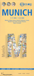
Munich Borch
the Theresienwiese park where the Oktoberfest Beer Festival is held, the central railway station and all the city’s main museums and concert halls, etc. A map of the environs at 1:130, 000 shows the motorway ring and extends north to Freising to include the airport. A road map at 1:850, 000 shows access from the city to the central part of the Bavarian Alps, including Garmisch-Partenkirchen and the famous castles of Ludwig II at Neuschwanstein, Linderhof and Herrenchiemsee. All the plans and maps are indexed with lists of streets/localities plus main sights and places of interest.Also included is a list of the city’s top 30 sights, all highlighted on the plans and the road maps, a diagram of the U and S-Bahn networks, a small administrative map of the Germany, and information
on the city’s climate.
This page now acts as a permanent archive for this product. Add more information using the comments box below to ensure it can still be found by future generations.
Use our search facility to see if it is available from an alternative contributor.
- External links may include paid for promotion
- Availability: Out Of Stock
- Supplier: Stanfords
- SKU: 9783866093096
Product Description
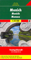
Excellent laminated & waterproof map for visitors to Munich, combining a plan of the city with an enlargement for the town centre, a map of the environs, & a road map showing access to the Alpine resorts of southern Bavaria. The main plan at 1:22, 000 extends westwards to Pasing & Aubing, to include the grounds of the Nymphenburg Palace & eastwards to the Munich Messe exhibition & fair grounds. Coverage north/south is from the BMW complex (with an extension on an inset to the Allianz-Arena sport stadium) to the access onto the motorways leading to the Alps. The plan shows one way streets, parking facilities, U-Bahn & S-Bahn connections, etc., & highlights places of interest. On the reverse is an enlargement a t 1:11, 000 for the central part of the city which
Includes:: the Theresienwiese park where the Oktoberfest Beer Festival is held, the central railway station & all the city’s main museums & concert halls, etc. A map of the environs at 1:130, 000 shows the motorway ring & extends north to Freising to include the airport. A road map at 1:850, 000 shows access from the city to the central part of the Bavarian Alps, including Garmisch-Partenkirchen & the famous castles of Ludwig II at Neuschwanstein, Linderhof & Herrenchiemsee. All the plans & maps are indexed with lists of streets/localities plus main sights & places of interest. Also included is a list of the city’s top 30 sights, all highlighted on the plans & the road maps, a diagram of the U & S-Bahn networks, a small administrative map of the Germany, & information on the city’s climate.
Reviews/Comments
Add New
Intelligent Comparison
Price History
Vouchers
Do you know a voucher code for this product or supplier? Add it to Insights for others to use.


 United Kingdom
 France
 Germany
 Netherlands
 Sweden
 USA
USA
 Italy
Italy
 Spain
Spain


 Denmark