
 United Kingdom
 France
 Germany
 Netherlands
 Sweden
 USA
USA
 Italy
Italy
 Spain
Spain
More From Contributor


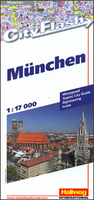
Munich City Flash
Munich on a double-sided street plan at 1:17, 000, waterproof, tear-resistant, and published in a convenient concertina format, with an enlargement of the town’s historic centre, a shop-by shop map of its main shopping area, a diagram of the U- and S-Bahn lines, a plan of the airport, plus a road map of Greater Munich.The plan of the city is spread across both sides of the map and extends north to the Ring Road to include the Olympic stadium and the BMW Museum, north-west to cover the palace and part of the gardens of Nymphenburg, plus south beyond the Theresienwiese – the grounds hosting the annual Oktoberfest. The plan shows U- and S-Bahn stops and taxi ranks; for drivers main traffic arteries are highlighted and car parks are marked. Important buildings are named, with
the most popular sights highlighted by small drawings. The index lists a selection of streets. Map legend includes English.An enlargement presents the city’s historic centre in greater detail at 1:11, 000, with an index of places of interest. Munich’s main shopping area, Nauhauser Straße and Kaufinger Straße are shown on a separate panels annotated with colour-coded names of shops, restaurants and cafes, hotels, etc. The map also includes a large, clear diagram of the U-and S-Bahn network, a plan of the city’s airport, a road map of Greater Munich including access to the Alianz Arena, plus useful contact details and other tourist information
the most popular sights highlighted by small drawings. The index lists a selection of streets. Map legend includes English.An enlargement presents the city’s historic centre in greater detail at 1:11, 000, with an index of places of interest. Munich’s main shopping area, Nauhauser Straße and Kaufinger Straße are shown on a separate panels annotated with colour-coded names of shops, restaurants and cafes, hotels, etc. The map also includes a large, clear diagram of the U-and S-Bahn network, a plan of the city’s airport, a road map of Greater Munich including access to the Alianz Arena, plus useful contact details and other tourist information

Product Description
Reviews/Comments
Add New
Vouchers
No voucher codes found.
Do you know a voucher code for this product or supplier? Add it to Insights for others to use.
Do you know a voucher code for this product or supplier? Add it to Insights for others to use.
 Denmark