More From Contributor

£13.99
Map No. 184, Munich & Environs (2-map set), including a nature guide to local wild flowers, in a series of hiking maps from Kompass providing extensive coverage of Austria & Germany plus the Slovenian Alps, with hiking routes on a topographic base, various types of accommodation, recreational facilities, places of interest, etc. Many titles are now published as competitively priced sets of two or more maps, offering a wider coverage. Kompass are Europe’s largest publishers of walking maps, with extensive coverage of hiking areas in other countries, all listed on our website. * Cartography:* all the maps are contoured with additional shading & graphic relief to provide a more detailed picture of the terrain, vegetation and/or land use. Contour interval varies from 10 metres in the coastal areas of Northern Germany to 40 or 50 metres in the mountainous parts of the two countries. All the maps highlight local & long-distance waymarked footpaths, including climbing trails. Most titles also show cycling routes, mountain bike trails, &, the in mountainous areas, ski routes. The maps indicate various types of accommodation (selected inns & hotels, youth hostels, campsites, mountain refuges), as well as recreational facilities, places of interest, etc. New editions also show access by public transport with bus stops and/or Park+ Ride facilities.* Geographical coordinates:* unless indicated to the contrary in the individual description, the maps have a UTM grid for GPS users. * Map legend:* most maps now include full English legend, particularly titles covering the Alpine areas. Some maps covering mainly eastern Austria or the less popular parts of Germany may still have a legend in German only.* Other
Features:* some titles now include on the reverse panorama drawings of their area with names of villages, peaks, valleys, etc. and/or have booklets with pictures of local wild flowers with their Latin names.*PLEASE NOTE BEFORE ORDERING!* * Booklets:* many titles come with booklets describing the area and/or various hiking routes. These booklets are in * German only*, apart from a handful of titles where an English language booklet is specifically indicated in the individual description. So, unless English language booklet is actually mentioned, the map can only be supplied with a German booklet. These booklets are not necessary to use the maps since, as stated above, most titles now include * full English language map legend.*
...
Archived Product
£15.99
Munich & Environs Cycling Atlas in a series of handy size spiral bound atlases from Verlag Esterbauer, Europe’s leading publishers of cycling maps. The guide covers cycle routes in & around Munich, extending north to Freising & Erding, & south to Murnau & Bad Tölz in the Alps. Ten tours are in the city & the rest are in the surrounding region. Distances range from 10km to 53km. Maps at scales 1:20, 000 for the city tours & 1:50, 000 for the surrounding countryside. Plan of Munich`s S-Bahn & U-Bahn network on the back cover. Cycling atlases from Verlag Esterbauer have a map legend which

Includes::
English &, although ALL THE TEXT IN THESE GUIDES IS IN GERMAN ONLY, information provided on the maps is sufficient to use them without any knowledge of German, particularly in the absence of similar products in English from other publishers. Please click on our sample image to see an extract from the map legend. Each atlas

Includes::
a selection of local cycling routes & tours, presented on clear, easy to follow maps. The overprint highlighting the routes indicates road surface & density of motorized traffic. Gradients, intermediate distances, danger points, & roads closed to cyclists are marked & route profiles show the degree of difficulty for each cycle path. A wide range of symbols indicate everything from covered & lockable bicycle stands, repair workshops & bike rentals to viewpoints, nature parks, leisure & sport centres, local shopping facilities, emergency services, etc. The guides also give opening hours of museums & other local places of interest. A separate section at the end of each guide list accommodation addresses with phone numbers. To see other titles in this series please click on the series link.


...
Archived Product
£7.99
Rick Steves Pocket guidebooks truly are a ”tour guide in your pocket.” Each colourful, compact book

Includes::


...
Archived Product
£14.99
Munich & the Bavarian Alps Eyewitness travel guide from Dorling Kindersley is a lavishly illustrated book concerned with providing the visitor with detailed background information to sightseeing in the country & a broad cultural introduction. Popular historical buildings & museums are often described with cutaway diagrams allowing you to view ...
Archived Product
£11.24
Munich & the Bavarian Alps Eyewitness travel guide from Dorling Kindersley is a lavishly illustrated book concerned with providing the visitor with detailed background information to sightseeing in the country & a broad cultural introduction. Popular historical buildings & museums are often described with cutaway diagrams allowing you to view ...
Archived Product
£8.25
Munich & the surrounding area on a detailed, GPS compatible map with cartography from the German topographic survey & extensive overprint for long-distance hiking paths & various cycling rouyes, all annotated with official symbols for easier identification. The contoured base map combines four standard sheets of German topographic survey at 1:100, 000 to provide a wide coverage around the city. Extensive overprint presents the area ...
Archived Product
£7.50
Pub Stops of The Lake District Wall Map from JJM Designs: beautifully produced, high quality, colourful & amusing wall map adapting the world-famous London Underground map to present the pubs as stops along (pub crawl?) lines. Pub names indicate which town or village they are in, & the map also shows the lakes & the fells. Printed on high quality, thick, glossy paper this innovative poster is ideal for framing. The map is part of a series of similar titles for other selected cities. Names of local districts are shown on city maps, with other landmarks including the collages on the two Oxbridge titles. ...
Archived Product
£8.99
Excellent laminated & waterproof map for visitors to Munich, combining a plan of the city with an enlargement for the town centre, a map of the environs, & a road map showing access to the Alpine resorts of southern Bavaria. The main plan at 1:22, 000 extends westwards to Pasing & Aubing, to include the grounds of the Nymphenburg Palace & eastwards to the Munich Messe exhibition & fair grounds. Coverage north/south is from the BMW complex (with an extension on an inset to the Allianz-Arena sport stadium) to the access onto the motorways leading to the Alps. The plan shows one way streets, parking facilities, U-Bahn & S-Bahn connections, etc., & highlights places of interest. On the reverse is an enlargement a t 1:11, 000 for the central part of the city which

Includes::
the Theresienwiese park where the Oktoberfest Beer Festival is held, the central railway station & all the city’s main museums & concert halls, etc. A map of the environs at 1:130, 000 shows the motorway ring & extends north to Freising to include the airport. A road map at 1:850, 000 shows access from the city to the central part of the Bavarian Alps, including Garmisch-Partenkirchen & the famous castles of Ludwig II at Neuschwanstein, Linderhof & Herrenchiemsee. All the plans & maps are indexed with lists of streets/localities plus main sights & places of interest. Also included is a list of the city’s top 30 sights, all highlighted on the plans & the road maps, a diagram of the U & S-Bahn networks, a small administrative map of the Germany, & information on the city’s climate.

...
Archived Product
£7.99
Munich on a double-sided street plan at 1:17, 000, waterproof, tear-resistant, & published in a convenient concertina format, with an enlargement of the town’s historic centre, a shop-by shop map of its main shopping area, a diagram of the U- & S-Bahn lines, a plan of the airport, plus a road map of Greater Munich. The plan of the city is spread across both sides of the map & extends north to the Ring Road to include the Olympic stadium & the BMW Museum, north-west to cover the palace & part of the gardens of Nymphenburg, plus south beyond the Theresienwiese – the grounds hosting the annual Oktoberfest. The plan shows U- & S-Bahn stops & taxi ranks; for drivers main traffic arteries are highlighted & car parks are marked. Important buildings are named, with the most popular sights highlighted by small drawings. The index lists a selection of streets. Map legend

Includes::
English. An enlargement presents the city’s historic centre in greater detail at 1:11, 000, with an index of places of interest. Munich’s main shopping area, Nauhauser Straße & Kaufinger Straße are shown on a separate panels annotated with colour-coded names of shops, restaurants & cafes, hotels, etc. The map also

Includes::
a large, clear diagram of the U-and S-Bahn network, a plan of the city’s airport, a road map of Greater Munich including access to the Alianz Arena, plus useful contact details & other tourist information


...
Archived Product
£7.50
The Flip Pad is a tried & tested format for notes in all walks of life. Thanks to these new City Flip Pads travellers will find their way around any metropolis as they have a fold out inner city map as well as plenty of space for your notes. All city Flip Pads are bound at the top with a hard cover that flips up to open & folds back for easy note taking. This portable, pocket-sized notepad features a sturdy construction & an elastic fastener to protect sheets on your travels.
- 160 lightly ruled pages
- Portable pocket-size is great for trips
- Personal data page
- Sewn binding
- Elastic band closure
- Fold out city map
- Perforated pages
- Shrink-wrapped


...
Archived Product

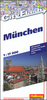
Munich And The German Alps Cycling Set (3-map Set)

The central part of southern Bavaria, from Munich and Augsburg to Garmisch-Partenkirchen and across the border to Kufstein, on a set of three double-sided maps printed on light, waterproof and tear-resistant plastic paper.The maps have contours at 100m intervals with relief shading and colouring to show the terrain and vegetation. Extensive overprint highlights both long-distance cycle routes and shorter regional trails, all annotated with symbols or letters to identify them. Gradient marking are shown on steep section.A very wide range of symbols mark various facilities and places of interest: different types of accommodation from hotels and inns to campsites, youth hostels and mountain refuges; sport facilities and sites for climbing, hand gliding, rafting, etc; cultural sites;
interesting trees, etc. Road information includes petrol stations, parking facilities, etc. Railways with stations and all kinds to mountain transport lines are included.The maps have a UTM grid. Map legend includes English.
RIP - This product is no longer available on our network. It was last seen on 25.09.2019

This page now acts as a permanent archive for this product. Add more information using the comments box below to ensure it can still be found by future generations.

Use our search facility to see if it is available from an alternative contributor.
  • Availability: Out Of Stock
  • Supplier: Stanfords
  • SKU: 9783850260558
Availability: In Stock
£13.95

Product Description

The central part of southern Bavaria, from Munich & Augsburg to Garmisch-Partenkirchen & across the border to Kufstein, on a set of three double-sided maps printed on light, waterproof & tear-resistant plastic paper. The maps have contours at 100m intervals with relief shading & colouring to show the terrain & vegetation. Extensive overprint highlights both long-distance cycle routes & shorter regional trails, all annotated with symbols or letters to identify them. Gradient marking are shown on steep section.A very wide range of symbols mark various facilities & places of interest: different types of accommodation from hotels & inns to campsites, youth hostels & mountain refuges; sport facilities & sites for climbing, hand gliding, rafting, etc; cultural sites; interesting trees, etc. Road information

Includes::
petrol stations, parking facilities, etc. Railways with stations & all kinds to mountain transport lines are included. The maps have a UTM grid. Map legend

Includes::
English.

Reviews/Comments

Add New

Intelligent Comparison

Oooops!
We couldn't find anything!
Perhaps this product's unique.... Or perhaps we are still looking for comparisons!
Click to bump this page and we'll hurry up.

Price History

Vouchers

No voucher codes found.
Do you know a voucher code for this product or supplier? Add it to Insights for others to use.

Facebook

Jargon Buster

Paper - A thin sheet mainly used for writing. Available in a variety of colours. Made mainly from wood pulp.
Plastic - A generic term for a synthetic product used in the manufacture of products
Hand - A part of the body at the end of the arm
Hand - A pointer which indicates time on a clock face
Waterproof - Resistant to water, usualy specified by depth in metres
Railways - A set of tracks that have been laid for the purpose of trains to travel up and down them
Set - a group of items usually related to one another. Some objects cannot function without the complete set of items.
Road - a manmade lane or a path that is used to speed up travel.
Resistant - Something that can repel against something.
Wide - Something with a large width.
Accommodation - A room in which someone can live in, for example in a hotel
Regional - An adjective to describe a set geographic area.
Transport - Something that carries people or goods.

Supplier Information

Stanfords
Stanfords was established in 1853 and opened their iconic Covent Garden flagship store in 1901. They have become the top retailer of maps, travel books and accessories in the UK and arguably offer the largest selection of maps and travel books worldwide. Famous names such as Captain Robert Falcon Scott, Ranulph Fiennes and Michael Palin have purchased from Stanfords. They now have a shop in Bristol and both stores together with other venues operate a calendar of events including talks, book signings and exhibitions. As a specialist map retailer, the map selection is comprehensive and includes road maps, street maps and walking maps from worldwide destinations, as well as a selection of world atlases and wall maps. Books include travel guides and travel literature. Stanfords also stock globes, from miniatures made of blue marble to magnificent floor-standing globes. The website features a selection of interesting articles on travel topics.
Page Updated: 2023-11-12 20:15:36

Community Generated Product Tags

Oh No! The productWIKI community hasn't generated any tags for this product yet!
Menu