-
Home
-
Contributors
-
International
-
Account
-
Information
More From Contributor
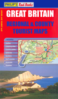
Includes:: caravan & camp sites, Park & Ride locations, recreation/leisure/sport centres, museums, historic buildings, English Heritage & National Trust sites, rural pubs, etc. The map legend is in English only, except for the tourist information content which is also in French & German. ...
Includes:: 20 varied walks that are suitable for walkers of all ages & abilities & is accompanied by detailed Explorer 1:25, 000 Ordnance Survey mapping with colour-coded marked routes. The guides are structured in three main sections with different levels of difficulty- short & easy walks, those of modest length that may include uphill walking & more challenging routes that may be longer & over more rugged terrain- covering a total of 20 walks. Each walk has a mini summary & an information box with details of starting points, distance, approximate time, parking & any individual route features. There is also information on refreshments, local transport & public toilets en route. Appendices provide further useful information on walking safety, GPS, the Countryside Code, local organisations & Ordnance Survey maps. ...
- Beautiful photography of scenes from the walks Ideal for families, or for those who prefer shorter distances, Short Walks guides contain 20 walks graded by distance, duration & difficulty. Each route
Includes:: points of interest as well as fun observation questions for children. ...

Isle Of Wight
lines are shown with stations and, where appropriate, ferry routes are marked. Presentation of the topography varies, with some altitude tinting provided on the more detailed maps. Unless specified in their descriptions, the maps have no geographical coordinates for GPS users. Many titles also include additional street plans of each area’s main towns.*In this title:* attitude tinting (in feet) and colouring for woods or forests and beaches. Ferry routes to the mainland ports are marked and several cycle routes are highlighted, including a tour around the islands. The map has an index of selected places of interest, but not a more general index of towns and villages. Also included are street plans of central Cowes, Ryde, Shanklin, Sandown and Ventnor, highlighting main traffic
routes, places of interest and car parks. Current edition date: 2009.
This page now acts as a permanent archive for this product. Add more information using the comments box below to ensure it can still be found by future generations.
Use our search facility to see if it is available from an alternative contributor.
- Availability: Out Of Stock
- Supplier: Stanfords
- SKU: 9780540094172
Product Description
The Isle of Wight at 1:50, 000 in a series of maps at varying scales, all designed to highlight very clearly each area’s diverse cultural & industrial heritage, natural attractions, sport & recreational sites, & tourist facilities. Different types of small icons or signs prominently indicate a wide range of places of interest from aerial activity, ancient forts or animal attractions to windmills, working farms & zoos. Most titles include campsites, caravan sites, youth hostels & holiday centres & several maps also show National Long-distance Trails and/or recommended cycle routes. Road information is clearly laid out, with minor country roads easy to see. Driving distances are given on main routes & in some titles recommended country tours are highlighted. Railway lines are shown with stations &, where appropriate, ferry routes are marked. Presentation of the topography varies, with some altitude tinting provided on the more detailed maps. Unless specified in their descriptions, the maps have no geographical coordinates for GPS users. Many titles also include additional street plans of each area’s main towns.* In this title:* attitude tinting (in feet) & colouring for woods or forests & beaches. Ferry routes to the mainland ports are marked & several cycle routes are highlighted, including a tour around the islands. The map has an index of selected places of interest, but not a more general index of towns & villages. Also included are street plans of central Cowes, Ryde, Shanklin, Sandown & Ventnor, highlighting main traffic routes, places of interest & car parks. Current edition date: 2009.
Reviews/Comments
Add New
Intelligent Comparison
We couldn't find anything!
Perhaps this product's unique.... Or perhaps we are still looking for comparisons!
Click to bump this page and we'll hurry up.
Price History
Vouchers
Do you know a voucher code for this product or supplier? Add it to Insights for others to use.


 United Kingdom
 France
 Germany
 Netherlands
 Sweden
 USA
USA
 Italy
Italy
 Spain
Spain


 Denmark