
 United Kingdom
 France
 Germany
 Netherlands
 Sweden
 USA
USA
 Italy
Italy
 Spain
Spain
More From Contributor

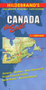
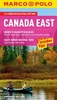
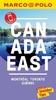
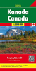

Canada East Reise Know-How
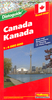
Eastern Canada in a series of three indexed, waterproof and tear-resistant road maps of the country with topographic and tourist information. The maps, published by Reise Know-How as part of their highly acclaimed World Mapping Project, are double-sided to provide the best balance between a good scale and a convenient size sheet. The area is divided east/west, with a good overlap between the two sides. Coverage on the eastern side extends beyond 60º north to include the whole of Labrador province. The western side extends beyond 56º north and includes Belcher Islands in the Hudson Bay, with coverage of Ontario extending to approx. 87º west. In USA Boston and Cape Cod are included.The map has altitude colouring with spot heights and plenty of names of rivers and lakes. Numerous
national and provincial parks and other protected areas are highlighted, as well as Indian reservation areas. Road network includes selected minor roads and tracks, with intermediate distances given on main routes. Railway lines, local airfields and ferry connections are also shown. Symbols mark locations of various places of interest including natural sites and UNESCO World Heritage areas, etc. The map has a grid with latitude and longitude at intervals of 2º, plus an index of localities. Map legend includes English. To see the other maps in this series please click on the series link.
national and provincial parks and other protected areas are highlighted, as well as Indian reservation areas. Road network includes selected minor roads and tracks, with intermediate distances given on main routes. Railway lines, local airfields and ferry connections are also shown. Symbols mark locations of various places of interest including natural sites and UNESCO World Heritage areas, etc. The map has a grid with latitude and longitude at intervals of 2º, plus an index of localities. Map legend includes English. To see the other maps in this series please click on the series link.

Product Description
Reviews/Comments
Add New
Vouchers
No voucher codes found.
Do you know a voucher code for this product or supplier? Add it to Insights for others to use.
Do you know a voucher code for this product or supplier? Add it to Insights for others to use.
 Denmark