
 United Kingdom
 France
 Germany
 Netherlands
 Sweden
 USA
USA
 Italy
Italy
 Spain
Spain
More From Contributor


Canada East
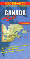
Eastern Canada at 1:1, 500, 000 on a large, double-sided map from Hildebrand providing coverage stretching from the Atlantic Provinces to the western part of Ontario, highlighting the region’s many provincial parks and other protected areas.Topography is presented by relief shading with numerous spot heights. Larger rivers and many of the hundred of lakes characteristic of this area are named and swamp are marked. The map presents the region’s road network highlighting scenic routes and providing driving distances on many local roads. Railway lines and local airports are included. Latitude and longitude lines are drawn at intervals of 1°. Map legend includes English.

Product Description
Reviews/Comments
Add New
Vouchers
No voucher codes found.
Do you know a voucher code for this product or supplier? Add it to Insights for others to use.
Do you know a voucher code for this product or supplier? Add it to Insights for others to use.
 Denmark