
 United Kingdom
 France
 Germany
 Netherlands
 Sweden
 USA
USA
 Italy
Italy
 Spain
Spain
More From Contributor


Malta And Gozo
Malta, Gozo and Comino on clear, waterproof and tear-resistant, indexed map with topographic and tourist information, including bus routes, published by Reise Know-How as part of their highly acclaimed World Mapping Project. Topography is shown by altitude colouring with contours and spot heights. Road network shows local roads and tracks, indicates scenic routes and gives driving distances on main and secondary roads. On Malta, roads are also annotated with bus numbers.Picturesque towns and villages are highlighted and symbols show locations of various places in interest, including UNESCO world heritage sites, viewpoints, beaches and diving sites, churches and monasteries, archaeological sites, harbours and marinas, botanical gardens, golf courses, etc. The map has both a
UTM grid and latitude and longitude grid at intervals of 5
UTM grid and latitude and longitude grid at intervals of 5

Product Description
Reviews/Comments
Add New
Intelligent Comparison
Archived Product
Malta And Gozo Stanfords
£8.50
Archived Product
Malta & Gozo Stanfords
£8.79
Archived Product

Malta & Gozo Stanfords
£14.99
Archived Product

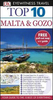
Top 10 Malta And Gozo Stanfords
£8.99
Archived Product

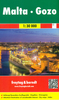
Malta - Gozo F&B Stanfords
£10.99
Archived Product
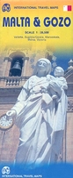
Malta & Gozo ITMB Stanfords
£9.99
Vouchers
No voucher codes found.
Do you know a voucher code for this product or supplier? Add it to Insights for others to use.
Do you know a voucher code for this product or supplier? Add it to Insights for others to use.
 Denmark