
 United Kingdom
 France
 Germany
 Netherlands
 Sweden
 USA
USA
 Italy
Italy
 Spain
Spain
More From Contributor


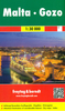


Malta And Gozo
Large map of Malta and Gozo from Freytag & Berndt for exploring the islands by car, with icons prominently highlighting various places of interest and facilities, and road network clear to see against the shading showing the topography.The map has contours at 20m intervals with additional shading, particularly to highlight the steep and rocky parts of the coastline. Road network includes country tracks, shows locations of fuel supplies, and gives driving distances on main and secondary roads. Ferry lines between the three islands and within the Valletta harbour are also shown.Large icons mark various tourist facilities and places of interest: campsites, churches, monasteries and pilgrimage sites, windmills, castles and museums, caves, golf courses, marinas, etc. The map has no
geographical coordinates. Map legend includes English. Also included is a large inset showing the historic heart of Valletta and Sliema at 1:12, 000.
geographical coordinates. Map legend includes English. Also included is a large inset showing the historic heart of Valletta and Sliema at 1:12, 000.
Product Description
Reviews/Comments
Add New
Intelligent Comparison
Archived Product

Malta And Gozo Stanfords
£9.50
Archived Product
Malta & Gozo Stanfords
£8.79
Archived Product

Malta & Gozo Stanfords
£14.99
Archived Product

Top 10 Malta And Gozo Stanfords
£8.99
Archived Product

Malta - Gozo F&B Stanfords
£10.99
Archived Product

Malta & Gozo ITMB Stanfords
£9.99
Vouchers
No voucher codes found.
Do you know a voucher code for this product or supplier? Add it to Insights for others to use.
Do you know a voucher code for this product or supplier? Add it to Insights for others to use.
 Denmark